Posts

Showing posts from November, 2010

Avenues snow

Image
The urban-ski terrain interface, 29 Nov 2010 Over the years I've enjoyed a number of tours in the Avenues Foothills.  Most of the aspects that you see from town are baked quickly by the sun, but there are a few short shots that drop into City Creek canyon that can be quite good. Stoked by the recent snowfall, we did a quick tour yesterday after work.  I debated which skis to grab, but fortuitously went with the old tele gear.  Although this latest snowstorm was impressive (16" in the upper aves), most of the snow was low density and fell on a meager base.  As a result, one could "feel the bottom" on many turns.  It is always odd to feel the powder waffing up your thighs while your skis feel like they are dragging across sandpaper. Mother nature never ceases to surprise and remarkably just a short distance from the cul-de-sac at the top of Terrace Hills we found this small natural wet-slab avalanche on a wind-loaded southeast exposure. A good reminder t...

Orographic precipitation enhancement, interrupted

Image
Yesterday's storm is now in the record books and it was an impressive one.  It's been quite a while since I can remember this much snow in my yard.  Perhaps the last time was Thanksgiving 2001 after the famed 100 inch storm (named for snowfall at Alta, although the valley got pounded too). Storm-total snowfalls reported on the NWS web site for locations in the Salt Lake and Tooele Valleys: And in the Wasatch Mountain south of I-80: Bottom line : There is remarkably little difference between the lowland and mountain snowfall in this case, as discussed in an earlier post .  Even overnight, when I thought we'd see more orographic precipitation enhancement, there was little.  This case provides a great example of why the use of a climatological precipitation-elevation relationship to downscale or redistribute coarse-resolution numerical guidance can be dangerous.  At issue is whether or not one could reliably anticipate a similar event in the future.  

Where is the orographic precipitation enhancement?

Image
This (Sunday) morning was interesting with regards to the lack of orographic precipitation enhancement.  Let's have a look: Snow-water equivalent at CLN from 0000-1400 MST: 0.31 inches Snow-water equivalent at KSLC from 0000-1400 MST: 0.27 inches Thus, the ratio of mountain to lowland precipitation, known as the orographic ratio, was only 1.1 (Actually, it may have been <1 for the period during which precipitation was falling at KSLC).  In contrast, the climatological Alta/KSLC orographic ratio is ~3.5.  Further, driving down Big Cottonwood Canyon this afternoon, I couldn't help but notice that more snow fell in the lower canyon and along the east bench than in the upper canyon .  How deflating for skiers!  What gives? The orographic ratio varies considerably from storm to storm and in some cases during storms.  Steenburgh ( 2003 , 2004 ) shows that the orographic ratio can be low in northern Utah when the precipitation dynamics are governed by stro...

The Greatest Snow on Earth is back

Image
Any good meteorologist or true snow geek wears black pants to make it easier to examine snow crystals while skiing.  The photo below shows that we're not dealing with accretional growth and graupel anymore and instead diffusional growth is once again dominating precipitation microphysics.  Click for a bigger image.

Stingy inversion

Image
I'm quite impressed with the intensity of the inversion that is presently in place over the Salt Lake Valley.  This morning's sounding shows a roughly 10C inversion extending form the surface to about 775 mb where the temperature was about +2C.   MesoWest obs this afternoon (~3:30 PM MST) show that fully inverted conditions persist over the valley.  At KSLC, it's only 27F, whereas is it in the 30s in the Park City area and at a few locations in the Wasatch Mountains.  I watched the car thermometer drop from 35F to 29F descending from the base of Mineral Fork to the bottom of Big Cottonwood Canyon this afternoon.   The flow aloft is certainly quite strong as Alta-Mt. Baldy has had several hours with gusts >60 mph and a peak gust of 72 mph.  My experience, however, is that strong flow at the ridge tops is pretty ineffective at removing an inversion/cold pool.  Instead, one needs some sort of large-scale pressure gradient to drive strong southerly ...

Today's mountain weather: A perfect 10

Image
No discussion today.  I just want to grin and enjoy what was an absolutely perfect day in the mountains.

Minimum temperature oddities

Image
A fascinating night last night with regards to minimum temperatures.  I figured we we were primed to get into the negative numbers at KSLC when it was 10F at 9 PM last night, but alas, it wasn't to be.  Instead, temperatures declined little, with 6F being the lowest temperature reported thus far in the 5-min obs. In fact, nearly all of the Salt Lake Valley is in the positive numbers this morning, as is the northern Wasatch Front.  If you want cold, -17 at Pony Express Marker and -15 in Logan seem to be the big winners at valley locations (note that these are not official lows, which may fall between observation times). Some of the minimum temperature variability is due to topography.  For example, it gets very cold at the Pony Express Marker and at Logan because they are in isolated basins.  In contrast, slope-valley flows persist all night long in the Salt Lake and Tooele Valleys, providing a mechanism for turbulence and mixing that weakens the intensity ...

A glimpse of things to come?

Image
Inversion: 22 Jan 2005 The next few days should prove quite interesting for inversion aficionados.  We've just had one of the strongest cold surges in years, have a nice coat of fresh snow, and, beginning tonight, an upper-level ridge will be building over Utah and temperatures aloft will rebound rapidly.  NAM 700-mb temperatures are forecast to reach -12C by tomorrow afternoon, which doesn't sound very warm, until you think about how cold it is down here in the valley.  Bottom line is we'll be inverted tomorrow. By Friday, we're pushing -2C at 700 mb and a whopper of an inversion should be in place.  The saving grace, however, will be reduced emissions during the holiday break and the fact that the next upper-level trough swings in later in the weekend, so air quality shouldn't suffer too much.  For PCAPers, this case should offer big "signal to noise" for examining the thermodynamic budget of inversion buildup, and then an interesting erosion of th...

Record cold and lessons for DLE forecasting

Image
The 12Z KSLC sounding is now available and it came in with a 700 mb temperature of -23.3C, which is the lowest observed in November since at least 1956 . It is presently 14F at KSLC, -3 at Alta Base, and -17 on top of Mount Baldy.  Don't be fooled by the warm temperatures downstream of the GSL and in the northern Salt Lake Valley where there's some cloud cover.  It is much colder in the southern Salt Lake Valley, Tooele Valley, Rush Valley, and West Desert.  Especially cold spots in the valleys include Bluffdale (1F), and Clover (-13F). With regards to the Dreaded Lake Effect, the wimpy stuff in the radar above has developed in the last hour or two and represents all that we got last night.  Yeah, we had a HUGE lake-700-mb temperature difference, but check out how dry the boundary layer is in the KSLC sounding above.  No matter how big the lake-700-mb temperature difference is, you still need additional ingredients to bake the lake-effect cake.  Witho...

That was easy, now it gets hard

Hats off to the weather enterprise, including NCEP, NWS/Salt Lake Weather Forecast Office, TV broadcasters, etc., for a really great forecast.  This is a watershed event for the weather prediction in Utah.  Our own mini-version of the 1993 Superstorm.  It is often said that life in Utah is about 20 years behind the rest of America (don't believe me, spend a weekend in Provo...) and metaphorically that is where we are with forecast skill in part because many of our storm systems are very small in scale and not usually driven by strong synoptic forcing.  As a result, model skill here lags the rest of the country.  I was shocked at how difficult it was to forecast here when I moved from Seattle in 1995. Since then, however, the observing system has improved substantially (e.g., MesoWest), the models have improved substantially, and forecasters have learned a lot about Intermountain weather.  We still lag, but now we can seize opportunities such as we had tod...

Fropa

Image
~5PM MST.  Now let the snow begin. Looking toward KSLC from the Salt Lake Avenues

Thar she blows!

Image
The cold front is just upstream of Hat Island and we can now get a pretty good look at its strength in terms of the airmass change and post-frontal winds.  The MesoWest analysis shows a 16F temperature contrast between Hat and Gunnison Islands. The temperature at Gunnison Island dropped from about 43F to 28F with frontal passage, which was accompanied by a 55 mph wind gust.  Post frontal winds, however, have subsided to about 25 mph sustained with gusts to just over 35.   It's a bit nastier along I-80 in the West Desert.  DPG17 warmed to 48F and then observed an abrupt temperature drop to 28F with fropa.  Impressive!  Post-frontal winds are sustained 40 mph with gusts to over 45.  This is blizzard strength for sure and it must be a mess and really lonely out there on I-80.  I suspect the surge to 48F may have been fueled a bit by a clear slot that was evident in the satellite earlier this afternoon (mentioned at weather discussion). It sho...

Noon update

Image
The frontal precipitation band has advanced into far NW Utah and both pre- and post-frontal winds are quite impressive. An interesting aspect of the front is the thermal structure.  There is a nice frontal nose (see below), but the coldest air lags well behind the front.   What this means is that we'll have an exciting frontal passage, but that it will take several hours for the really cold air to move in.   

And so it begins...

Image
The most anticipated winter storm in many years is on our doorstep and let's hope it doesn't disappoint.  Right now we have the "calm before the storm" so to speak, with a south wind and temperatures in the mid 30's over the Salt Lake Valley.  However, the 1430 UTC MesoWest analysis shows surface temperatures in the teens and single digits across east-central Oregon - a harbinger of things to come. Where is the front?  Well it just passed Jerome County Airport (KJER) in central Snake River Plain. At present, the front has not yet strongly contracted as the initial temperature fall at KJER was only about 7F.  However, the 700-mb analysis shows a 14C temperature contrast from southeast Idaho to the Columbia basin with a temperature minimum below -24C, so there is broad post-frontal baroclinity in place. The surface front appears to undergo scale contraction in the  12Z NAM  and passes through KSLC between 5 and 8 PM tonight.  Weather conditions ...

Historic cold surge

Image
We are still on track for what should prove to be an historic surge of cold air into northern Utah as both the NAM and GFS are bringing in an airmass for Wednesday that would produce the coldest 700-mb temperatures observed in Utah since at least 1956.  The NWS is now calling for a  maximum temperature at KSLC on Wednesday of 16F. I did some quick Hysplit trajectories this morning.  These can be flaky (not sure what is going on with that one from SoCal), but show we're dealing with air originating from the Arctic and interior British Columbia (these are 84 hour backwards trajectories from 12Z Wed).

Hell is about to freeze over

Image
Photo: good-times.webshots.com In an earlier post , I mentioned that there aren't alot of days when the 700 mb temperature is below -20C and that the GFS was going for something like -21C this week.  I also wondered if that would verify, thinking that it would probably not end up being that cold. Well, the latest GFS runs are instead calling for it to be even colder .  The latest GFS 700-mb temperature forecast for 15Z Wednesday is -25.3C.  Trevor has examined the KSLC RAOBS for 1956-2010 and has found that the coldest November 700-mb temperature observed in that period is -22.6C.  Further, there have only been 14 soundings (out of 40,246) with a 700-mb temperature below -25C during the entire record.  The last day we were below -25C was on 30 December 1990 when the 700-mb temperature was -27.2C. Let's convert to American units to put this into perspective.  -25.3C = -13.5F.  That is a seriously cold day of skiing in the mountains.  Well mi...

Kyle Tietze 1984-2010

Image
All of us in the Department of Atmospheric Sciences are deeply saddened at the loss of Kyle Tietze, who passed away last Friday night. We will miss you Kyle Kyle was an exceptional young man, scientist, and friend.  He brought out the best in everyone.  It was an honor and privilege to attend his memorial service this evening, which I found deeply inspiring.  Below is a remarkable photo of the frontal passage that occurred just prior to the service.   Frontal passage just prior to Kyle's memorial service (photo T. Cruickshank) I can't help but think the frontal passage was more than merely coincidence.  Our best to Kyle and all his family and friends.  Our thoughts and prayers are with you.  

Graupelfest continues

Image
We've gone directly from Octoberfest to Graupelfest this year and the first part of this storm cycle is certainly bringing plenty of styrofoam balls to ski on (and I like it!). We've spoken a little about Graupel formation in an earlier post, but I'll add a bit more here.  Graupel forms as supercooled cloud-liquid water collides and freezes with on an ice crystal, with the crystal so fully encased in frozen cloud droplets that it is no longer distinguishable.   This is not your brain, it is graupel (USDA/Wikipedia Commons) Graupel lies at the outer end of rimed particles according to the Magono and Lee (1966) snow crystal classification , which actually discusses four types of graupel: (1) graupel-like snow, (2) hexagonal graupel, (3) lump graupel, and (4) cone-like graupel.   They all hurt your face, but enable fun skiing.  I used to love to ski graupel storms in the Cascades not only because it was so smooth and silky, but also because they didn't stick to m...

Sierra Nevada and airmass transformation

Image
During southwesterly flow, a pronounced gradient in precipitable water (i.e., the PW wall) often develops over the High Sierra crest with a cloud and precipitation shadow extending downstream over the Intermountain West.  During the day, sensible heating within the cloud and precipitation shadow can enhance frontogenesis directly through differential heating (assuming post-frontal cloud cover) and indirectly by driving a thermally forced circulation that reinforces the cross-front ageostrophic circulation.   Koch et al. (1995) describe this process nicely.  A marvelous example of the Sierra PW wall and downstream cloud and precipitation shadow has developed.  Note the local minimum in PW that extends downstream of the High Sierra across nearly all of Nevada, the lack of cloud-cover within this minimum. 2045 UTC 19 Nov 2010 Visible Sat & RUC PW and 925 mb Wind One can literally see the influence of the varying crest height of the Sierra Nevada in this imag...

Local and remote effects of Sierra Nevada

Image
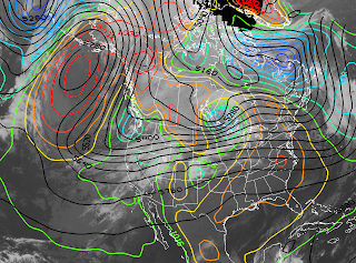
The next two days offer a great opportunity to examine the influence of the Sierra Nevada on the meteorology of the Intermountain West.  As of 1430Z this morning, a high-amplitude upper-level ridge and surface anticyclone were planted over the Gulf of Alaska with a positively tilted upper-level trough off the Pacific coast of the contiguous US.  As a result, large-scale southwesterly flow extends across California, the Sierra Nevada, and the Intermountain West. IR Sat/GFS Forecast Valid ~1430 UTC 19 Nov 2010 On the regional scale, the leading edge of 700-mb baroclinity is draped across central Nevada and northern Utah and is collocated with a sea level pressure trough that extends from the Sierra Nevada across the Great Salt Lake Basin. IR Sat/RUC Valid 1500 UTC 19 Nov 2010 The trough lies within the so-called Great Basin cyclone region identified by Jeglum et al. (2010) as having a high frequency of Intermountain cyclone occurrence and genesis downstream of the Hi...

Oh what a night

Image
It was a remarkable night last night with "flat line" temperature conditions persisting at KSLC all night long.  Check out the meteogram, which shows temperatures nearly dropped only a few degrees in the late afternoon and evening and then remained remarkably steady all night long with a lowest 5-min observation of 54 F. The combination of a thick cirrostratus deck combined with strong winds (sustained at > 15 mph for nearly the entire night) appears to have prevented the formation of any significant surface-based cold pool.  Even still, you don't see too many nights where there isn't a brief lull in the winds to enable a quick trop in temperature of a few degrees. 

The 20/20 "rule"

Image
This morning's GFS forecast drops 700-mb temperatures to about -21C by 0000 UTC Wednesday. My 20/20 rule is not really a rule, but derives from my impression there are only a small number of days where the 700-mb temperature at KSLC is lower than -20C or greater than 20C.  Thus, anytime I see -20C or +20C air, it piques my interest and I know we're out there on the ends of the bell curve for temperature.  Plus, 20/20 is easy to remember.  On the otherhand, one should always verify such rules of thumb.  Perhaps someone can run some sounding stats and we'll see if my intuition is any good. Also at issue is if this GFS forecast will verify.  Beyond just the usual issues related to the need to think probabalistically at this time scale, the source of air this cold is interior western Canada and in the past the GFS sometimes had a cold bias in these scenarios because the real-world topography produces more blocking and airmass transformation.  The GFS has b...

Potential warming

Image
Tomorrow is going to be an interesting day.  The 18Z NAM is forecasting a midday 700-hPa temperature of 2C.  If we were to mix out to that level, that would give us a max temperature of about 19C (66F).  We lack the solar energy to mix out to that level, but will the wind do the job for us?  There is a fairly strong along-barrier pressure gradient tomorrow, so I'm interested to see if we can get the southerlies going in the valley and really warm things up or if we keep a stable layer going as the NAM suggests. PCAPS folks might want to keep an eye on this and run through some scenarios.  

Did it "blow like snot" yesterday?

Image
CDC Public Health Image Library/Wikipedia Commons As posted by Wendy yesterday, a peak gust of 96 mph was observed at Alta-Mount Baldy yesterday afternoon and appears to be the big winner in yesterday's storm.  A quick look at MesoWest reveals that 84 stations reported at least one gust in excess of 50 mph including: Alta-Mt. Baldy - 96 mph Logan Summit - 78 mph Deer Valley Mt. Baldy - 75 mph Powder Mountain - 75 mph Alta-Collins - 73 mph Ogden Peak - 71 mph UT30 - 65 mph (appears to be highest gust at lowland station) Curlew Junction - 63 mph Utah Test and Training Range (TTU) - 61 mph University of Utah - 57 mph Thus, there is little doubt that it "blew like snot" yesterday.  However, in saying that, I'm speaking metaphorically and not scientifically.  In reality, there are wide-ranging estimates for the speed of snot, with  Mythbusters producing a humorous 35-40 mph estimate.  And, like the speed of snot, wind speed and gust reports are also s...

As winds nuke in the Wasatch

Image
Check out Alta Mount Baldy (AMB) winds ...... gusting to 96!! The sensor was rimed of course until recently.....apparently you don't need a heater if the winds are around 100mph.......

Proposed blog changes

It's pretty clear that the restricted access of this site is a pain for a number of students.  Although I had some concerns that public access might restrict our ability to freelance, I'm not sure that really is the case.  Thus, I'm considering making it open access.  Please add a comment here and let me know your thoughts.

Welcome to the Cascades

Image
Whatever happened to the Greatest Snow on Earth?  The UAC is reporting that 10 inches of heavy dense graupel fell last night in LCC, with a water content of 20%!  There were numerous reports of riming and drizzle in the Cottonwoods yesterday as well.  Green light conditions are over in the backcountry. To understand the 24 hours, we need to recognize that liquid water needs a "partner", known as an ice nuclei, to turn into ice, even at temperatures below freezing.  Liquid water's preferred partner is ice, and if it comes in contact with ice, it will gladly freeze if the temperature is below 0C.  On the otherhand, liquid water is more selective with other potential ice nuclei.  If the water comes in contact with a particle that has a molecular structure similar to ice, it may freeze at relatively warm temperatures that are only a few degrees below freezing.  On the otherhand, if the water comes in contact with a particle that is dissimilar to ice, it...

Computers, guns, and tequila

Image
I happened to notice this morning that something is askew with regards to one of the place names on the Google map image behind the MesoWest plot below (click on it to make it bigger).  Can you find it? I'll post the answer in a couple of days if nobody figures it out, but backcountry skiers with a tendency to study topo maps and gape at big lines in Little Cottonwood Canyon should find it quickly. This is a nice little reminder of the Mitch Ratcliffe quote that "a computer lets you make more mistakes faster than any invention in human history -- with the possible exception of handguns and tequila."

Dirty ridge

Image
With us teetering on the edge of really getting the ski season going, I've been looking at the guidance regularly hoping to see a glimmer of hope for the "big one."  Nothing would please me more than to see us lay down another 2-3 feet of the white stuff, especially at lower elevations, in order to open up the backcountry fully. At issue is whether or not the GFS and NAM are teasing me.  I've been fairly surprised at just how wet they are for Monday.  As shown below, we're downstream of a long-wave ridge, in NNW flow, and yet the GFS is going berserk for precip.  The NAM is also fairly wet as well.   Experience suggests that we'll get some periods of snow out of a pattern like this, but not the behemoth dump I'm looking for.  Sometimes in a pattern like this we get a strong riming event.  Typically that happens if we're on the anticyclonic side of the jet so that we get a layer of altostratus with cloud-top temperatures that are fairly mild, say -5...

SOLPEX IOP2 photos

Image
Storm chasing Utah style.  These photos are from Christy Wall and all but the first were taken at the east-side site near the Antelope Island Causeway. Student-designed mobile mesonet unit Jeff by the Perry mercury observing trailer Balloon inflation Wait, come back!  Just kidding Cozy spot...internet and all