Sunday, January 31, 2021

Dawn on the Last Day of January

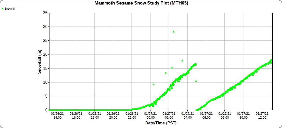
As I write this, dawn is breaking on the final day of January, which promises to be the nicest weather day of the winter so far with our deepest snowpack, fresh snow (although probably tracked out in resort terrain that was open yesterday), and bluebird skies.

Sadly, it sounds like there was another fatality yesterday in the backcountry adjacent to the 9990 chair at Park City Mountain Resort.  We have talked previously about the high frequency of fatalities there and some of the heuristic traps that contribute to them (see The Lure of Dutch Draw).  Today has all the hallmarks of the type of day that causes skiers to push it into steeper terrain with fresh snow, beautiful weather, and a season of pent-up powder frustration.  Don't let Powder Fever cloud your judgement.  

We have another shot at a major winter storm Tuesday night and Wednesday associated with an upper-level trough passage within large-scale northwesterly flow.  Below is the GFS forecast valid 5 PM MST Wednesday afternoon.  

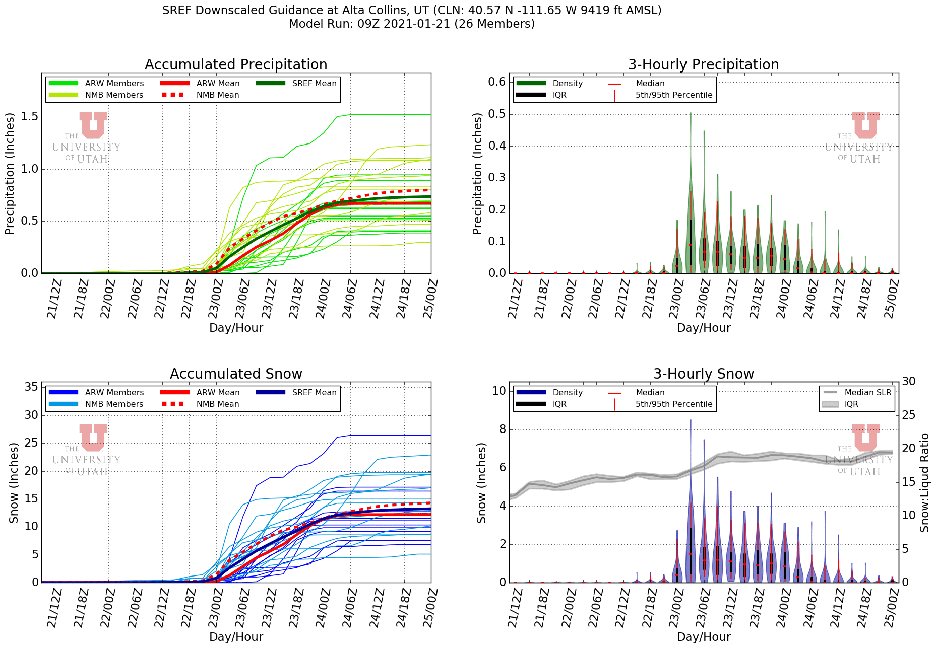
There have been ongoing problems with the NWS server that provides us with much of the data we use at weather.utah.edu.  I've been able to rewrite code to get the GFS and NAM from other sources, but haven't had time to do so for our downscaled ensemble products (it's not as simple as just changing the server name).  I really miss those as they allow me to quickly and easily assess event likelihoods for specific locations.  For this next storm, I'm just going to say keep your fingers crossed.  Snow-sports enthusiasts and hydrologists agree we need more snow.

Some have asked me if I think this could be a "Steenburgh Winter", defined by me to be a winter during which we reach a 100" snow depth at Alta-Collins by February 10.  Currently we sit at 72" at Alta-Collins, although I would expect that to settle back into the 60s before the next storm.  

I think it's pretty unlikely, but not impossible, if things later this week totally went off, but I also don't think even if we were to get there that there's any making up for the slow start to this season.  I'm just glad that things are finally improving.  

Thursday, January 28, 2021

Did Someone Say It Is Snowing?

Rumors are its snowing in the Wasatch.  I see about 6" since yesterday on the Collins Stake at Alta and Ski Utah's morning report advertises a max for the Wasatch resorts of 9" at Brighton.  

Peshaw!

Excuse me for being distracted, but my eye's gaze is drawn to the Sierra.

Other than a bit more of a bend and northward shift in the precipitation band, the radar over central California changed little overnight.  Heavy precipitation associated with an atmospheric river continues to have its crosshairs aimed at the Sierra Nevada.

The main change is the northward shift, which has allowed the Sierra around Lake Tahoe to get more snow overnight after a bit of a lull yesterday.

Here are some changes in total snow depth based on automated sensors in the Sierra Nevada from Squaw Valley to Mammoth Mountain from 1800 UTC (1000 PST) 26 January to 1200 UTC (0400 PST) 28 January:

Belmont-Squaw Valley (8000’): 25”
Roundhouse Bottom-Alpine Meadows (6950’): 21”
Caples Lake Near Kirkwood (8000’): 27”
Stanislaus Meadow (7750’): 35”
Deadman Creek (9250’): 35”
Slide Canyon (9500’): 46”
Mammoth Mountain Sesame (9014’): 47”

The change increases as you move southward, maximizing in the high eastern Sierra from Mono Lake to Mammoth Mountain.  I haven't looked further south yet to see if that's the maximum, but I suspect it is close to it as water equivalents from remote observing sites in the Sierra drop off quickly once you get a bit south of Mammoth.  

Below is snowfall data from the interval board at Mammoth's Sesame Snow Study Plot.  This board gets wiped from time to time, resulting in a reset of the snow depth back to zero.  You can see accumulations of 16", 18" and then 18" again before each wipe.  Sadly, the obs go haywire after that, but this is enough to indicate 52" of snow in about 26 hours.


While good for base, the problem with that much snow is resort operations will be difficult to impossible and the backcountry requires Herculean trail breaking through deep snow with slopes that might be steep enough to keep momentum going on too dangerous to ski.  In situations like this, instead of flocking to areas with the most snow, it's better to think about venturing to areas with lesser amounts in the "Goldilocks" range.

The good news is it will be there in the spring. 


Wednesday, January 27, 2021

Some Big Numbers So Far in the Sierra

Today is one of those days when I look at the observations coming in and I keep redoing the math in my head and asking myself if I'm doing it wrong.  The numbers from the Sierra Nevada near Mono Lake are ASTOUNDING. 

For much of the night and day, that area has been in the crosshairs of an atmospheric river and slow moving frontal precipitation band.  Below is the synoptic situation as of 2100 UTC (1400 MST) showing heavy precipitation over central California in the southwesterly flow ahead of the upper-level trough (note that portions of the Sierra have poor radar coverage. 

Twenty-four hour snow depth change diagnosed from automated sensors shows the heaviest snowfall in the eastern Sierra near and around Mono Lake, including an increase of more than 20 inches at one site.  Most of this snow has fallen in a period of about 15 hours (ignore the 39 near Lake Tahoe which may be eroneous).  


Not shown here are observations from Mount Rose in the Carson Range near Lake Tahoe which also got more than 18 inches last night.  

Those are changes in total snow depth.  That's a bit different than new snow which is ideally measured on a board that is wiped between 1 and 4 times a day.  The Sesame Observing site at Mammoth Mountain is their equivalent of Alta-Collins here in the Wasatch (they also have a remarkable snow-energy balance station elsewhere on the mountain with great data).  The trace below from their interval board shows 16 inches from 2200-0500 PST when the board was wiped, followed by another 18 inches.  

That adds up to 34 inches in 13 hours.  

Try saying that five times fast.  

And this storm is just getting started.  

Tuesday, January 26, 2021

Huge Storm Coming to Sierra

 Continuing with our theme of lyrics from 70s pop songs in this week's posts, Albert Hammond once sang, "it never rains in southern California, it pours." 

I'll take artistic license and extend that more broadly to the Sierra Nevada and snowfall.

Model forecasts for the Sierra in the coming days are pretty incredible.  The setup is a deep, cold cyclone and upper-level trough dropping down out of the Gulf of Alaska, with a slow-moving cold front and atmospheric river stalling over central California and the Sierra Nevada.  Below is the GFS forecast for 1500 UTC 27 January (8 MST Wednesday) showing the situation during the early stages of the storm, with the front just south of the Bay Area and heavy precipitation in the Sierra Nevada.  

Below are GFS integrated vapor transport forecasts showing the southwesterly flow and transport of moisture associated with the atmospheric river near and ahead of the front at 1200 UTC 27 Jan (0500 MST Wednesday) and 1200 UTC 28 Jan (0500 MST Thursday).   

Source: CW3E

Source: CW3E

Persistent and large moisture transport oriented perpendicular to the Sierra Nevada is a recipe for heavy orographic precipitation.  However, this is also a relatively cold storm.  The National Weather Service has issued a winter storm warning covering the northern Sacramento Valley and the Sierra Nevada foothills for example.  

Source: NWS Sacramento

Our downscaled snowfall products are spitting out some huge numbers for the Sierra.  Below is the downscaled GFS forecast for the 24-hour period ending at 0600 UTC 28 January (2300 MST Wednesday).  Local accumulations > 36" at upper-elevation locations in the Sierra Nevada near and north of Lake Tahoe and widespread accumulations > 48" in the high Sierra south of Lake Tahoe. 


It's worth a look at how we're getting those amounts.  To do this, we'll look at a time series produced from the GFS and our downscaled products by University of Utah graduate student Mike Wessler for Kirkwood near the Sierra crest south of Lake Tahoe.  At this location and in general in the high Sierra, the downscaling doesn't change the precipitation much.  Through 1800 UTC 29 January (1100 MST Friday) the GFS with and without downscaling produces a bit more than 6 inches of water-equivalent precipitation (upper-left panel), including a peak 3-h accumulation of almost 0.7 inches.    

The average snow-to-liquid ratio in the Sierra Nevada is about 8 to 1, so if we got 8 inches of snow out of that, the total would be 48 inches.  That's impressive, but not insanely so.

However, this is a cold storm.  The temperatures for the storm at 700 mb, for example, are near or below -8˚C (center-left panel).  In Utah, that would mean snow down to the valley floor and probably a snow-to-liquid ratio in the mountains of perhaps 13:1.  

Indeed, our snow-to-liquid ratio algorithm is spitting out snow-to-liquid ratios of 12.5:1 or greater (center-right panel).  This leads to snowfall totals > 80".  

The plot below illustrates the relationship between snow-to-liquid ratio and 700-mb temperature in past storms at Soda Springs along I-80 north of Kirkwood.  For temperatures between -8 and -10˚C, as forecast by the GFS for most of the period, the linear fit snow-to liquid ratio is about 10-11 to 1.  Numbers like we're getting from our snow-to-liquid ratio algorithm are in the upper part of the distribution.  

Graph source: Van Cleave (2014)

We can also look at our downscaled SREF products.  The mean for water equivalent is right on 6" and the GFS forecast, with a range of about 3-9".  Mean snowfall is also right on the GFS, around 80", with similar snow-to-liquid ratios.  


Both water equivalent and snow-to-liquid ratio must be considered when making snowfall amount forecasts.  This will be a significant snow event in terms of water equivalent, but snow-to-liquid ratio will strongly affect how huge the snowfall amount goes.  The algorithm we use for snow-to-liquid ratio right now is temperature dependent and doesn't consider wind or precipitation amount.  While temperature favors larger ratios, the wind and precipitation amount do not. 

I'm excited to see where this all ends up.  Another 2 meter (80") storm?  Let's hope so.  

Monday, January 25, 2021

We Need Snow

The weekend snowstorm and powderfest notwithstanding, the snowpack situation in northern Utah remains dire and it is important that you all continue to provide sacrifices to Pagan gods so that the situation improves.  Human sacrifice not recommended, but please consider other legal options.

Alta ski area's web site reported totals through Sunday morning of 22".  The hourly interval stake observations from Alta-Collins indicated 19".  In either event, it was a good storm.  Several of my colleagues at the University of Utah in Mechanical Engineering and Atmospheric Sciences are testing out a new measurement system at Alta-Collins that provides very high-frequency measurements of snow density (expressed below as water content).  Below is what they found with the first couple of inches varying around 10% and then the next several inches varying around 8-9%, before some larger fluctuations for the last couple of inches.   

Source: https://my.mech.utah.edu/~pardyjak/DEID.php

That's actually a pretty consistent snowfall.  We see larger variations in many storms around here. 

I'm sure it helped the skiing a great deal (I avoided the powder panic and went skate skiing).  However, the Alta-Collins snow depth sits this morning at 57", below my 60" threshold for "good early season conditions" despite it being late January.  NRCS SNOTEL data shows that sites like Thaynes Canyon above Park City are still at the lowest snowpack water equivalent in the past 30 years.  

Source: NRCS

Thus, we are still "yo-yoing off the back." 

The week ahead is best summarized by lifting some lyrics from Stealers Wheel lyrics:

Clowns to the left of me
Jokers to the Right
Here I am
Stuck in the Middle with You

And that looks to be precisely where we will be this week with BIG storms to the west of us, BIG storms to the south, and BIG storms to the north, as indicated by the NAEFS downscaled snowfall product through 0000 UTC 1 February.  

However, it probably won't be a shutout as there are enough bits and scraps coming through to give us some snow and if we're lucky, one or more of the storms will come close enough to give us a bit more.

The forecast plume for Alta-Collins gives us some dribs or drabs through the 27th, but then picks things up.  The mean 7-day storm total is actually a fairly healthy 30 inches, although the spread is large. A lack of clustering around any one event is indicative of the bits and scraps and differences in their timing and intensity.  


I think that 30" is optimistic and perhaps on the upper end of what I would go for for the period.  Still let's hope we get something.  I don't want to have to resort to human sacrifice.

Saturday, January 23, 2021

Storm Update

It is, as my ski-touring friends like to say in situations with a hair-trigger snowpack, a good day for a walk in the woods.  

Storm totals as of this (Saturday) morning as reported by the Utah Avalanche Center include 16" (1.42" SWE) in upper Little Cottonwood, 15-20" (0.95"-1.50" SWE) in upper Big Cottonwood, 10-13"  (.85-1.2" SWE) on the Park City Ridgeline, 14" (1.30" SWE) in Mill Creek, 10-12" (1.0-1.23" of SWE) in the Provo area mountains, and 8-12" (0.50-1.10" SWE) in the Ogden area mountains.

Basically a little something for everyone, with more to come.  

Not surprisingly, snow-starved Salt Lakers were out in full force this morning.  Alta reported full parking lots at 8:12 AM, a full hour before the scheduled opening of the lifts at 9:15.  


In some years, a 16" storm might make for great backcountry skiing, but the snowfall in this instance is falling on a house of cards snowpack and the Utah Avalanche Center has issued an avalanche warning for backcountry areas of northern Utah.


Such conditions lead to the so-called "walk in the woods" avoiding avalanche terrain.

I suspect the storm so far has been good for the Nordic skiers as well, adding to the base at Jeremy Ranch, Round Valley, and other Park City area trails.  I'm not so sure about Mountain Dell.  Yesterday's warmth and rainfall likely hurt the snowpack there some (I skied in the morning but before it really warmed) before snow levels lowered and I haven't seen a report yet.  

The current radar shows precipitation trying to get organized in some sort of a band over the northern Wasatch Front and Great Salt Lake, with more scattered snow showers to the south.  

With a bit of a hole in the northeastern Salt Lake Valley, it's a beautiful scene looking toward the Wasatch Range.

I've been waiting a long time for a view like that.  I've missed mountain storms!

Consistent with the radar image above, model forecasts for today keep the action over northern Utah along a slow moving trough.  The heaviest snowfall will likely fall in a band that is near that trough, as indicated by the NAM forecast below.  

There's some variations in the placement and details of the precipitation amongst the models.  The HRRR, for example, keeps the heaviest snow over the northern Wasatch Front and southern Great Salt Lake, as well as in orographically favored regions to the south, like Mount Timpanogos and the Alpine Ridge above Little Cottonwood.  


I'm inclined to think that snowfall today will be heaviest in that band, which is most likely to linger over the northern Wasatch Front and Mountains.  However, we'll see periods of snow over the Salt Lake Valley and central Wasatch.  

Enjoy!

Friday, January 22, 2021

Everything Is Broken...

For those of you who use weather.utah.edu, my apologies for the very long outage of model graphics and derived products.  

We have occasional outages sometimes due to computer or networking issues at the University of Utah. We also have them from time to time due to crappy programing on my part. 

The current one, however, is due to scheduled downtime of the NOAA server that serves as host for model data produced by the National Weather Service. Such downtime is typically postponed if the National Weather Service declares a "critical weather day," but neither yesterday or today met the criteria for such a day outlined at https://www.nws.noaa.gov/directives/sym/pd01022003curr.pdf.  The potential for heavy snowfall in the Wasatch certainly apparently meets critical weather day status for us, but not the nation.  Thus, the downtime went forward as scheduled.   

The last update issued on the server was at 1339 UTC (0639 MST) when a statement was issued that the maintenance was complete and they were working to get systems back online.  Sadly, nothing yet.

There are a couple of other options for receiving some of the model data, so you may find it elsewhere, possibly at lower spatial or temporal resolution depending on the site and how they are receiving the data.  

NOMADS has been pretty reliable until recently.  I may have to build some redundancy into our software if this continues, although critical data for some of what we access isn't available elsewhere.  

Thus, rather than looking at model data today, I'm burning skis and praying for snow.

Thursday, January 21, 2021

Location, Location, Location

The three most important things in real estate are location, location, and location, and that's often the case for winter storms in northern Utah.  The position of precipitation systems can make or break the forecast at a given location, and that's the case for the Friday-Saturday storm that we've been hoping for over the past several days.  

The storm has at least two parts and possibly more depending on how things come together.  Due to scheduled downtime of the National Weather Service server that we get our model grids from, I'll be using the 1200 UTC NAM forecast from this (Thursday) morning to illustrate these parts.

The forecast for 1500 UTC 22 Feb (0800 MST Friday) shows a deep upper-level trough over the northern California coast.  At this time, there's only spotty precipitation in the southwesterly flow over the southwest US, including Utah.  

However, during the day tomorrow, due to the strong dynamics associated with the trough, things moisten up nicely and precipitation develops across much (but not all of Utah) by 0000 UTC 23 Jan (1700 MST Friday).  

This moist, southwesterly flow is the first storm part.  Any precipitation in the Salt Lake Valley will be rain Friday afternoon, with snow levels potentially reaching as high as 6500 feet, before they lower Friday evening and Friday night, reaching the valley floor early Saturday morning.  

The second storm part forms along the surface and low-level trough axis further to the northwest on Friday night, evident as an area of heavy precipitation northwest of Salt Lake City at 1800 UTC (11 AM) Saturday in the NAM forecast below.  

The flies in the ointment concern the potential to be "dry slotted" between the moist southwesterly flow period and when that band moves through, as well as the precipitation pattern and intensity associated with that band.  A best case scenario is everything produces and the mountains see a great deal of snow.  A worst case scenario is the storm comes through in fits and starts and accumulations are more limited.  

These features can be seen in the NAM time-height section below.  From late Friday through about 6Z Saturday (2300 MST Friday) low-level relative humidity is high and moisture is deep.  After that, there's a period where things dry out and you can see a slot of dry air at mid levels Saturday morning (i.e., from about 12-18Z).  Then the surface trough finally comes through after 0Z Sunday (1700 MST Saturday).  

Because of the server downtime, I'm using an old SREF as well.  The plume below is for Alta and shows a mean of about 13 inches and a range from about 5 inches to 26 inches.  

Most members fall between about 7 and 15 inches.  By and large, this should be a decent storm and I would lean toward a 10-20" storm total for the upper Cottonwoods.  This could come in pieces though, beginning Friday afternoon and ending Sunday morning.  More than 20" will require one of the pieces to come through big time, or for the event to be more continuous.  

I haven't given much thought for Mountain Dell or Round Valley, so I'm just going to be burning skis and praying to Ullr that they get snow too.  

Tuesday, January 19, 2021

Yesterday's Snowmaggedon

January has brought a whopping...wait for it...16.5 inches of snow to Alta through January 19.  That's not a lot, but many driving through Little, Big, or Parley's canyon got bit by the red snake anyway.  

Highway impacts from winter storms depend on several factors.  Snowfall amount can matter, but snowfall intensity, pavement temperatures, traffic, timing, and other factors can cause even storms with relatively small totals to cause huge problems.  

Twenty-four hour snowfall total in the central Wasatch through this morning are in the 1-3" range.  However, most of that snow fell in the late afternoon with relatively high intensity, especially west of the crest, strongly affecting road conditions in the canyons.  

Source: NCAR/RAL

The situation at the time was a bit unusual.  Winds at mountaintop level (e.g., on Mt. Baldy and at the top of the Snowbird tram) were weak and northerly as we were beginning the transition to the easterly flow that would develop overnight and produce downslope winds along some areas of the Wasatch Front.  However, upstream, northwesterly flow was impinging on the Wasatch Range over the Salt Lake Valley.  Some light easterlies were observed in the Olympus Cove area, but I suspect this was produced by local outflow from the precipitation area along the west slope of the Wasatch.  


The afternoon sounding was consistent with the surface-based observations with northwesterly flow at low levels and very light flow at crest level (700 mb or 10,000 feet). 


Thus, it appears that shallow, low-level upslope flow led to the frequent initiation of shallow convection over the westernmost portions of the central Wasatch.

Additionally, the layer from about 750 to 600 mb was between -10 and -20˚C, a temperature range known as the dendritic growth zone.  This is a range in which ice crystals, when conditions are right, can grow rapidly.  I was out walking yesterday with a world-famous meteorologist and we both commented about how even the smallest cumulus clouds were producing virga.  

Finally, weak flow at crest level, these crystals had no where to go.  The fell out predominantly at and west of the crest.  

This led to traffic armageddon in all three canyons as down-canyon traffic was picking up at the end of the day.  Below is the UDOT traffic camera at Alta showing the dreaded red snake at...wait for it...6:22 PM.  
Source: UDOT

At that time, it appeared it wasn't even snowing anymore and I was seeing tweets claiming it took 2-2.5 hours to get down the canyon.  All of this, despite the fact that the Snowbird snow cam showed only about 3 inches on the stake.  

Source: Snowbird

And, to add insult to injury in this low-snow year, the strong winds last night have done their damage, transporting and beating up the snow.  


I miss real winter. 

Friday, January 15, 2021

Big Japanese Snows

The Tokyo Climate Center of the Japan Meteorological Agency just released a report discussing the heavy snowfall observed in Japan in recent weeks.  If you want the gory details, the report is available here.  The figures below are from the report.  

As detailed in the report, beginning in mid December, an anomalous jet-stream pattern led to frequent cold air outbreaks from interior Asia over the Sea of Japan, which was anomalously warm.  72-hour all-time or January snowfall records were broken at 19 stations, spanning nearly the entire length of Honshu.  

There are a couple of things that stand out for me in the image above.  First, there are some stations well inland from the Sea of Japan that set records.  These occurred during the mid-December event in which strong flow enabled deep inland penetration and orographic enhancement of sea-effect snowfall (see our previous post Gosetsu Chitai Dumpage for more information).  

Second, there are a few stations on or near the Pacific coasts of northern Honshu and Hokkaido Islands that also set records, including on the far east coast of Hokkaido.  These are not discussed explicitly in the report, and I wonder if they might reflect the influence of a passing mid-latitude cyclone rather than sea-effect spillover.  That might be most likely in far eastern Hokkaido.  Something to look into in a future life when time permits.

Maximum snow depths exceeded the maximum on record at one site and the maximum for January at four others.  If you squint, you can see a few sites in central Honshu and one in northern Honshu (probably Sukayu Onsen) that reached a snow depth of more than 300 cm (120 inches). 


Note also the stark contrast across Honshu.  This is actually not that unusual, but it's still remarkable.  Traveling by train, including Shinkasen (bullet train) from Tokyo to the Hokuriku district of central Honshu near the Sea of Japan (or vice versa) can be a mind boggling experience as you move through a remarkable climate gradient.  There's currently no snow in Tokyo, but more than 3 meters in the mountains near the Sea of Japan.  

In 2017, I left the Myoko Kogen where it was snowing heavily and the owner of the Myoko Mountain Lodge had to drive me inland to catch my train because the nearby stations were closed.  Here's how things looked the night before I left.


We had a difficult drive, but I caught my train.  The snowfall dropped off quickly inland.  I can't remember exactly where I took this photo on the Shinkasen to Tokyo, but the mountain in the distance is Mt. Fuji and you can see there is no snow on the ground.  


Tokyo is near sea level, but so are the cities on the Sea of Japan coast that currently have around a meter of snow.  Thus, even at the same elevation, there is a stark contrast.

The snowiest cities in the world are located on the Sea of Japan coast of Honshu and Hokkaido Islands.  Many average over 200 inches a year.  Huge "Gosetsu" winters (heavy snow winters) in the past have crippled those cities.  Here's a great video of Nagaoka in the 1963 Gosetsu Winter. 


All of this is a reminder that while Utah is in the grips of drought, Mother Nature can still bring it.  

Tuesday, January 12, 2021

The Difference between the Inversion and the Haze/Pollution Layer

Many people equate pollution in the Salt Lake Valley with the inversion, but they are different but related phenomenon.

Understanding the difference between the two explains unusual days like yesterday when haze and smog filled the Salt Lake Valley through a relatively deep layer, extending up to about 7500 feet.  This occurred not because the inversion was deep, but because the inversion was elevated.  In addition, the atmosphere below the inversion featured weak stability, enabling pollution to mix through a relatively deep layer.  

The image below includes a photo taken yesterday morning from Alta Ski Area and the sounding taken that afternoon at the Salt Lake City International Airport.  Haze and smog filled the Salt Lake Valley to an altitude of about 7500 feet where there was a sharp boundary to clearer air (indicated by the dotted line).  The afternoon sounding showed that in that haze and smog layer, the stability was relatively weak. Meteorologists refer such a region as a mixed layer because the weak stability promotes vertical mixing.  

Sounding source: SPC

However, at about 7500 feet (7400 feet in the sounding), there was a pronounced inversion in which temperature increased rapidly with height.  This put a lid on the mixed layer, preventing mixing with the free atmosphere aloft.  Thus, pollution wasn't trapped very near the surface, but instead was able to mix to the top of the mixed layer at 7400 feet, but no higher.   

This situation is similar to what commonly happens in the Los Angeles basin where the marine boundary layer typically features a mixed layer at low levels capped by an inversion.  

The reality is that the situation yesterday from an air quality standpoint was probably better than if the inversion were in its usual position very near the valley floor.  When that occurs, pollution is trapped in an even shallower layer.  

I'm interested to see how things evolve today.  Overnight, the mixed layer was destroyed for two reasons.  First, temperatures near the valley floor cooled, while those between the surface and the elevation of the top of yesterday's mixed layer (i.e., near 7400 feet) increased.  This has produced a sounding that is very stable.  

Source: SPC

If there was snow on the ground and there wasn't a trough approaching, I would say our goose is cooked.  However, the lack of snow on the ground will enable the sun to produce a shallow mixed layer today (although probably not as deep as yesterday).  Thus, I suspect the haze/pollution layer won't be as deep today, but will probably envelop the upper benches this afternoon.  Hopefully the trough passage tomorrow and tomorrow night will scour things out and hit the reset button on air quality.

Sunday, January 10, 2021

Valley Stratus

Low overcast clouds that fill the lower elevations of mountainous regions are sometimes referred to as valley stratus.  They can occur any time of year, but are most common during the cool-season when the energy input from the sun is low, enabling the stratus to be more persistent.  

We are experiencing valley stratus in the Salt Lake Valley today, with mostly cloudy skies.

However, the highest elevations of the Wasatch are above these clouds.  Note the contrast below between the lower and upper mountain at Snowbird.

Source: Snowbird

Source: Snowbird

Satellite imagery shows an interesting transition in the valley stratus today.  At around noon, the stratus was confined to near the Great Salt Lake, which was fully covered by clouds. 

Visible satellite imagery at 18:56 UTC (11:56 AM MST). Source: College of Dupage

An hour later, stratus was developing along western slope of the Wasatch Range and within the Salt Lake and Utah Valleys immediately upstream.  

Visible satellite imagery at 18:56 UTC (11:56 AM MST). Source: College of Dupage.

This morning's sounding from the airport is typical of valley stratus situations.  At low levels, there's relatively cool, moist air, capped by a strong inversion that in this case is based at about 725 mb (about 9000 feet above sea level).  

Source: SPC

The stratus forms near the top of the cool, moist layer, just beneath the inversion.  Conditions at. higher elevations are spectacular due to the dry air aloft, but the valley remains cool. 

If this were summer, the energy input from the sun would be sufficient to warm the valley airmass enough to break up or completely dissipate the clouds.  This time of year, however, they often persist unless other atmospheric changes contribute to their demise.  

This situation differs from pollution inversion events because the inversion is based quite high.  Thus, pollution in the valley, while still trapped to some degree, is able to mix to about 9000 feet, so air quality today is good.  Over time, however, the inversion will lower, which will dissipate the clouds, but also trap the pollution in a shallower layer.  I would expect to see more haze tomorrow, for example. 

Valley stratus events are even more common in wetter environments, such as the Coast and Columbia Mountains of British Columbia and the European Alps.  When I taught at the University of Innsbruck, the students were required to forecast the likelihood of valley stratus.  

The ability to recognize valley stratus events is valuable for mountain adventures.  If you woke up in Innsbruck this morning, you were greeted by grey, depressing skies.

Source: foto-webcam.eu

It might also be cloudy at upper elevations, but in the Inn Valley, it is always worth a look at the web cams.  Indeed, the mountains near town were above the clouds, a short funicular and tram ride away.  

Source: foto-webcam.eu

Just like Utah, at least meteorologically.