Showing posts with label Rime. Show all posts

Sunday, November 6, 2022

The Formation of Drizzle and Freezing Drizzle

This post is dedicated to everyone who came out to break trail for me today.  So many people turned out.  Your dedication and efforts are greatly appreciated.  I need all the help I can get at my advanced age.  
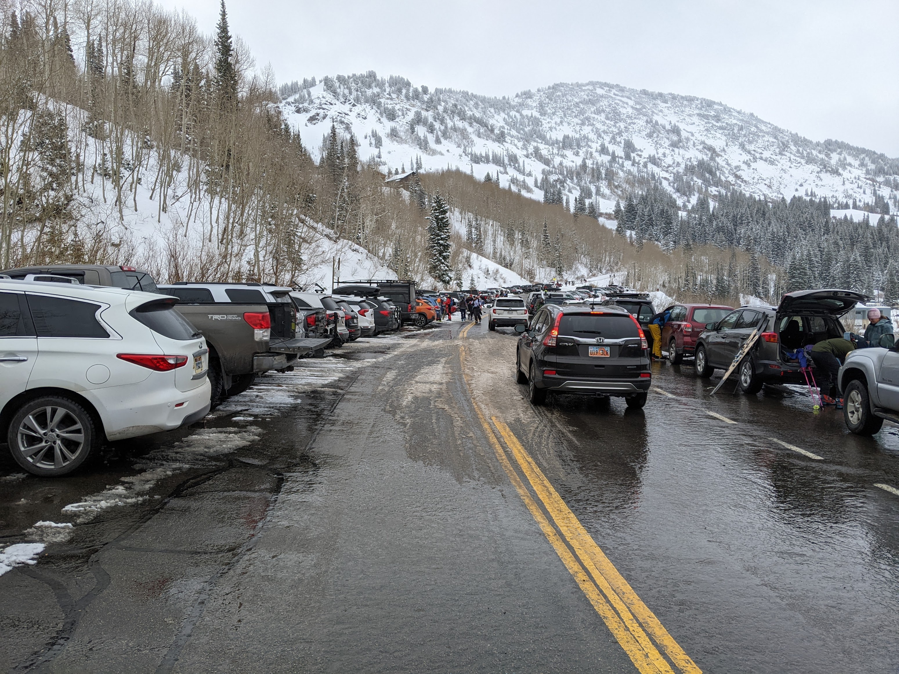
If you happened to be one of those ski tourers in upper Little Cottonwood today, you may have experienced drizzle (below the freezing level) or freezing drizzle (above the freezing level).  Let's take a look at what these are and how they form.  

Drizzle is a form of liquid precipitation comprised of small water droplets.  Scientifically, drizzle droplets are larger than 100 nanometers and less than 0.5 mm in diameter.  If the droplets are smaller than 100 nanometers, they are cloud droplets.  If they are more than 0.5 mm they are rain droplets.  

Freezing drizzle is drizzle that freezes on impact with the ground or other objects.  It occurs when drizzle forms and collides with the ground or other objects at temperatures below 0˚C.  In such conditions, the drizzle drops are supercooled, meaning they exist as liquid water at temperatures below 0˚C. 

Somewhat related to freezing drizzle is rime, the white icy deposit when supercooled cloud or drizzle drops collide with the ground or other objects like trees, structures, or your goggles.  On my descent at about 1 PM, I used my thumb several times to scrape the rime off my googles that formed as I skied through the freezing drizzle.   

Drizzle or freezing drizzle typically forms in shallow stratocumulus or altocumulus clouds.  A few large droplets form typically near cloud top, turbulence allows them to collide and merge with other droplets, and grow into drizzle drops that can fall out of the cloud.  The process of droplets colliding and merging is called collision-coalescence.  This can occur in clouds that are entirely above freezing (i.e., > 0˚C) or in clouds that have temperatures reaching as low as about -10˚C.  In the case of the latter, freezing drizzle occurs at altitudes where temperatures are at or below 0˚C.  

Critical for the formation of freezing drizzle is the existence of supercooled water droplets.  These supercooled water droplets can exist because water does not necessarily freeze at or below "freezing."  Between -40˚C and 0˚C water needs what is known as an ice nucleus or ice nucleating particle to catalyze the ice formation process.  Ice nucleating particles include some forms of clay and some types of bacteria.  For instance, snowmakers often use an additive known as Snowmax, a microbe that helps water freeze.   Just below 0˚C, water needs a particle with a structure very similar to ice to freeze.  But as the temperature decreases, a greater diversity of particles can initiate freezing.  At -40˚C, water will freeze whether or not it has an ice nucleating particle.  

Getting water to freeze in a puddle or a lake isn't a problem because there are all sorts of particles in a large volume of water to initiate freezing.  But in a tiny cloud droplet, the odds it contains an ice nucleating particle is very very low, especially at temperatures just below 0˚C.  

I think the freezing drizzle produced this afternoon in upper Little Cottonwood was produced in relatively shallow clouds that were draped over upper-elevation ridges.  You can see these shallow clouds in upper Albion Basin.  Note that they appear to be somewhat decoupled from the higher clouds aloft.  

I noticed the drizzle around 1 PM. At that time, temperatures at 10,500 feet within those clouds were around -4˚C.  At such temperatures, there are very few ice nucleating particles.  Most of the cloud droplets are supercooled and with a little turbulence, one can develop freezing drizzle.  

If, however, the clouds extend to altitudes where temperatures are near or below -10˚C, there are usually enough ice nucleating particles to freeze some of the water droplets.  When this happens, some of those droplets will shatter as they freeze, producing many ice particles.  This process is known as ice multiplication and it allows the cloud with cloud top temperatures below -10˚C to contain a stew of ice and supercooled liquid water particles.  Typically in such a cloud, the ice particles grow more rapidly than the cloud droplets (I'll avoid talking about why this occurs as this is already a long post) and this short-circuits the drizzle formation process.  You either don't get any precipitation or you get snow.

A curious aspect of our tour today is that it was snowing when we arrived at about 9:15, so something changed between then and about 1 PM when the freezing drizzle formed.  One possibility is that at 9:15, the cloud was deeper, with cloud top temperatures below -10˚C, or the snow was being produced in a cloud layer aloft and falling through the lower clouds.  I don't have sufficient observations to evaluate these hypotheses.  Often our routine weather observations do not allow us to adequately probe the mysteries of cloud microphysical processes.  

Thursday, November 11, 2021

Today's Rime Event

 The models have advertised a possible riming event today and tonight in the upper elevations of the central Wasatch and it seems to be setting up as advertised.

As illustrated by the photo below, taken about 8:15 AM looking south from my office on the University of Utah campus, shallow altostratus clouds are now impinging on the highest peaks of the central Wasatch.

The GFS forecast sounding valid 2100 UTC (1400 MST) this afternoon suggests that by this afternoon, the altostratus layer will extend from about 750 mb (8000 ft) to 650 mb (11,775 ft), enveloping much of the upper elevations of the central Wasatch.  


Cloud base temperature will be 0˚C and cloud top temperature about -7˚C, so this cloud will largely be "subfreezing."  

However, water droplets in clouds do not necessarily freeze if the temperature is below 0˚C.  To freeze, water needs an ice nucleating particle to serve as the nucleus for ice crystal formation.  These particles are typically called ice nuclei or IN for short.

The number of particles that can serve as an IN varies depending on the types of particulate matter in the airmass and the temperature.  All else being equal, the lower the temperature, the more particles that can serve as IN.  

At temperatures just below 0˚C, however, there aren't typically many IN available.  As a result, clouds that don't extend to temperatures below about -10˚C tend to contain a lot of supercooled cloud droplets.  If these droplets can combine and grow into larger droplets, especially drizzle, they tend to freeze on contact with a sub-freezing surface, such as trees, the ground/snow, lift towers, buildings, etc.

In general, conditions in Utah do not favor extreme riming events like occurs in other parts of the world, especially in maritime regions like the Olympic and Cascade Mountains, southern Andes, etc. In Patagonia, spectacular rime mushrooms often form and represent a challenge and hazard for mountaineers.

Rime mushrooms on Cerro Torre (Photo: Rolando Garibotti).  Source: Whiteman and Garibotti (2013).

You can read more about them in this article by my college Dave Whiteman and mountaineer Rolando Garibotti.

It's probably a good thing we don't get such extreme riming in Utah, although even our light rime can be an issue for ski area operations, ski conditions, and future avalanche conditions.  

Although the cloud and temperature conditions today and tonight are generally favorable for rime, the severity of the event will depend to large degree on small-scale processes that are more difficult to anticipate.  In particular, with the winds, turbulence, and cloud microphysical processes favor the development of larger supercooled water droplets that rime more efficiently?  Will the clouds get just deep enough that some droplets can freeze and help reduce supercooled water concentrations?  These are questions I can't answer.  We will just have to see how things evolve today and tonight.

Tuesday, November 9, 2021

As November as It Gets

If you are into grey, today is your day.

Morning dawned with a very November scene.  Valley smog trapped beneath and inversion with cirrostratus clouds aloft. 

Radar shows a harbinger of things to come with echoes moving into the western part of the state at 1440 UTC (0742 MST).

Its pretty dry at low levels, so I suspect that's virga or light rainfall on the desert floor, but precipitation is coming with rain developing in the Salt Lake Valley today, and snow at upper elevations.

A look at the latest (0600 UTC) GFS-derived forecast for Little Cottonwood shows not much has changed from yesterday, although it has gotten a bit wetter and snowier compared to yesterday's run discussed in the prior post.  Winds on Mt. Blady begin to shift beginning around 11 AM today, veering from southerly to westerly through evening.  Temperatures are mild this morning and sitting at 39˚F at the base of Alta, but the wet-bulb temperature is around 30˚F and the GFS wet-bulb zero level forecast for today has it around 8000 ft.  Thus, although we might see a spot or rain at 8000-9000 ft to start, snow levels should fall quickly to about 7500 ft once precipitation picks up.  For Alta-Collins, up at 9600 ft, the GFS puts out 1.33" of water and 13" of snow through 4 AM Wednesday morning, which would be a very healthy and needed snowfall with a mean water content of about 10%.  

Numbers from the Euro, as is often the case, are a bit lower and around 0.82" for Alta, which would be about 8" of snow.  Additionally, the downscaled SREF mean sits at around 0.6".  I'm inclined to stick with the 6-12" forecast for Alta Collins from yesterday, but hope the GFS verifies.  

Wednesday looks to be a break day, but Wednesday night and Thursday the GFS is advertising strong northwesterly flow with warm air advection and high crest-level relative humidities. 

Moist, unstable northwesterly flow is often good for the Cottonwoods, but this is stable northwesterly flow.  The GFS forecast sounding valid 1800 UTC (1100 MST) Thursday shows stable, saturated conditions from just below 700 mb (10,000 ft) to 600 mb (13,750 ft).  Above that, the air is subsaturated in the middle troposphere.  This would result in a stratus deck that envelops the upper elevations of the central Wasatch with cloud top temperatures at or above -10˚C.  Those are marginal temperatures for generating snowfall due to a lack of ice nuclei.  

Thus, Thursday could be a riming event for the upper elevations, with perhaps some fits and starts of snow at times.  

Saturday, February 8, 2020

A Trip to Bizzaro World

Today's ski tour was one of the more surreal that I can recall.

For better or worse, we decided to leave late, opting to head out mid morning.  It seemed pointless to deal with the canyon traffic, but with the weather of the past week, it seemed essential to get to high elevations in the hope of finding decent snow.

While driving south on I-215, the sign flashed "Little Cottonwood Closed", which we expected, but then "Big Cottonwood Closed" which we didn't. 

We opted to drive to the canyon mouth anyway, where the sign said the canyon was closed above mile post 11.  Hooray, we can find something to ski below that, even if it's just a walk in the woods.  We talked our way through the bottom roadblock and then another partway up the canyon.  We ended up skinning up the Mineral Fork road in complete solitude. 

The snowpack at elevations we skied was topped by a stout crust.  In places it was 5 cm thick. 


A close look at the crust, which my photo doesn't really reveal, showed that there were two layers, with the one on top relatively clear and perhaps 5 mm thick. 

Clear ice was also evident on tree branches. 


Rime ice is not uncommon in mountain areas, but is typically produced by smaller cloud droplets and has a white, translucent look.  Clear ice of the type above requires bigger droplets.  At least drizzle sized if not larger. 

Thus, the clear ice is evidence of either freezing drizzle or freezing rain.  The distinction between drizzle and freezing rain can be made based on size (drizzle droplets have diameters < 0.5 mm, rain > 0.5 mm) or process.  With regards to the latter, the pathway to freezing rain typically involves snow falling through a warm layer (>0˚C), melting into rain, and then falling into a subfreezing layer where it becomes supercooled but does not freeze until it contacts an object.  This didn't happen yesterday.

Instead, some hints at what happened are provided in the 0000 UTC sounding from yesterday afternoon.  Note how the dewpoint (green line) and temperature (red lines) meet near 700 mb and parallel each other to about 650 mb.  That is reflective of a shallow cloud layer.  At 650 mb, where the lines spread out again, is cloud top.  There, temperatures are just a bit higher than -10˚C. 

Source: SPC
Clouds that extend to altitudes where the temperature is lower than -10˚C typically glaciate, meaning they convert into a cloud that is part ice and part supercooled water.  However, clouds that do not extend to altitudes where the temperature is lower than -10˚C often consist of very little ice and instead are comprised primarily of supercooled liquid water droplets.

When such clouds intersect the mountains, they can cause riming, but something happened yesterday to cause large droplets to form.  I think this occurred for two reasons.  First, the rate of change of temperature in the cloud layer is about 0.65˚C/100 meters.  In a cloud, that results in air parcels that are statically "neutral," meaning if you give them a push up or down, they can easily move further up or down.

Second, there is wind shear in this layer.  Such shear, in a neutral environment, can easily cause turbulence and overturning.  That turbulence and overturning enables larger droplets to grow.  I suspect this led to large drizzle or even small rain droplets that in turn froze on contact with the snow (or any other surfaces). 

This mechanism was first proposed as a contributor to precipitation enhancement by Bob Houze and Socorro Medina of the University of Washington based on data collected in the Cascade Mountains and European Alps.  Their conceptual model is shown below and highlights the turbulent, overturning cells in the shear layer.  Below the melting band, this leads to precipitation enhancement as droplets grow through collision and coalescence.  Above it, through the riming of snowflakes. 


Their conceptual model assumes a deep cloud that is glaciated.  It appears that at some point yesterday we were dealing with a cloud that had a great deal of supercooled liquid water.  Thus, the turbulence and overturning led to large drizzle drops. 

At least this is my hypothesis.  I wasn't out yesterday to observe the event.  Please share your observations in the comments and perhaps they will support the hypothesis or suggest revision. 

One thing is for sure, that crust is supportive and it actually skied reasonably well on lower angle terrain.  It is also here to stay for a while.  It may be an issue for avalanche safety in the coming days or even weeks. 

Wednesday, December 28, 2011

Rime

Today if you are in the high country, you might getting a first hand look at rime, which forms as supercooled cloud droplets freeze when they contact solid objects.  

I got a pretty good coat of it on my googles in upper Collins gulch while skiing through the altostratus deck that was draped over the Wasatch Mountains early this afternoon.  

Source: Alta Ski Area
In fact, I even resorted to a maneuver I call the Snoqualmie swipe, which involves rubbing my thumb across my goggles to remove the rime between turns.  I don't use the Snoqualmie swipe much in Utah, but I was a real pro at it when I lived in Seattle and skied frequently at Alpental in Snoqualmie Pass, where rime is practically an every day occurrence.

Unless heated, no object is safe from rime.  One of the Snowbird cameras at the top of the tram was coated with it.

Source: Snowbird Ski Area
Rime is produced by clouds that contain large supercooled cloud droplets or drizzle.  Supercooled means that the droplets or drizzle are below 0ºC but are comprised of liquid water rather than ice.  Water does not necessarily freeze when it is below 0ºC.  To freeze, it needs a particle, known as an ice nuclei, to help it transition to ice.  Without such a particle, it can become supercooled.  

At temperatures just below 0ºC, there aren't many particles that can serve as ice nuclei.  So, shallow clouds that are just below 0ºC are prone to riming.  Today as we have a shallow layer of altostratus hanging over the Wasatch Range.  The temperature at Alta-Collins, which sits right at cloud base, is about -1 to -2 ºC.  

Riming is a concern for aviators.  The buildup of rime ice on aircraft not only adds weight to an aircraft, but also changes the wing aerodynamics.  The National Weather Service Aviation Weather Center produces analyses of icing severity, on which they overlay pilot reports of icing.  Light icing is presently being reported by pilots over northern Utah.  They won't linger long at altitudes where this is a concern.

Source: NWS/AWC

Wednesday, March 30, 2011

Riming in Action

In the previous post, I suggested that we might be in for a period of riming in the mountains, which we often see in moist, northwesterly flow downstream of a low-amplitude upper-level ridge (a.k.a., the dirty ridge).

That riming appears to have come to fruition.  The Utah Avalanche Center reports "overcast skies and light snow, rime, and graupel" in the mountains this morning and there are multiple pilot reports along the Wasatch Front of light or light-to-moderate icing.

Maximum icing severity analysis with pilot reports of icing annotated.
Source: NOAA/NWS Aviation Weather Center
Frequent blog reader David clued me into the the product above, which is is produced by the NOAA/National Weather Service Aviation Weather Center and available here.  For you science geeks, the techniques used to produce the analysis are described by Bernstein et al. (2005).    I suspect lead author Ben Bernstein, who was my next door neighbor as an undergraduate at Penn State, never expected that it might be useful for ski forecasting!

Riming and aircraft icing occur in clouds that contain large amounts of supercooled liquid water.  Ice crystals have a difficult time forming at temperatures near freezing but warmer than -10C.  Since there is some snow forming in the mountains today, obviously we're able to form some ice crystals, but there's also a lot of supercooled liquid water.  The morning sounding shows why.  Note the strong inversion at about 640 mb and that cloud top temperatures are near or just below -10C.

Source: NCAR/RAL
The area downstream of a low-amplitude upper-level ridge is where one frequently finds shallow altostratus layers that contain large amounts of supercooled liquid water.  This year we've had several events of this type and now we have yet another.

Tuesday, March 29, 2011

Return of the Dirty Ridge

The Wasatch are facing a couple of days with warm advection in northwesterly flow downstream of a low amplitude upper-level ridge.  The pattern, sometimes referred to as a dirty ridge sets up tomorrow


and is progged by the NAM model to persist through early Thursday.


In this type of pattern, which we've had on a few occasions this year, we often have a shallow altostratus deck that can produce a little snow, but also rime.  Rime is produced when supercooled liquid water (i.e., cloud droplets or drizzle that is below freezing but remains liquid) freezes on contact with the snow surface, trees, the ski lift, your googles, etc.

Riming in the Wasatch is tame compared to that in coastal ranges, but can still be a pain.  We'll have to see how things pan out over the next 48 hours, but it will be interesting to see what happens on the higher peaks and ridges of the Wasatch if things come together as forecast by the NAM model.