Posts

Showing posts from December, 2022

Storm Update

Image
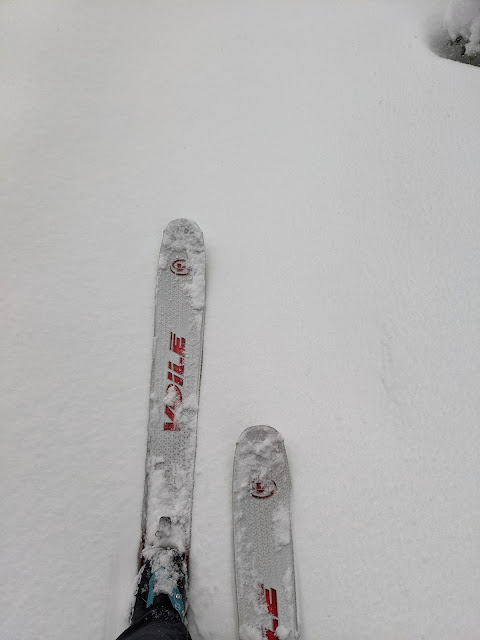
Storm total water equivalent as of 4 PM Saturday:  Alta-Collins: 1.53" Spruces: 1.24" Ben Lomond: 3.5" Snowbasin-Boardwalk: 1.81" Brighton SNOTEL: 1.6" Deer Valley Ontario: 0.88" Sundance-Mid Mountain: 6.08" Bunnels Ridge: 3.78" So far, the storm has delivered as I might have expected in the southern Wasatch (Sundance, Bunnels ridge) and on Ben Lomond.  Elsewhere, we're running near or below expectations (so far).  In this case, that's probably a good thing.  As a meteorologist, you want your forecast to verify, but you can be happy when the hurricane comes onshore with impacts lower than expected.  I think that's the case here as it enabled us to go skiing, albeit in Sierra Cement rather than the Greatest Snow on Earth.  The ski touring was better than I expected, mainly because the high water content snow wasn't excessively deep.   Speaking of water content, Alta-Collins automated observations suggest 14% at 9700 feet.  At lower...

Conflicted

Image
I confess that I feel somewhat conflicted right now.  The backcountry riding has been really great since the last storm and it's a bit of a shame that we're going to submerge those sublime crystals with what is coming over the next few days.  Ideally we would have another day or two before another goldilocks storm, but instead we have a monster on the doorstep.   The models continue to put out big numbers for this storm.  Our downscaled NAEFS product is putting 4 to 10 inches of water for Alta Collins through 12Z January 2nd (5 AM MST Monday), with an average of about 7 inches of water.  Note that today is just a minor appetizer.  Things pick up this evening and then continue for about 60 hours.  There could be a break or two in there, but expect big numbers.  The high resolution HRRR is also going off.  The forecast below covers the period from 1800 UTC 30 December (11 AM Friday) through 1800 UTC 1 January (11 AM Sunday) and puts out 6+...

The Pacific Basin Is Ready to Get it On

Image
"Storm 1" for this cycle is in the books.  Per the Utah Avalanche Center report this morning, snowfall totals were 15–35" with 1.58 to 2.95" of snow water equivalent.  Backcountry tree skiing yesterday was simply superb on all aspects.  It's great to have a right-side-up storm on a deep base with a low-angle sun in late December.   The well-advertised parade of storms is set to continue over the next few days ad the Pacific Basin is ready to get it on.  As of 1200 UTC this morning (5 AM Thursday December 29) there were four key storm systems and two major atmospheric rivers upstream over the north Pacific.  Storm systems 1 and 2 were along or just off the Pacific Coast this morning.  These are expected to weaken as they move inland, brining just some periods of mountain snow showers through Friday.   Storm system 3 is potentially the big one as it is accompanied by a potent atmospheric river that extends upstream into the tropical west P...

Pacific Storm Track Makes Holiday Visit

Image
The next week looks very active as the Pacific storm track has finally got its act together and is going to bring a parade of storms to northern Utah and much of the western U.S.  Below is the GFS 500-mb analysis for 0600 UTC 27 December (11 PM MST Monday) showing strong westerly flow extending across nearly the entire Pacific basin. Coincident with the strong jet is potent atmospheric river that also extends across nearly the entire Pacific.   The downscaled NAEFS plume for Alta-Collins is known for overforecasting, but is laying down some big numbers with 6–13" of water equivalent and 100+ inches of snow over the next seven days.   Those numbers are eye popping, but I often use the plume for Brighton as a better approximation and even it is in the 5–10" range for SWE and 60–120" for snow.   Let's take a closer look at the event for today and tonight, beginning with the situation as I prepare this post on Tuesday morning.  At 7:40 AM MST, it was ...

Holiday Wishes

Image
Thanks for visiting the blog again this year.  Here are a few holiday wishes from the Wasatch Weather Weenies. For Utah Nordic skiers: A season that runs continuously into April. For the Alta Ski Patrol: No more riming of the Mt. Baldy anemometer. For the UDOT Avalanche Team: No surprise high intensity nighttime snowfall events. For Alta beginning skiers: A functional Sunnyside chair. For other Alta skiers: Many country club days. For Snowbird skiers: A new tram (isn't that enough?). For Brighton skiers: Steeper terrain. For Solitude skiers: Limits on the number of IKON days. For Cottonwood Canyons skiers: A real transportation plan. For Deer Valley skiers: A foot of freshly groomed snow every day. For PCMR skiers: Fully open and staffed mountain operations. For Snowbasin skiers: Fewer IKON skiers. For PowMow skiers: A cessation of all talk about Powder Mountain. For Sundance skiers: More snow in northwesterly flow. For backcountry skiers: Further strengthening of the persistent we...

The West–Northwest Wind Doth Blow

Image
It snowed last night, but the real story was the wind.  Paraphrasing Mother Goose, The west-northwest wind doth blow, And we shall have snow, And what will poor skiers do then? Poor things! They'll sit in a car, And to keep themselves warm, Will hide their heads under their wings, Poor things! OK, that doesn't quite work, but the west-northwest wind did blow hard last night.   I'll focus here on Mt. Baldy because it has reported quasicontinuously to MesoWest for some time.  I just happen to have a plot of the observed wind gusts on Mt. Baldy over the past three cool seasons (1 October - 8 May).  Events with gusts in excess of 40 m/s (80 knots or 89 mph) have happened about once or twice a cool season over the past 3 seasons. The peak gust over the past 3 cool seasons was 47.7 m/s (93 knots or 106.8 mph), which occurred at 2 AM MST 14 January 2021.    Observations from that event show it also featured west-northwest flow and saw gusts at or above 99 mph...

We Will Likely Be Kissed by Arctic Air

Image
As mentioned in prior posts, a major surge of cold air will affect a significant portion of the continental United States over the next several days.   To be sure, an impressive pool of cold air lies over Alberta this morning with many stations at or below -30˚F and a few in the -40s.  Cold air is pushing into the northern Plains already with temperatures in North Dakota already as low as -29˚F.  At least it's windy too! The large-scale setup for this cold surge involves interactions between high-latitude and midlatitude circulation features.  Last night, at 0600 UTC 29 Dec (11 PM MST Monday), an upper-level ridge was parked just north of eastern Siberia in the high latitudes with a weaker ridge in the midlatitudes over the northeast Pacific.  Over the next two days, the upper-level ridge north of eastern Siberia strengthens further into an upper-level anticyclone while the midlatitude ridge migrates eastward.  Concurrently, an upper-level trough drift...

What Is Artificial Snow

Image
Depending on how you look at it, artificial snow is either a blessing or a necessary evil.  Even in Utah, it has become essential to start the ski season in most years and ensure coverage in heavy traffic areas during the season.  Natural snow is far superior for skiing, but even I've learned to live with the reality that we are lucky to have snow from hoses. Snowmaking at Deer Valley Utah likes to say that it has the Greatest Snow on Earth, but it also has some of the Greatest Snowmaking Weather on Earth.  For snowmaking, it's not the temperature that matters, but the wet-bulb temperature .  The wet-bulb temperature is the minimum temperature that air can be cooled through evaporation.  It depends strongly on the humidity.  When the humidity is low, the wet-bulb temperature can be several degrees or more lower than the actual temperature, sometimes enabling snowmaking when the temperature is actually above "freezing." On the other hand, when the humidity i...

When Almost Anything Can Happen

Image
A few days ago, some of the "deterministic" global forecast models, namely the GFS and the ECMWF HRES, forecast a truly spectacular cold surge for the continental United States this coming week.  There were a few forecast runs that brought the cold surge directly into the mountain west.  Below is an example from the ECMWF HRES initialized on 0000 UTC 13 December, which produced a 240 hour forecast [valid 0000 UTC 23 December (5 PM MST Thursday) with a spectacularly low 700-mb (10,000 ft) temperature of -34˚C (-29˚F) over southern Wyoming and -30˚C over Salt Lake City.   How insane is cold air like that for Salt Lake City?  A 700-mb temperature of -30˚C has only been observed once in the upper-air sounding record for northern Utah, which began in 1950.   However, today we run ensembles of forecasts to get a handle on the uncertainty in the forecast, and other members of those ensembles had different ideas.  Some didn't bring the cold surge into no...

STEENBURGH WINTER IS HERE!!!!

Image
What a storm!  At 2 PM 15 December, the snow depth at Alta-Collins reached 100", officially marking the beginning of Steenburgh winter .  The 33" snow interval ob is clearly spurious, but having some sort of observational irregularity to add to the controversy of this announcement always adds to the fun.   Long-time readers of this blog know the importance of Steenburgh winter, but new readers may not.  I coined the term during a moment of narcissistic weakness during the winter of 2010/11, an epic year in which Alta-Collins reached 100" on December 20th (see Last Day of Steenburgh Winter from February 10, 2011). As I wrote then, there are many ways to define winter.  There is astronomical winter , which runs from the winter solstice to the spring equinox.  There is meteorological winter , which is typically defined to run from the beginning of December to the end of February, and then there is Steenburgh winter , which covers the prime powder sk...

Calling a Wrap on the Great Dendritic Storm Cycle of December 11–14, 2022

Image
What an incredible, long-duration, dendrite-filled storm.  I'm calling it a wrap, although the next storm moves in tonight.   I'm pretty certain Alta came in at over 50 inches. The NWS had them for 47 inches at 430 AM this morning.  They got another 6 inches of cold smoke today.  53 inches here, 53 inches there, pretty soon it adds up to great skiing.   Indeed we did some deep-dive dendritic sampling in the Wasatch Backcountry today.  The ages of my partners ranged from 24 to 65, the former for trail breaking and the latter to show old-school powder skiing form.  I started the day with a proper breakfast for an all-day tour.   Snowfall during the day was light, but consisted of primarily of lightly rimed ice crystals, many of dendritic, six-armed form that has dominated the storm cycle.  There was only a very brief appearance made by the sun and it provided only feeble warmth.   We are not quite to the coveted 100 inc...

Cold Smoke

Image
What an incredible night of low-density snow at Alta.  From the 4 PM board wipe yesterday afternoon to 7 AM this morning they've had 10 inches of snow with .31" of water for an average water content of 3.1%.  There is a tendency for precipitation gauges to undercollect snowfall, but still, this is very much cold smoke.  Let's take a look at why the snow is so low density.  Two important clues are in the morning upper-air sounding from the Salt Lake City International Airport.  First, the temperatures between about 750 mb (2500 m/8000 ft) and 650 mb (3500 m/11,500 ft) are between -12 and -18˚C.  This is in the heart of the temperature range for growing dendrites, those six-armed snowflakes that we all love and can create low-density snow.  I've identified this region with the green box.  The second is that the winds in this and the surrounding layers are very light: 15 knots or less.  Thus, Mother Nature isn't bashing these flakes and they are...