Wednesday, October 25, 2023

A Healthy Front

I like the looks of the storm on tap for late tonight and tomorrow.  It's a pretty good front that is going to usher in the coldest air of the season so far for northern Utah.  

We'll start with a look at the GFS forecast valid 0900 UTC 26 October (3 AM MDT Wednesday) when a compact upper-level trough is centered over southeast Oregon and the preceeding cold front is draped across northern Utah.  At 700 mb, roughly 10,000 feet or crest hight of the Wasatch Range, there is about a 12˚C (22˚F) temperature contrast across this front, so it's a whopper. 

By 1500 UTC (0900 MDT), the trough is over southwest Idaho and the front is draped over Salt Lake City.  We will be post-frontal by this time with steady rain on the valley floor and snow intensifying in the mountains.  Woo hoo!


By 2100 UTC (3 PM MDT), the cold air is into northern Utah in earnest with 700-mb temperatures over the Salt Lake Valley below -6˚C.  This will mean some flakes down to bench levels.  


The phasing of the frontal band with the coldest air is such that accumulations below 6000 feet will probably be limited, but I'd keep an eye on forecasts as such details are hard to anticipate with precision.  

For Alta, most of the models are producing forecasts clustering around about 0.7 to 1.2" of water and 8-16 inches of snow.  The latest HRRR generates a quick hitting frontal passage with precipitation beginning just before 3 AM tonight and ending by about 10 or 11 AM tomorrow, resulting in just over 8 inches of snow from about 1" of water.  


The GFS, has somewhat different ideas on timing, with precip starting after midnight and continuing until the late afternoon.  This solution would be more favorable for some flakes on the benches since the precip keeps going until the arrival of the coldest air.  That said, the GFS produces a bit less precipitation with just over 8" of snow and about 0.7" of water.  


The downscaled SREF is coming in with 0.5 to 1.5" of water with a mean just under 1".  The snowfall range is around 7 to 17".  There are a couple of members going for a bit more with a second trough friday night and Saturday, but right now I'm not expecting that to do very much. 


Bottom line is this looks like an 6-12" storm for Alta.  We may do a bit better if the front moves through slowly.  

A look at the High Rustler cam this morning shows this will fall on dirt and grass on the lower mountain and on old snow from prior storms on shadier aspects (other aspects have melted out even at upper elevations).  


Anyone skiing is going to experience the lowest of low tide conditions with plenty of buried and unburied hazards.  I haven't been up to poke around the snowpack where it exists, but early snow often becomes weak snow, so be careful out there.  

Tuesday, October 24, 2023

About Cody Townsend's Sierra Rotor

I'm a big fan of Cody Townsend's The Fifty, which documents his efforts to ski all the lines in the book Fifty Classic Ski Descents of North America.   I've skied a few of these lines and dreamed of skiing a few others.  Some are beyond either my physical or technical abilities, or the suffering to powder ratio is too high to interest me.  Cody and cinematographer Bjarne Salén do a remarkable job capturing footage of their adventures and bringing me along for the tour.  I keep thinking about all of the parameters they are dealing with including the snowpack, weather, route finding, climbing hazards, and ski challenges, and yet they are also shooting some great footage (and carrying all that gear).  It's an impressive accomplishment.  

The latest episode, Tragedy and Triumph in the Split Couloir, documents their attempts to ski the extremely challenging (and often snow starved) Split Couloir on the 14,058 foot Split Mountain in California's Eastern Sierra.  In one attempt, they are blown off the mountain by strong winds.  In a recent Instagram Post, Cody attributed these winds to "the Sierra Rotor", an "extreme terrain-induced downslope wind."   

I'm not sure what day they were on the mountain, but watching the episode a couple of weeks ago, I immediately thought that they were in a downslope windstorm.  Let's take a look at what may have happened and why the term "Sierra Rotor" is perhaps not best used for what they experienced.

Severe downslope windstorms occur on the lee-side of mountain ranges around the world.  They have many regional names including the Foehn (northern Alps), Bora (Croatia), and Chinook (Rockies).  In Utah they are sometimes referred to as "Canyon Winds." They are produced by what meteorologists call "high-amplitude mountain waves."  These are the atmospheric equivalent of a hydraulic in a river in which the flow accelerates downstream of a rock or rocks and then decelerates in a turbulent hydraulic jump.  

Source: Wikimedia Commons, Author: aokomoriuta

This also happens in some situations during flow across mountain ranges as shown in the schematic below. In some cases a rotor can form downstream of the hydraulic jump.

Source: Whiteman 2000

The rotor is a component of the downslope windstorm system.  In a well developed rotor, there is flow reversal at the surface.  Incredibly, you can go from severe downslope winds in one direction to relatively light flow from another direction over a short distance.  

The eastern Sierra and especially the Owens Valley are well known for severe downslope windstorms and rotors.  Some of the seminal research on severe downslope windstorms was conducted in this area during the Sierra Wave Project in the 1950s (see Sierra Wave Project Revisited by Vanda Grubišić and John M. Lewis) and the Terrain-induced Rotors Experiment (T-REX) in 2006.  

Below is a classic photo of a Sierra downslope windstorm taken by Robert Symons.  The view is toward the south with the eastern Sierra on the right.  The flow is from right to left.  Strong downslope winds extend from the Sierra across the Owens valley where they pick up dust.  This dust is then elevated in the rotor circulation.  The ascent is deep enough that clouds form near the top of the rotor. 


One of my favorite papers on rotors (and subrotors, which are embedded in rotors) is Doyle and Durran (2007).  In it, they present the average cross-mountain wind speed (top panel color fill with reds away and blues toward the mountain) and vectors (bottom panel).  Note that in this figure the mountain is on the left. One can see the intense flow descending the mountain, with the speed maximizing just before the rotor.  The strong winds then elevate in the hydrolic jump and follow an arc over the rotor.  Near the base of the rotor (i.e. at the ground), the flow is actually reversed and is moving toward the mountain. The transition from strong downslope flow to light reversed flow occurs over a distance of less than 2 kilometers.  

Source: Doyle and Durran (2007)

The rotor is not the cause of the downslope windstorm, it is a component of it.  Not all downslope windstorms produce rotors and in some the rotor circulation may wax and wane.  The rotor circulation is sensitive to the of the characteristics of the atmospheric flow impinging on the mountain range (i.e., wind and stability) and affected by the presence of downstream ranges like the Inyo Range in the case of the Owens Valley.  

So, Cody Townsend did not experience the rotor while on Split Mountain.  He experienced the downslope wind.  The rotor, if it existed, would have been over the Owens Valley.  It's probably best not to call this phenomenon the Sierra Rotor since the rotor is a component of the downslope wind system and isn't always present.  That said, it would be appropriate to refer to the circulation beneath the hydraulic jump and Owens Valley as the Sierra Rotor.  

Congrats to Cody for eventually skiing the Split Couloir. 

Monday, October 23, 2023

A Cold October Trough

The last week of October is going to be an interesting one for mountains of the western United States.  I've been watching forecasts for a cold trough to drop into the Pacific Northwest for about a week now.  It's going to bring significant October snows to portions of the western United States.  

It's worth a look at the origins and forecast evolution of this trough.  It all began with the formation of a midlatitude cyclone off the coast of Asia late last week and over the weekend.  This cyclone built a ridge that was over the Behring sea at 1800 UTC 22 October 2023 (1200 MDT Sunday, orange line).  Just east of this ridge was a weak trough and jet streak that I've circled in red. These represent the incipient cold trough.  

Both the ridge and the incipient cold trough are forecast to amplify through 0000 UTC 24 October (1800 MDT Monday) with the trough digging southward over the Gulf of Alaska. 


By 0000 UCT 25 October (1800 MDT Tuesday), the now well developed high-amplitude ridge is parked over the Gulf of Alaska with the cold trough over Vancouver Island.  This is a dream mid-winter pattern for Northwest Skiers and potentially a horror show for lowland snow in the Puget Sound area, although in October, the latter won't happen.  Still, it is a recipe for the first big snow of the year in the Cascade Mountain Passes.  


Finally, that trough swings eastward across the interior Pacific Northwest.  By 1800 UTC 26 October (1200 MDT Thursday), the trough axis is moving over Utah and a second trough is dropping into the Pacific Northwest.
  

Let's start with a look at what this will do in the Cascades through 0600 UTC 25 October (Late Tuesday Night).  Our HRRR derived snowfall product shows 24-h accumulations in some mountain areas of over 16 inches. Although the snow starts a bit before this accumulation period, this is the bulk of the snowfall through that time.

Below is a time series from a HRRR grid point very near Stevens Pass Ski Area.  The HRRR is going for 1.25 inches of water and about 13 inches of snow, with more to come from the second trough after the end of the HRRR forecast period.   


Here in Utah, the forecast is trickier as much will depend on the track and structure of the trough and the models have been all over the place on those two storm characteristics.  Over the weekend, I saw a GFS run that was putting out about 18" for Alta with the trough passage, now it's down to about 9". 

Let's have a look at the latest GFS-derived forecast guidance for Little Cottonwood. In this forecast, the bottom drops out with a frontal passage around noon on Thursday.  Temperatures at Alta-Collins and Mt. Baldy drop, the wet-bulb zero crashes from 9000 ft to 6000 feet (and then lower Thursday night), and there is a pulse of snow adding up to about 3 inches.  This is followed by a second round on Friday that brings the storm total to an inch of water and about 9 inches of snow.  


The latest Euro too is right around an inch of water.  

The normally jacked downscaled NAEFS is a bit more optimistic with a mean of about 1.3" of water equivalent with the frontal passage and then a few members that are excited about the second trough pushing storm totals over 2 inches of water and nearly 30 inches of snow.  


These are fairly extended forecasts covering a period of 72 to about 144 hours out, so uncertainties are to be expected.  Note that the NWS is also advertising a range of outcomes depending on storm characteristics.  


Bottom line.  Keep an eye on the forecasts. 

Friday, October 20, 2023

About Those Seasonal Forecasts

 NOAA released an updated seasonal forecast yesterday, which immediately got everyone in a lather with much of Utah being "in the green" for January to March precipitation.  


But let's all take a deep breath here.  First, these outlooks have never been very reliable (or all that useful for skiers).  Remember the outlooks from last season?  My "favorite" was the one issued by Accuweather last September.

That didn't age well in the Sierra and Utah that's for sure.  

Second, let's talk a bit about what the NOAA seasonal outlook actually means.  It is a probabilistic outlook, meaning that they are not forecasting those areas in green to definitely receive above normal precipitation.  Instead in the first two shades of green, they are saying that the odds are leaning to above normal.  For example, southern and central Utah are in the first shade of green, which means they are giving a 33–40% chance of above normal precipitation.  In any given season, if you have no idea what will happen, there's 33% chance of above normal, a 33% chance of near normal, and a 33% chance of below normal, so this is a very minor shift of the odds. 

But let's look a bit closer at the rationale behind the NOAA forecast.  Such forecasts are based in part on precipitation during prior El Nino events (this winter is expected to be an El Nino winter) and ensemble forecasts produced by statistical and numerical models.  Here's a snippet from the discussion issued with the seasonal outlook:

"Despite a strong El Nino event highly likely this upcoming winter and spring, the NMME and C3S dynamical model guidance depicts high forecast spread and seasonal precipitation outcomes - both in sign (i.e., wet/dry) and location. This is quite different from similar forecast guidance preceding the 2015-2016 El Nino event. Given this, the forecast probabilities for either above-normal or below-normal seasonal precipitation are quite modest for the western CONUS. Elevated odds for above-normal precipitation is depicted for parts of California and Nevada during DJF 2023-2024 and JFM 2024, with slightly elevated probabilities extended across the central Rockies. The best convergence of ancillary information, forecast tools and model guidance is the primary basis for the selection of this area."

I have underlined a key phrase, which essentially says there is a lack of correspondence in the guidance.  And this guidance isn't very good in the first place!  Walk away from the craps table now! 

Note also that the northern edge of the green shading is draped across Salt Lake County.  If they are anticipating any loading of the dice for the central Wasatch, it is very slight.  

I continue to stand by my usual outlook for the central Wasatch.  We simply cannot provide a reliable outlook of what is going to happen with snowfall this season near and above about 7000 feet.  If you guess below, near, or above average, you have about a 1/3 chance of that guess being right.  Below 7000 ft, there is probably some loading of the dice for below average snowfall and snowpack simply due to the fact that we are now living in a warmer climate system, but as we saw last year, Mother Nature can still bring the goods with the right pattern, so I'm not going all in on that.  

Finally, stop worrying about this winter.  A bad year in the Cottonwoods is better than a good year in Colorado, so just plan on skiing it if it's white. 

Monday, October 16, 2023

Olympic Venue Oddities

The Salt Lake Tribune published an article this weekend discussing plans for Olympic Venues assuming Salt Lake is awarded the games again, which is looking likely (see Utah Olympic Venues Coming into Focus as Organizers Get Creative).   

Perhaps most surprising and disappointing is that Snowbasin may not be interested in hosting the men's and women's downhill, super G, and combined events.  Perhaps they are just posturing for a better deal with the Olympic committee, but that would be a major loss if it happens. 

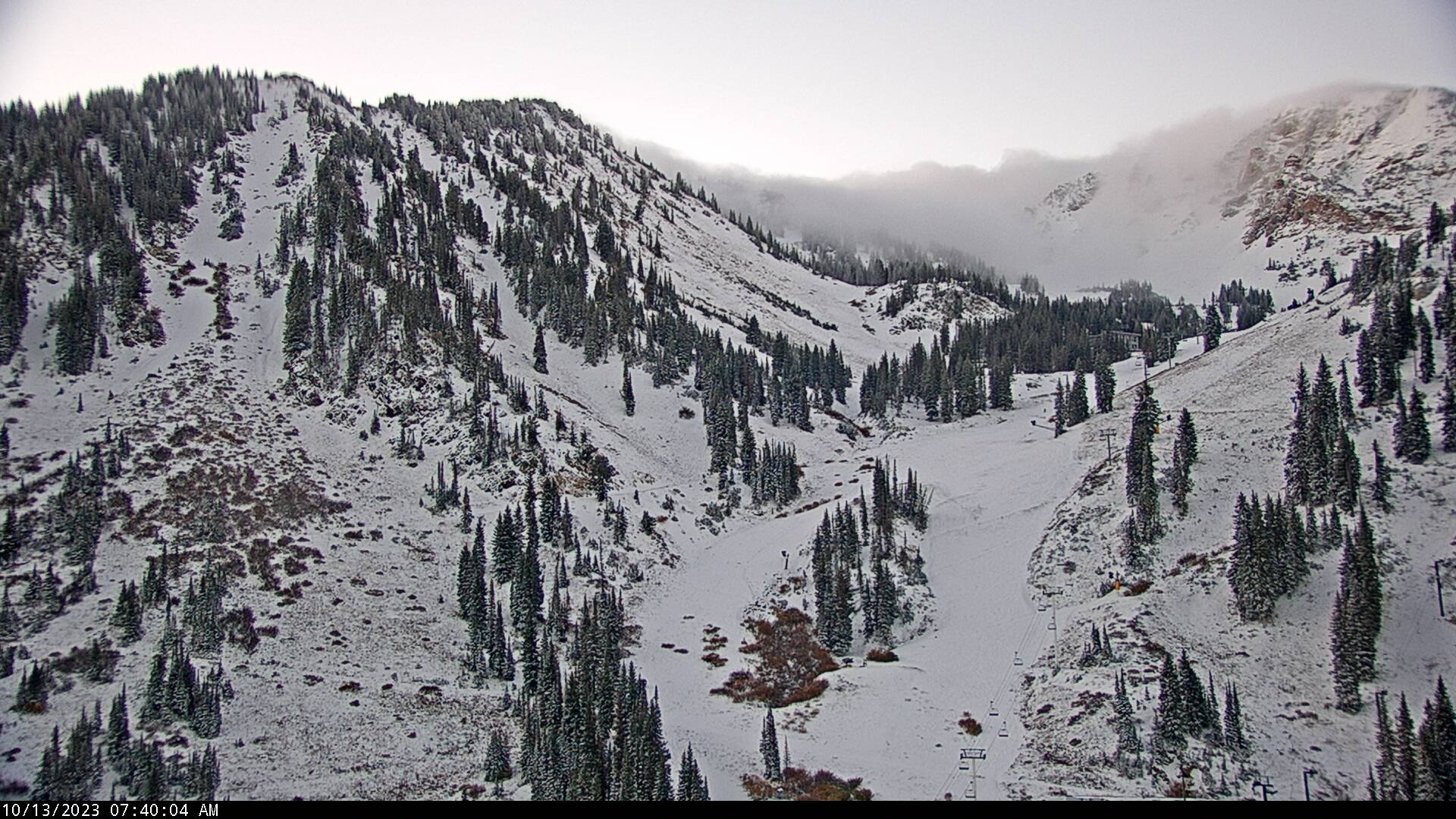
As far as Olympic downhills go, the Grizzly and Wildflower downhills are pretty good ones.  There's a decent amount of vertical and they are steep and technical.  Not all Olympic downhills are so challenging.  The terrain is scenic, and access for spectators is excellent.  

Top of John Paul Tram and start house for the Grizzly Downhill

The options outside of Snowbasin appear to be limited or simply less exciting.  Per the International Ski Federation (FIS), the minimum vertical drop for an Olympic downhill course should be 800 meters for men (2625 ft) and 700 meters (2297 ft) for women.  Perhaps like other Olympic "rules" these can be bent, but let's go with them for now.  Snowbird would meet this bill, but the Cottonwoods are not being considered for Olympic events for a variety of reasons (and there are some reasons why Snowbird would be a challenging place to hold the downhill even if they wanted it).  Powder Mountain might be able to get a bit over 2500 vertical feet if they did something off of James Peak, but they would have to move heaven and earth to do it and there's no current way to get spectators to the finish line.  PCMR could do enough vertical feet in the Mountain Village area, but it would be a sleeper of a course involving long gliding stretches.  In the Canyons Village area, the terrain is so convoluted that I'm not sure if you can piece together a solid 2625 vertical feet of Olympic level downhill anywhere.  

Which brings us to Deer Valley.  With the Mayflower expansion, I think they could get something exceeding 2625 vertical feet from the top of Bald Mountain or Park Benchmark Peak down to Mayflower, which is accessible by US-40.  It doesn't snow much there, which is actually a plus.  It couldn't hold a candle to Grizzly and Wildflower, but perhaps it is the best alternative. 

Next we have this tidbit from the article: "A ski mountaineering course at City Creek Park." 

The article goes on to say that such a course would only require 330 vertical feet (100 vertical meters) and that this could be done with several truckloads of manufactured snow.  Apparently they are thinking about doing this above the capitol.  

There are no details provided, so let's think about how this could be done.  One possibility is to do it on city streets, which would enable the truck access.  From City Creek park to Ensign Downs Park is over 330 vertical feet. 

One can also come up with some wild idea ideas involving off-street routes, however, these have some serious challenges.  First is the truck access.  Let's keep in in mind that there are a lot of south aspect slopes in this area and the elevation is low.  These slopes go through melt-freeze cycles regularly in the winter, which means bringing in a lot of snow for insurance or bringing it in at the last minute. Additionally, mud is potentially an issue and a concern if trucks are going to be traveling in off-road areas.  

My suggestion is to do skimo in the mountains.  Perhaps the most feasible ski event that could be held in Salt Lake city is a cross-country sprint.  Such events have been done in cities in Europe, can be done on existing streets, and can be done in a relatively short circuit, requiring less snow.  Sprints are usually 1 to 1.5 km long and with laps, one might only need to cover 0.5 to 0.75 km of city streets with snow.  

There is one underlying issue to consider for any event held in Salt Lake City and that is the possibility of air pollution.  February is inversion season and there is the very real possibility of hazardous air quality for any event held in the valley.  

Friday, October 13, 2023

Purgatory

The storm is over.  Automated observations from Alta-Collins indicate a storm total of 15" and a settled snow depth this morning of 12".  The High Rustler cam shows it's white.  If I squint, I think I see some tracks on Nina's.  

By and large though, this puts us solidly in ski purgatory.  Enough snow to whet the appetite, but not really enough to ski.  I'm sure some people will get out, but the current snowpack situation is below my tolerance level and I'm not inclined to risk injury.  Additionally, the forecast looks ridgy.  The NAEFS downscaled ensemble forecast is pretty much a flatline for the next 6-7 days, although there is one plucky member that generates six inches.  


There is always hope.  

I suspect, however, that most of the snow on sunny aspects will melt out over the next several days.  It will survive on upper-elevation shadier aspects, but likely facet and weaken.  Expect heterogeneous avalanche conditions when the next storm comes, whenever that may be.  

Thursday, October 12, 2023

Not Enough Snow for Me

As of 7 AM this morning, the automated Alta-Collins measurements are showing what looks to be 9 inches of new snow (based on 2" through 1600 MDT yesterday and 7" overnight) and a total snow depth of 8 inches.  This from about 1.28" of water.  


Overnight radar imagery (hopefully not mangled by blogger) showed bonafide lake effect for a time overnight that looked strong enough to perhaps produce a bit of lightning and thunder.  


That has now transitioned to more widespread precipitation with a flow direction that is a bit more northerly than I'd like for Alta magic to kick in, as evinced by this morning's 1200 UTC (0600 MDT) sounding.

Source: NOAA/NWS/SPC

I'm inclined to think another 1 to 3 inches today and then you can stick a fork in it.  

I'm sure that will be enough to get some diehards out, but that's not enough snow for me.  I'll continue to recreate on the brown ribbon of flow in the lower to mid elevations.  

Wednesday, October 11, 2023

Thoughts on Great Salt Lake Effect Forecasts from Computer Models

Great Salt Lake Effect forecasts from computer models have historically exhibited poor reliability for a few reasons.  

One is that many computer models have had insufficient resolution (or grid spacing) to adequately resolve the Great Salt Lake and surrounding mountain effects.  

Another is that the Great Salt Lake is simply very sensitive to small changes in the ambient flow and surface conditions, so when you look at a handful of model runs, they don't always capture the full range of possibilities.

Let's take a look at how these issues are manifest in current model runs, starting with the GFS.

The effective grid spacing of the GFS is 13 km.  At it's current level, the Great Salt Lake is about 25-km wide, meaning that in northwesterly flow, the GFS at best has two or three grid points that include lake characteristics.  In addition, the GFS is unable to distingish between the Stansbury, Oquirrh, and Wasatch Ranges, so it cannot separate mountain effects from lake effects.

Below is the GFS forecast for 1200 UTC (6 AM MDT) tomorrow.  The background lake and terrain are not from the GFS.  The lake is from an older, "good old days" lake level and the terrain is fairly realistic.  I use them for reference.  Note that the GFS is capable or producing lake-effect precipitation, but as an enormous blob covering a huge area.  While it is possible we will get lake effect, it's not going to look like this.  

The HRRR, on the other hand, has better resolution.  It has 3-km grid spacing and it better resolves the Great Salt Lake and various mountain ranges of northern Utah.  If we look at the HRRR forecast valid at the same time, we see considerably more structure due to this better resolution.  It produces a lake band that is more concentrated and it also produces orographic precipitation over the central Wasatch.  This is somewhat more realistic.  

That's good, but studies have shown that high resolution models still have problems. Several years ago John McMillen, a graduate student in my group, did retrospective forecasts of 19 lake-effect events using the Weather Research and Forecasting (WRF) model with 1.33 km grid spacing, even finer than the HRRR.  He found that those forecasts were "band happy."  While they produced banded forecasts of banded events, they also produced banded forecasts of non-banded events.  Basically, the model could not reliably distinguish events that were banded from non-banded.  So, when the HRRR generates a band, that's great, but you can't have a lot of confidence that Mother Nature will do the same.  

He also found that the bands were often in the wrong place and most commonly to the right (relative to the downstream flow direction) of the observed band position.  This is something that has also been identified in other model forecasts over other lakes, such as Lake Ontario.  

Another challenge for getting the lake-effect location right is sensitivity to the large scale flow.  The centers of the GFS and HRRR bands in the forecasts above are clearly different, but so are the flow fields.  Small changes in wind direction make a big difference, and current ensemble modeling systems can't paint out the full range of possibilities due either to insufficient resolution or too few members.  

So, many elements are in place for lake-effect tonight.  Many elements are also in place for orographic precipitation.  Either could materialize, but location and intensity are difficult to anticipate at this time.  

I look forward to seeing how this all plays out.

Tuesday, October 10, 2023

A Storm Worth Watching

Enjoy today's mild weather because things are gonna change. I can feel it.  

By tomorrow morning, we will be in colder air.  The GFS shows that by 1200 UTC (6 AM MDT) tomorrow morning the surface cold front is through and we are in colder, westerly flow.  

Temperatures and snow levels will be dropping overnight and in the wake of the cold front.  Our GFS-derived forecast product for upper Little Cottonwood shows forecast highs for Alta-Collins today in the low 50s, fairly close to yesterdays 54°F max, and then temperatures falling overnight and remaining in the low 30s tomorrow.  

Concurrently, the wet-bub zero level drops to below 8000 ft by 9 AM tomorrow morning and near 7000 ft by 6 PM tomorrow afternoon.  That puts the snow level around 7500 feet in the morning and perhaps 6500 ft by afternoon.  

The GFS generates periods of snow with and following the front, adding up to about 8" at Alta-Collins by  6 AM Thursday.  The HRRR produces just under 8" by 6 AM Thursday, so that's decent agreement.  

There are, however, some real wildcards for this one.  The models are generating a prolonged period of cold, unstable post-frontal flow through Thursday afternoon.  The GFS has WNW flow at crest level (700-mb) during that post-frontal period.  

This raises the possibility of orographic and lake-effect snowshowers.  In the case of the latter, our GFS-derived lake-effect guidance is generating decent lake-effect likelihoods late Wednesday night and Thursday morning.  


The GFS large-scale forecast conditions in terms of instability and flow direction looks pretty good for the Cottonwoods.  However, that model can't really resolve the Great Salt Lake or the central Wasatch terrain.  The HRRR, on the other hand, can better resolve the Great Salt Lake and the central Wasatch.  However, it favors more northerly flow.  As a result, it produces a lake band, but more for the Oquirrhs than the hallowed ground of Cottonwoods.


The HRRR also produces a powerful lake band.  That might come through, but models like the HRRR tend to produce strongly banded features more commonly than Mother Nature, who favors more disorganized systems.  

We'll have to see how this one plays out.  I think that 6-12" for Alta-Collins is likely through Thursday afternoon, but we could do better if we can get the right flow and productive orographic and/or lake-effect snow showers late Wednesday night and Thursday.  

I usually conclude posts like this with "keep your fingers crossed," but it is unclear what to root for so early in the year.  I've seen these early season snowfalls turn to freaky facets too many times.  This is a storm that perhaps needs to go big or go home. 

Sunday, October 8, 2023

October Is a Great Bonus Month

October is my favorite "bonus" month.  Everything about the month is a bonus.  If it snows, the skiing is a bonus.  In Utah, if it doesn't snow, there's a good chance the weather is great for hiking or mountain biking.  The colors start to change and the views are wonderful.  Southern Utah is more tolerable.  It's hard to say anything negative about October.  

And today was the epitome of October.   Blue skies, mild temps, beautiful colors.  

The new BST from Mueller Park to Wild Rose is such a pleasure to ride this time of year.  Much of the trail was dense and moist.  Almost as if someone had oiled it.  Views were spectacular both up mountain

and down mountain.

Residents of Bountiful and North Salt Lake are fortunate to have such a great trail to ride.  I feel jealous whenever I go there given the unfinished trail plans in the Avenues.  

The colors this year seem especially vibrant.  I think this is one of the better falls for colors I've seen here in Utah.  What do others think?

Friday, October 6, 2023

Great Fall Weekend Ahead

We have a sublime WYSIWYG (What You See Is What You Get) forecast for this weekend.  Currently, parked under and upper-level ridge.

Tomorrow we're parked under an upper-level ridge.  


Sunday we're parked under an upper-level ridge.


You get the point.  "Severe clear" is the operating phrase.  Enjoy the fall colors.  

Monday, October 2, 2023

October Snow Is Here

October is coming in like a lion with thunderstorms late yesterday and more action overnight.  Dawn broke this morning with a light coating of snow at Alta.  I'm surprised nobody has put a skinner in yet. 

Source: Alta Ski Area

Looks like trace amounts at the base, but perhaps 2-3" up high, which may include a bit of snow from Saturday night.  It's unclear if the Collins snow-depth sensor is working yet, but the gauge came in with 0.38" of water equivalent in the last 24 hours. 

I mentioned in the previous post the possibility of snow, but was leaning toward a few inches and was inclined to have low expectations for the event.  The models, however, have been trending toward a wetter event.  The GFS, for example, is putting a low moving precipitation band directly over the central Wasatch today.  


It then brings a cold, moist secondary trough trough Utah tomorrow.  


Telescoping down to Little Cottonwood, the GFS generates a remarkable 1.75" of water at Alta-Collins from midnight last night through this afternoon, followed by dribs and drabs tomorrow with the trough passage.  It's a warm event, with the wet-bulb zero between 8000 and 9000 feet, but that would still mean snow levels around 8000 feet.   


The HRRR is coming in with somewhat similar numbers, but has a bit less precipitation for today.  

Snow totals for the HRRR are around 12" and for the GFS around 20" for Alta-Collins, which is at 9700 feet.  I suspect the snow-to-liquid ratios being produced by our algorithm are going to be too high for this event since it's not really designed for early season events with a warm ground and frequent excursions during dry periods to temperatures above 32°F.  

I'm inclined to lean toward 4-8" of wet snow from 8 AM to 6 PM for today at and above Alta–Collins.  The GFS is putting out some big numbers, but I think it may be generating a bit too much precipitation based on what I'm seeing on the radar this morning.  Things should quiet down tonight and then we will have to see what happens with the trailing cold trough.