Monday, August 31, 2020

Simply Spectacular Sleeping Weather

Through 6 AM, the overnight minimum at the Salt Lake City airport was 58˚F, with temperatures likely falling below that prior to sunrise.  At my place, it was 55˚F when I awoke, with cool air pouring through the windows.  Relief!  Simply spectacular sleeping weather.

Yesterday's high at the airport reached only 89˚F.  It was the first day we did not reach 90 or higher since July 22nd.  That 38 day run is the 4th longest on record, tied with four other such periods.  #1 is a 50-day run ending on September 5, 1967.  

Yesterday's low was 63 and that marked the end of a run of 51 consecutive days with a minimum of 64˚F or higher at 51, the 2nd longest all time behind a 75-day run ending on August 8, 2013.  

One brute-force measure of the demand for energy to cool buildings is cooling degree days.  Through yesterday, this August sits at 566, ahead of 2013 with 554. 


Source: NOAA Regional Climate Centers

Thus, regardless of where we end up for monthly average temperature, this month was a record for cooling degree days.  Note how during August, that metric is exhibiting both an upward trend and increasing variability over the past few decades, an observation with significant implications for the energy industry.  

Nothing would have pleased me more than to have titled this post "It's Over," but it's not.  The GFS forecast valid 0000 UTC 5 September (1800 MDT Friday) shows a high amplitude ridge parked over the Great Basin once again.  


Bottom Line: Enjoy the cool weather while it lasts and start praying for snow.  


Wednesday, August 26, 2020

Quick Hitters

 There's a lot going on today.  I'll have to go into rapid-fire mode.

August Temperature Record a Lock? 

2020 has opened up a bit more of a lead on 2013 for the warmest August on record.  The gap is now 1.1˚F.  


The max/min temps for the last days of August 2013 were 84/71, 84/67, 93/67, 97/71, 97/71, 93/72.  

NWS forecast calls for 96/68*, 94/71, 93/68, 92/67, 89/67, 81/60 (*last nights minimum).  

Someone can run the numbers, but I'm betting if the forecast verifies, we'll have a new record given the current 1.1˚F lead.  

August Precipitation Record a Lock?  

Nope.  0.10" from overnight storms.  Easy come, easy go.  

Cooling Coming!

I'll just put this forecast here because it calls for an actual push of cooler air into northern Utah late Sunday.  It won't feel like fall, but it will drop us a bit below averages for Monday and Tuesday.  Did I just say that?


Laura Looking Very Dangerous

The National Weather Service doesn't mince words.  The key messages from 10:00 AM CDT this morning says it all.  


As does this tweet, which serves as a reminder that winds are dangerous, but it water is what kills the most people and does the most damage.  


 Hoping for the best for those on the Gulf coast and that warnings were heeded.  

Monday, August 24, 2020

Welcome Back

Today marks the first day of classes at the University of Utah and the start of a semester like no other. 

You might be surprised to learn that nobody currently at the University of Utah, including us old timers, worked at the University of Utah during the Spanish Flu pandemic.  Even still, the world has changed a lot since then, so I think it is safe to say that Fall semester will be unique and unprecedented.  

I've posted frequently over the past few months about delusional administrators and their plans for reopening.  We have already seen outbreaks at other Universities that have had to shift online.  The University of Utah has adjusted its plans during the summer to a greater percentage of online classes, which I was glad to see.  I have concerns in other areas, such as testing and transparency, which seems to lag behind institutions like the University of Illinois, which is now testing thousands of people a day for free and providing information on positivity rate on campus.  

I hope we will get better information than we did on Friday when we were told "a handful" of students tested positive in the dorms.  Voids in information are filled with misinformation, so let's hope greater detail is provided today and as we move forward.  

To the students, reach out if you need anything, whether it be a question on class material or just the need to talk to someone.  The University of Utah offers some of the best outdoor recreation available at an institute of higher education.  Take advantage and make new friends as you explore the area around campus.  

We will get through this together.  

Sunday, August 23, 2020

Improving Air Quality and Some Mountain Showers

After two days of cowering inside due to high PM2.5 and afternoon ozone, I was glad to get out for a hike this morning.  In the Salt Lake Valley, PM2.5 has slowsly been declining since it's peak very early Friday morning and is now sitting near the transition from low to moderate (top graph below, with green indicating low values and yellow moderate).  

Additionally, although ozone peaked at unhealthy levels the last two afternoons, it appears to be leveling out at moderate levels this afternoon, although I can't rule out a spike to higher levels later.  

There are two big differences between summer smoke and winter particular matter events.  The first is that, as evident in the graphs above, summer smoke can be accompanied by unhealthy ozone concentrations during the day.  Basically, it's a double whammy for bad air quality.  The second is that mixing during the summer occurs through a deep layer, so when the smoke is thick, it's usually thick everywhere including in the mountains.  I'll add that the mountains are not necessarily an escape from the ozone and I suspect that in the Wasatch, the ozone concentrations in the afternoon might be higher than found in the city.  This has been observed in mountains adjacent to other urban areas (e.g., Vancouver, Seattle).  

One special treat was a band of showers that moved through the central Wasatch at just before 11 AM.  They produced just enough to dampen the ground and encourage my son to throw on his hard shell.  

They lasted about 10 minutes, but the cloud cover prevailed for most of our hike, which was wonderful.  It was only in the mid 50s while we lounged on Mt. Baldy, and that was damn comfortable.  

Forecasts right now suggest the worst of the smoke will remain to our north through tomorrow.  Below is the near-surface smoke forecast from the HRRR smoke for 1800 UTC tomorrow (noon).  We're not clear, but hopefully concentrations will remain below "nasty" levels.  

There's enough emissions sources and mixing of smoke throughout the west that the only region of the western contiguous US forecast to be pretty much smoke free is the far northwest.  These experimental smoke forecasts are at https://rapidrefresh.noaa.gov/hrrr/HRRRsmoke/ if you want to monitor for yourself.  They aren't perfect and emissions from new starts aren't always included right away.  However, I find them helpful for planning. 

Friday, August 21, 2020

The Ridge from Hell

If we were to name ridges like we name Hurricanes, surely the one that has gripped the western U.S. in recent days would be called Satan or Lucifer because it is straight from hell.

You are already aware of the heat records.  130˚F in Death Valley, the 3rd highest temperature every recorded on this planet (and possibly the highest).  Five record highs at Salt Lake City so far this month, including two consecutive days of 105˚F on the 1st and 2nd and three straight above 100˚F this week.  Below average precipitation across much of the interior western United States, but lightning sparked fires in California.  Indeed, the Devil would be proud.

Now we add poor air quality to the mix in Salt Lake City, with PM2.5 concentrations rising overnight due to smoke with values peaking at 86.1 ug/m3 (unhealthy) and remaining high at 44.3 ug/m3 (unhealthy for sensitive groups) at 6 am this morning.  


Source: Utah Division of Air Quality

That was high enough to cause me to skip my morning hike. 

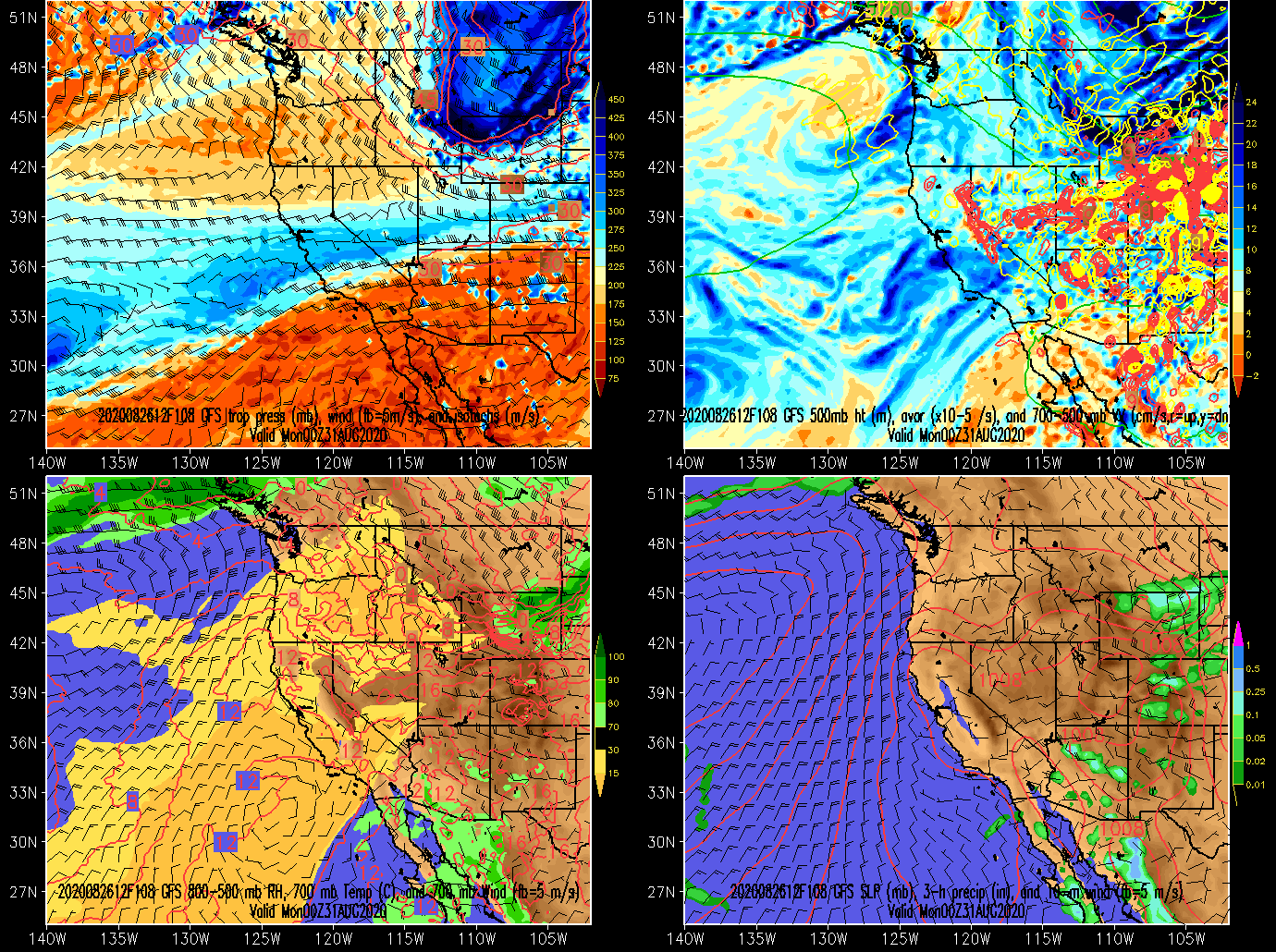
It's worth a quick look at the past few days to show how the large-scale evolution of the ridge brought us to where we are today.  

On Saturday, August 15, clear skies prevailed across much of the southwest United States, with localized smoke evident from fires in northern California and Colorado.  At this time, the ridge was relatively low amplitude and northern Utah was actually in northwesterly flow


Source: NASA

By Sunday, August 16, the ridge amplified, with temperatures increasing across much of the west.  Death Valley reached 130˚F that afternoon.  However, moisture was streaming northward around the western periphery of the ridge and into northern California, producing thunderstorms.  


Source: NASA

Ditto Monday, with some evidence of smoke from fires in the Sierra Nevada.


Source: NASA

On Tuesday, smoke emissions and spread increased.  A complex flow pattern led to smoke being transported both southward by the northerly low-level flow associated with low-level high pressure off the California coast and northward around the periphery of the mid- and upper-level ridge over the western interior.  


Source: NASA

This continued on Wednesday, but in addition to the now growing fires in California, emissions in Colorado increased as well.  


Source: NASA

And by yesterday, smoke permeated much of the western Great Basin from California and, with contributions from Colorado (and lesser contributions from a few other spots), had largely encircled the upper Colorado river basin.  


Source: NASA

Meanwhile in northern Utah, some weakening of the ridge and the passage of a weak trough allowed smoke that had encircled the ridge from California to gradually move in yesterday and finally permeate the Salt Lake Valley overnight.  As I write this, it's a little early for a good visible satellite image, so I'll use the HRRR-smoke vertically integrated smoke analysis to illustrate the situation as of 1200 UTC (0600 MDT).  Very high concentrations stream northward through northern California and then northeastward through northwest Nevada and southeast Oregon and over the southwest Snake River Plain.  High concentrations are draped across northwest Utah, with a sharp gradient to our south.  


Source: NOAA/ESRL

There is a tendency to assume that high-pressure, or ridges, are relatively benign, but the events of the last several days provide a clear example of the severe impacts that these systems can produce.  Extreme heat, lightning-caused wildfires, and poor air quality associated with smoke emissions and transport are examples of the "severe" weather and related hazards associated with this ridge.  We could add extreme wildfire behavior to the mix if we wanted too (see Fire Tornadoes Reported in Northern California Wildfire from the New York Times).  Additionally, this event is an amplifier of drought conditions that plague the region.  

Indeed, this is the ridge from hell.  Sadly, weather and related extremes associated with high-amplitude ridges during the warm season are going to become more common and severe in the coming decades.  

Thursday, August 20, 2020

Numbers for August So Far

Last night was pretty miserable.  The overnight minimum was only 78˚F.  If 78˚F were to survive through the calendar day, it would stand as the highest daily minimum ever recorded in August (the current record is 77˚F, observed several times).  The highest daily minimum on record is 81˚F on July 18, 2016.  

Really, August rates pretty high on the misery scale overall.  As illustrated by the graph below, the August 1-19 period has been remarkably warm with an average temperature of 83.9˚F, which is the 2nd highest all time behind only 2013 (84.1˚F).  


Source: NOAA Regional Climate Centers

During the month to date, every day has had a maximum above average and a minimum at or above average (range of average temperatures in graphic below indicated by green fill).  


Source: NWS

In addition, 7 of the 18 days have had a maximum of 100˚F or greater and all but three have had a maximum of 95˚F or greater.  

Was there any night relief?  Not really.  The lowest temperature observed so far is 64˚F on the 14th.  Nine days failed to dip below 70˚F.

I'm actually surprised that this wasn't August 1-18 on record.  I can't remember 2013.  Given the pandemic, it seems like 70 years ago instead of 7.  

I hopped in the Wasatch Weather Weenies time machine and found one post declaring that it was Easily the Hottest Ever and another claiming, unofficially of course, that it was The Most Boring Summer Ever.  

Although this August might have a shot at being the warmest on record, I'm not sure the summer can get there.  You might recall that we had the occasional and greatly appreciated cold surge in June and early July.  As such, the average temperature for the summer so far (i.e., June 1 - July 18) is "only" 77.5˚F, well behind 2013 (80.8) and only the 13th warmest on record.  


Source: NOAA Regional Climate Centers

I haven't run the numbers to see where we'd stand if we maintain this heat through the end of the month and I'm hoping not to find out.   

The NWS does have a 20% chance of an isolated thunderstorm this afternoon, which is about as exciting as it gets right now.

Monday, August 17, 2020

Scorching Heat in Death Valley

 Yesterday's maximum temperature at Furnace Creek in Death Valley reached 130˚F.  


Source: Richard Brian/Las Vegas Review-Journal/AP

It appears that this is the third highest temperature ever recorded on the face of the Earth, behind the 134˚F recorded in Death Valley on July 10, 1913 and 131˚F in Kebili, Tunisa on July 7, 1931.  Both of those early 20th century temperatures have, however, been called into question by weather historian Christopher Burt (see this Capital Weather Gang article).   

Let's have some fun and compare the 134˚F day in Death Valley to yesterday's 130˚F.  We can do this using the 20th century reanalysis, which has created global atmospheric analyses from 1835 to 2015.  The 20th century reanalysis is a product of mathematical and statistical wizardry in which surface observations, which are essentially the only observations available in the 1800s and early 1900s, are used to create an analysis.  

Below I plot the 500-mb analysis for 0000 UTC July 11, 1913, which corresponds to 5 PM on the afternoon of Death Valley's 134˚F day.  Death Valley was beneath a west-to-east oriented upper-level ridge, which meteorologists refer to as zonally elongated.  500-mb heights over Death Valley were a bit higher than 5940 meters.  

The 850-mb (about 5,000 feet above sea level) temperature analysis (in degrees Kelvin, subtract 273 for Celsius) shows temperatures near Death Valley of about 306K, or 33˚C (sorry for K, but it's what the 20th century reanalysis site provides).  Assuming constant density to the elevation of Furnace Creek yields a temperature of about 48.5˚C (119.3˚F).  A quick note that there are good reasons why the maximum surface air temperature might exceed this constant-density temperature estimate in Death Valley (and indeed, in Salt Lake City, the maximum surface air temperature in summer is often 3˚C/5˚F higher than such an estimate).  Thus, is is provided for comparison rather than absolute purposes.  

Yesterday, when Death Valley hit 130˚F, the ridge orientation was somewhat different.  It was centered over Utah and elongated from south to north, or what meteorologists call meridonally elongated.  500-mb heights over Death Valley were above 5970 meters, so a bit higher than on the 134˚F day.  

850-mb temperatures were around 35˚C, also higher than on the 134˚F day.  Assuming constant density, that would yield a temperature at the elevation of Furnace Creek of about 50.5˚C (123˚F).  

There is enough uncertainty in the 20th century reanalysis that we probably can't conclude with absolute certainty that the large-scale airmass yesterday was warmer than on the 134˚F day.  The 20th century reanalysis is also lower resolution than the analysis presented above for yesterday, and this affects the numbers used for comparison.  With more sleuthing and statistical analysis of the uncertainty in the 20th century reanalysis, one can probably estimate the likelihood of the airmass yesterday being warmer than that on the 134˚F day.  I suspect such an estimate would indicate that it is more likely than not that the airmass resident over Furnace Creek yesterday was warmer than that on the 134˚F day.

Maximum surface temperature is dependent, however, on other factors, including the land-surface conditions, cloud cover, etc.  I lack the time to dig into this, but suspect the team that investigates the veracity of the 130˚F measurement will be considering these factors and it is something that Christopher Burt discusses in his analysis of the 134˚F day.

That team will also investigate potential instrumentation biases, which hopefully we will hear about soon concerning yesterday's maximum.  

In any event, yesterday does appear to have been an exceptionally hot day in Death Valley, amongst the hottest weather conditions ever measured on the face of the Earth.  Sadly, we will probably yesterday's maximum eclipsed in the coming decades as global warming continues. 

Friday, August 14, 2020

Dry, Hot, and Nasty

The forecast for the next week is ugly.  Persistently dry, hot weather of the variety that I despise.  

Today will probably be the coolest day of the next week.  The GFS 700-mb (roughly 10,000 ft above sea level) temperature forecast below shows the highest temperatures over western North America moving over Utah this weekend and then remaining until at least 1200 UTC (0600 MDT) 21 August when I decided not to look any farther out.  

Afternoon 700-mb temperatures are above 18˚C in northern Utah on some afternoons, such as 0000 UTC 19 August (1800 MDT Tuesday). 

This is exceptional warmth for mid August.  In the upper-air sounding record for the Salt Lake City International Airport, the highest 700-mb temperature on record is 20.2˚C (measured at 0000 UTC 13 July).  After 10 August, however, the highest 700-mb temperature on record is 18.4˚C.  

Consistent with the GFS forecast, the National Weather Service has issued an Excessive Heat Watch for Sunday Afternoon through Wednesday Evening for the Wasatch Front and much of Utah.  Note that there is potential for the heat wave to extend beyond that.  

Below is their forecast for the Salt Lake City International Airport, with highs of 100 or more on Sunday, Monday, and Tuesday and in the upper 90s Wednesday and Thursday.

The record highs on Sunday, Monday, and Tuesday are 100, 100, and 99, so we have a shot at setting daily records.  The highest temperature observed after August 10th is 103 on August 20, 1960.  

About the only good thing about a heat wave this deep in August is that the days are shorter, which means the blistering sun sets earlier and rises later, making the mornings and evenings a bit more pleasant, with the longer night sometimes giving us lower minimum temperatures.  

Nevertheless, I'm not looking forward to this heat wave. 


Thursday, August 13, 2020

Don't Let Football Distract You

News headlines related to higher education this week are dominated by articles about the postponement of the football season by the Big-10 and Pac-12, including the impacts on student athletes, athletic department budgets, and regional economies.

Don't let this distract you from the reality that higher education is about to embark on a grand experiment as they attempt to reopen in various ways for the fall semester.

My daughter leaves today for her junior year at Arizona State University.  She came home in March after ASU foolishly decided to reopen after spring break, only to move everything online two days after students returned.  For fall semester, their home page advertises a "safe and welcoming environment." The latter is possible, the former unclear.  

At the University of Utah, where my son is a student (and I'm a faculty member), the home page makes no assertions to safety, but simply welcomes new and returning students.  

Both Universities have been moving more and more classes online.  All of my daughters classes are now online and all but one of my sons classes is online.  This is, in my view, a reasonable and prudent move, but I'm sure there are some with differing perspectives.  

My advice to my kids has been to recognize that this is an experiment, that Universities are not partially or fully reopening because the pandemic is over, that we don't really know how this will play out, and that their best option is to be as cautious as possible.  For my daughter, who will be 500 miles from home, we have talked with her about the realities if she gets COVID and that we won't be able to drive down there and bring her home.  She and her roommate and their closest friends are going to have to take care of each other if any of them contract the virus (she lives off campus).  We hope that if any of them contract the virus, that the symptoms are minor and there are no long-term issues.  

As a faculty member, I have been preparing to teach online throughout the summer.  This includes attending online bootcamps and webinars on how to teach online using a variety of resources.  I am in the process of converting a class that I've taught in person and in a specialized computer lab for 25 years to an online format.  Many other faculty have done the same and I am hopeful that students will benefit from this during the fall semester.  

The coming semester will be like no other in the history of higher education.  Please stay safe and healthy as we embark on this grand experiment.  

Tuesday, August 11, 2020

Continued Scant Monsoon Moisture

Blogging has been tough the past few weeks as the weather has been pretty monotonous.  The monsoon has largely been a nonsoon for Utah (and Arizona).  

That doesn't look to change through at least Friday.  The color fill in the GFS forecast loop below is a variable known as precipitable water.  Precipitable water is a measure of the total amount of water vapor in the atmosphere, expressed as the depth of water if all that water vapor were condensed out.  This time of year, 12.5 mm might give you an isolated dry thunderstorms over the mountains.  Shower/thunderstorm and precipitation potential increase as precipitable water approaches 25 mm or an inch, when I start to pay closer attention.  I've picked a color scale below that transitions from light brown to green to blue around 20 mm.  


Today, we have some weak instability and moisture with precipitable water around 15 mm.  Thus, we could see a few thunderstorms in northern Utah, but nothing widespread.  Ditto tomorrow, after which even lower precipitable water predominates through the Saturday, after which we slowly climb to about 20 mm on the 17th (Monday).  

By and large, a pretty dry airmass for northern Utah in August. 

Friday, August 7, 2020

Slight Relief from Wimpy Trough

A weak trough is pushing into northern Utah this morning, bringing in slightly cooler air and just a bit of relief from our recent run of hot weather.  

MesoWest observations this morning show northwest to northerly flow across northwest Utah, especially along I-80, over the western and northern Great Salt Lake, and along the Utah-Idaho border.  

Source: Mesowest
Source: Mesowest

Time series from milepost 29 along I-80 show a wind shift, increase in dewpoint and humidity, but virtually no drop in temperature with the trough passage.


Nevertheless, there is a slight decline in temperature over the 24-hour period, so there is a very slight transition to a cooler airmass.

The HRRR calls for winds in the Salt Lake Valley to shift to NW this afternoon.  This is consistent with both the approaching trough and the usual development of afternoon up-valley flow and lake-breeze effects.  The trough is so weak that it is difficult to entangle these forcing agents.  Perhaps we'll see slightly enhanced northwest flow this afternoon.  
By late afternoon, northwesterlies have penetrated to the southern Salt Lake Valley and into the central Wasatch north of Little Cottonwood and upper Big Cottonwood.  
Firefighters in Parley's canyon will surely be briefed on and alert for this wind shift.  One positive is that the winds are not strong, but are forecast to be around 10-15 knots.  

With the slightly cooler airmass, highs today should be in the low 90s (the NWS forecast for KSLC is 91˚F).  Should that verify, it would be our lowest maximum since July 22nd when it reached only 85˚F.  Since then, we've reached 92 or higher every day, with seven days reaching 100 or more. 


Wednesday, August 5, 2020

Causes of the Teton Village Balloon Accident

Jack Hales is an alum of my department at the University of Utah with 46 years of experience in the National Weather Service, including time as a forecaster at the Storm Prediction Center, which is basically the Dream Team for US meteorologists.  

He retired in 2011 to Star Valley in Wyoming and runs the Star Valley Weather Blog

He has just posted a detailed analysis of the recent Teton Village Balloon Accident showing it was caused by a microburst.  


It's worth a look and is a good reminder of the dangers of microbursts not just for airplanes, but other aviators.

The Beirut Shock Cloud

You may have seen videos of the terrifying and tragic explosion in Beirut, Lebanon yesterday.  Below is one from VOA.  


Note the mushroom-like veil of cloud that forms and propagates very rapidly away from the explosion.  This veil of clouds is moving much faster than the smoke generated by the explosion and quickly moves out of view.  If you watch and listen to the video carefully, you'll notice that the cloud passes out of the view of the camera before the sound of the explosion is recorded.  Thus, the cloud appears to be moving at speeds at or above the speed of sound.  

Phenomena of this type are outside my normal areas of study but I suspect that the cloud is being produced by the shock or blast wave generated by the explosion.   Such a wave is characterized by a sharp increase in pressure at its leading edge followed by a decrease in pressure to sub-ambient values.  These pressure changes occur in less than a second as the wave passes, with the cloud forming in the area of lower pressure due to expansional cooling.  Shock waves move faster than the speed of sound.  

If you look carefully at the footage at the moment of explosion, you can also see some very low stratocumulus clouds.  Thus, I suspect the relative humidity was fairly high, which helped enable cloud formation.  In a drier airmass, the drop in pressure probably would not have produced the cloud.  

It's also interesting that you can see smoke rising before the expansion cloud appears.  I don't know if this might indicate that it was not the first but a second explosion that produced a shock wave sufficient to generate a cloud.  

Please comment if you have some background in explosives or fluid mechanics and can add to this discussion.  As a meteorologist, I typically deal with phenomenon acting on time scales of minutes to days rather than microseconds.  

Saturday, August 1, 2020

"Nonsoonal" July for Much of Utah and Arizona

The numbers are now fully in for July.  At the Salt Lake City airport, yesterday's maximum of 104˚F brought our average temperature for the month up to 81.1˚F, tied for 14th all time and behind only one 20th century year, 1960.  

Source: NOAA Regional Climate Centers

I've beaten this storyline like a rented mule, but here goes again.  This July was quite hot in Salt Lake City by 20th century standards, but about middle-of-the road by early 21st century standards.  In fact, it ranks 13th out of the 20 Julys since 2001.  

If you want to see real heat, look at Phoenix.  The average temperature at the airport there in July was an incredible 98.9˚F, the hottest month on record at that location.  

Source: NOAA Regional Climate Centers

Cloud and precipitation observations indicate that the monsoon was largely a "nonsoon" for Utah, Arizona, and points west.  Outgoing long-wave radiation, commonly used for infrared satellite imagery, was anomalously high across much of the western United States in July, as indicated by the anomaly (departure from average) map below.  This is consistent with a lack of deep convection (thunderstorms) and high cloud cover.  
Source: NOAA/ESRL/PSL

The percent of average precipitation was at or below average across much of Arizona and Utah as well.  Although there are a few areas in southern Utah and northern Arizona above average (e.g., the area around Capitol Reef National Park), these were the result of localized, intense storms.  For most of the region, precipitation was scant.  


This pattern of limited monsoon moisture and precipitation in western and northern Arizona and Utah looks to persist for the next several days.  Monsoonal thunderstorms during the period look most likely in southeast Arizona and New Mexico.  About the only positive for northern Utah is a lowering of temperatures with highs in the low 90s on Tuesday.  100s look likely for Salt Lake City today and tomorrow (Sunday).  Ugh.