Showing posts with label Avalanches. Show all posts

Thursday, March 20, 2025

Avenues Avalanche!

Let's have some fun with a post based on what I'll call "sidewalk science."  

The Hall of Fame Baseball catcher Yogi Berra once said "you can observe a lot just by watching."  This applies for sure to both meteorology and snow science.

This afternoon, right near my house, I encountered an avalanche in the front yard of a house on 16th Avenue in the upper Avenues.

Oh, I didn't actually see the avalanche happen, but I did see the aftermath, which I've summarized in the below.  It contains many of the hallmark characteristics of an avalanche.  The first is the starting zone, which in this case I measured to be 35°.  Most avalanches start on slopes between 30 and 45 degrees, so the slope here was right in that range.

There is also the crown or crown line, which is the upper fracture line of the slab that broke away to create the avalanche, as well as the flank or fracture line along the side of the avalanche.  There is one on the other side, although I have not labeled it.   


Most avalanches that kill people are slab avalanches in which a cohesive layer of snow slides down the slope.  Indeed that was the case here with the slab sliding about 20 inches or 50 cm down the slope as a cohesive layer.  In this case, the length and speed of the avalanche was such that the slab remained intact.  However, eventually it encountered the lower angle sidewalk where the slab decelerated, debris built up, and the toe of the avalanche was found.  

The bed surface for this avalanche was the grass rather than a weak layer in the snow.  The trigger was likely solar heating, which led to a lubrication of the grass by liquid water as the snow melted, weakening the bond between the snow and the grass.  Such an avalanche is referred to as a glide avalanche, which is defined as a release of snowcover as a result of gliding over the ground.  

So much snow science in such a small space!  However, there are real-world applications.  Glide avalanches can be deadly and destructive.  In the Wasatch Range, they are probably most common in Broads Fork, a subdrainage of Big Cottonwood Canyon where glide avalanches commonly occur on steeply sloped rock slabs.  Here's a link to a report about one in Broads Fork: https://utahavalanchecenter.org/avalanche/69596. Note the fully exposed rocks in the starting zone of the avalanche.  

Glide avalanches are hard to predict, but can have deadly consequences.  They are also common in the Alps where the mountains are not only steep, but there are a lot of grassy, high altitude meadows that are grazed in the summer.  The resulting steep, grass slopes can make the perfect bed for an avalanche.  I saw the aftermath of many glide avalanches when I lived in Innsbruck, Austria.  Below is a photo looking down at one during a ski tour on the Gammerspitz, a 2500 meter peak in the Alps south of Innsbruck.  It was on a south facing slope and likely was triggered by solar heating like the avalanche I saw today in the Avenues.  We avoided slopes like this on our tour! 

I found the number of glide avalanches and the expansive coverage of glide cracks in the Alps to be very disconcerting and often made conservative terrain choices because of them.  Fortunately it was easy to avoid avalanche terrain today in the Avenues.

Tuesday, December 3, 2024

Book Review: The Starting Zone


If you are looking for a good gift idea this holiday season, one that will expand the snow knowledge of your friends and family (or maybe yourself), look no farther than Karl Birkeland's recently published "book" The Starting Zone, available from avalanche.pressbooks.pub ($49.95).

I put book in quotes because The Starting Zone is an e-book available from the Friends of the Colorado Avalanche Information Center.  The Starting Zone is a living document, with tons of figures and videos and more references than you can shake a stick at (these are footnotes, so they don't clutter up the reading).  Everything is hyperlinked, allowing you to watch videos or access supporting materials with the click of the mouse or a tap of the finger (I read it on my tablet).  

I am not an avalanche professional or researcher, so my perspective is of a scientist in a complimentary field (meteorology) who has been backcountry skiing for more than 30 years but has little formal avalanche training.  I loved that the book was written in plain English with many opportunities to dig deeper into subject matter.  This appeals to my practical and sciency sides.

Karl is an excellent writer and does a great job of simplifying complicated subject matter.  I found the chapter on Dry Snow Metamorphism to be especially insightful.  I finally understand the differences between near surface facets and surface hoar and can now better explain the physical processes that distinguish metamorphism that leads to facets vs. rounds.  Karl utilizes laboratory experiments to illustrate many concepts, with extensive use of videos and images from micro-CT scans.  This also appealed to my sciency side, but also my bias toward visual learning.  I much prefer to be shown something rather than be told something or forced to infer from equations. 

There is one oddity with The Starting Zone.  It is still in the runout zone.  Sections I (Laying the Foundation) and II (The Mountain Snowpack) are finished and available except for one section (Spatial Variability at Multiple Scales).  The final section (Avalanche Release, Mitigation, and Forecasting) will be released by Fall 2025, although all three sections of the book are included in the purchase price.  Think of this as an opportunity to advance your eduction as you creep out on the slab but before you feel the collapse, hear the whumpf, and are carried down the hill by the snowy torrent.  Perhaps what you learn from Sections I and II will keep you from creeping out on that slab in the first place. Not everyone in that situation gets a second chance.

Thursday, September 26, 2024

Congrats to Ron Perla

 Ron Perla, an pioneering avalanche researcher and Little Cottonwood legend, was recently named a distinguished alumnus of the University of Utah Department of Atmospheric Sciences. As described in this College of Science online article, Ron was an Alta Ski Patroller and US Forest Service Snow Ranger in the 1950s and early 1970s who researched slab properties, avalanche rescue methods, etc.  He commuted back and forth from Alta to the U to complete his classes in meteorology and conduct his research.  Ron was also a mountaineer who established first routes on Mt. Robson (Canadian Rockies), Grand Teton, and our own Lone Peak in the Wasatch.  

Ron Perla, US Forest Service, 1968

Alta skiers may be familiar with a run called "Perla's" on Mt. Baldy, which is named for Ron.  Ron tells the story of how he survived an avalanche on Mt. Baldy in 1967:

“In 1967, I was working as a USFS Snow Ranger near the top of Mt. Baldy,” Perla says. “The cornice broke off prematurely, and I fell into a Baldy chute. The cornice blocks triggered a large avalanche. I was tumbled around with no chance of 'swimming,' and somehow I missed all of the rocks. Just before I lost consciousness under the snow, I managed to thrust an arm up to the surface. I was found quickly.” 

Backcountry skiers might also be familiar with "Perla's Peak" on the south side of Little Cottonwood Canyon just up canyon from the head of Coalpit #4. I don't know if there's a good story behind that.  

Last year I spoke with Ron about the history of the J & J Quinney Alpine Meteorological Research Center at Alta, which for a time in the 1970s was "operated" by my department.  You can read about it here.  

Congratulations to Ron and many thanks for all he has done to keep us safer in the mountains. 

Saturday, September 14, 2024

It's Snowing!

It's snowing, not in Utah, but in the Alps.  And probably enough to ski in some areas.

Today's snow depth analysis for western Austria shows significant snow depths for September at mid and upper elevations.  

Source: https://avalanche.report/weather/map/snow-height

There are a few questionable observations, mainly due to the need to recalibrate (i.e., some stations strated with no snow but a measured snow depth of say 10 cm) but here's one that looks legit:  76 cm (30 inches) at Seegrube (1921 m) above Innsbruck.  

Source: https://avalanche.report

Here's a corresponding web cam view confirming that it looks legit.

Source: https://www.foto-webcam.eu/

The GFS forecast for 0600 UTC 14 September shows a great setup for heavy precipitation in the northern Alps of Austria and the Alpine Foreland (i.e., the upstream plains) of Austria and Germany with a deep closed low centered over the Balkan States and strong integrated vapor transport wrapping cyclonically (counter-clocwise) from the western Mediterranean and across the Black Sea Basin, Ukraine, Poland, and Germany.  That is a favored moisture-transport corridor for the northern and western Alps.   


The situation though in eastern Austria is quite serious as heavy precipitation in that area is expected to continue for some time.  Below is the GFS forecast valid 1200 UTC tomorrow showing continued precipitation in the Lower and Upper Austrian States.  

Todays Tirol Daily News in western Austria highlights the flooding in the east as well as the heavy snowfall and avalanche situation in Tirol in western Austria.  


I took a look at the Avalanche danger article and if my translation is accurate, it was a 70 year old hiker who was buried on Saturday and is still not recovered.  The second person was on the rescue team and was partially buried and with a right leg injury.  The rescue was called of that afternoon.  

Tuesday, January 23, 2024

Steenburgh Winter (Sort of)

This has been a ski season characterized by dramatic boom and bust cycles that are very clear in the snowpack water equivalent trace for Snowbird below.  Evident are two major storm periods from December 1 to 10 and from Jan 3 to 22 that added 6.4 inches and 8.6 inches of water, respectively.  Together, these two periods account for 15 inches of the total water equivalent in the Snowbird snowpack, or about 75% of the 20.1" total.  

Source: NRCS

During the January storm period, it is likely that we eclipsed the 100 inch mark on the Alta-Collins total snow depth stake, but due to some erratic reports, it was difficult to know with confidence if that was the case.  The time series of total snow depth at that site over the past two weeks is below and it shows 100" first being eclipsed late in the evening on January 13.  Shortly after that though, the measurements drop abruptly back down to 94 inches and then bounce around from the high 90s to 118 inches until the 16th when things settle down again.  We have remained at or above 100" since then.  

Source: MesoWest/Alta Ski Area

January 13 was quite windy.  The Mt. Baldy anemometer hit 90 mph overnight on the 12th and ultimately succumbed to riming on the 14th.  Thus, a combination of wind transport and instrument flakiness greatly complicated matters. 

Given how late in the day we first reached 100" on the 13th, and the fact that the non 118 inch reports next reached 100 inches late in the day on the 14th, I'm going to declare 14 January as the official start of Steenburgh winter, that period between the first day of 100" on the Alta-Collins Snow Stake and February 10th when the sun angle begins to have an increasingly caustic effect on the snow.  This period is the crème de la crème of backcountry skiing given the deep snowpack and low angle sun, enabling powder to persist for long periods on a wide range of aspects.  

However, this year we have been thrown a curve ball and it is one of the reasons why I am not celebrating.  That curve-ball was the prolonged dry period from December 10 to January 3, which ultimately led to the development of a persistent weak layer that is now buried by all of the snow that fell over the past couple of weeks.  This led the Utah Avalanche Center to raise the black flag for extreme avalanche danger at all elevations and aspects on Sunday January 14. 

Source: Utah Avalanche Center, issued 14 December 2024

About 30 years ago, when I was leaving Seattle for Salt Lake City, famed avalanche forecaster Sue Ferguson, a former director of the Utah and Northwest Avalanche Centers, told me that in Utah you can avoid many avalanches by simply waiting three days after a storm before entering into avalanche terrain.  This was not meant to be rigorously followed advice as Sue knew as well as anyone that there is variance around the mean, but it was her way of saying that persistent weak layers are less common here and that patience is a virtue in Utah where we are often dealing with new snow and wind-driven instabilities that can heal quickly.  

However, there are years when that is clearly not the case and this is one of them.  That persistent weak layer may have strengthened some in some areas, but we are still dealing with a Russian Roulette snowpack.  We still have considerable avalanche danger on a good portion of the avalanche rose and, as summarized by Drew Hardesty in today's report "dangerous and tricky avalanche conditions exist."  


Drew comments further that cautious route finding and conservative decision making are essential.  Indeed, many people that I know are laying low right now, staying away from of steep terrain.  

So, Steenburgh winter is here, but the green light is not on in the backcountry.  That said, the coverage is good in the aspens and reports are that the resort skiing has been quite good (I was in Steamboat last week and the snow conditions there were also quite good).  It is always good to reach 100" of snow depth and 20" of water at the Snowbird SNOTEL in January.  In the case of the latter, the median snowpack doesn't reach 20" until February 1st.  

Sunday, January 14, 2024

Had Enough Yet?

I'm up early and looking at the overnight numbers.  It was quite windy last night, so there is more uncertainty in the automated observations than usual, but from 5 PM yesterday to 5 AM this morning, the Collins gauge measured 1.91" (48 mm) of water and probably about 20 inches of snow (the 33 below is spurious).  The drop in total snow depth is odd, and that is one reason why I mention the uncertainty.  

Assuming it came in around 48 mm in 12 hours, that's somewhat unusual.  Below is a histogram of twice-daily 12-h snowfall and water equivalent (called liquid precipitation equivalent in the chart) over a 22 year period at Alta.  48 mm or more happened 10 times in that period, so about once every 2 years.  

Source: Wasserstein and Steenburgh (2024)

Since those are twice daily measurements, we would probably expect a few more events than that for any 12-hour period, but still, it appears we were in unusual territory.  Combined with wind and a weak snowpack, I suspect things were pushed over the edge last night.  Closing both canyons and declaring interlodge were 100% the right call, although you don't need a meteorologist to tell you that.  

Give the highway maintenance, public safety, and snow safety teams all your patience and respect today.  We are deep into too much of a good thing territory.  I love snow, but better it be spread out more than come like this.  

Saturday, January 13, 2024

Storm Cycle Update

Snow continues to stack up in the Wasatch and the red flag continues to fly for the backcountry avalanche danger.

Utah Avalanche Center Forecast Summary Issued 13 January 2024

From 5 AM MST Wednesday to 5 AM MST Saturday, the Alta-Collins automated snow-depth sensor has ticked off 30" of snow, putting us half way to the over-under that I set at that time for the remainder of the storm cycle through Monday (see Shall We Set the Over Under for This Storm Cycle?).  It also lifts us up to about 43" since Jan 9 and 68.5" since Jan 4.  These numbers are based on a mixture of data from the Alta Snowfall history and the automated snow stake so they may differ slightly from other estimates, especially given yesterday's wind.  I notice that the Alta web page is listing the storm total as 44", so they must be using Jan 9 as the start date. 

As I write this at 7:20 AM, we are in a bit of a lull, but I say that with a caveat. There are still some snow showers around, including three wind-parallel bands that extend downstream from the three primary ridges in the central Wasatch and into the Wasatch Back.  It is not unusual for the radar to exhibit echoes over those ridges due to ground clutter, but these bands clearly extend well downstream.  The one that extends downstream from the Mt. Raymond – Park City Ridgeline was best developed when I grabbed the image below and extended downstream to near Jordanelle Reservoir.  


Expect some periods of snow today, increasing in frequency and intensity later this afternoon as the next major system approaches.  The GFS forecast valid 0300 UTC 14 January (8 PM MST Saturday) shows  a compact upper-level trough over southern Oregon with strong integrated vapor transport, warm advection, and precipitation over or just upstream of northern Utah.  


This is a recipe for a transition to higher-density snow and potentially higher water-equivalent snowfall rates, especially as the trough approaches overnight, as illustrated below.


Tomorrow, with the trough through, we transition to northwesterly flow with, you guessed it, more snow.  

As noted above, the backcountry avalanche danger is high, with forecasts calling for it to rise to extreme.  In the video below, Trent Meisenheimer calls the avalanche danger "as wild as I've seen it in my tenure." 


My touring party yesterday elected to go for a "trail" tour for exercise, staying entirely in thick trees, and I think we have all decided to give up on mid- and upper-elevation ski touring and let Mother Nature have "fun" for a few days.  I often talk about outlier mode in meteorology, but these are outlier mode conditions for the snowpack and microterrain features in many "safe" zones are producing hair trigger avalanches that are catching experienced riders.  One skier was buried yesterday and fortunately recovered by their partners.  The provided a very honest and sobering write up that is available at https://t.co/s05EuP7ypl.  I am grateful all is well and thankful they had the courage to share this report.

Getting back to the forecast, I'll focus here on the the latest HRRR run for Alta/Little Cottonwood, which just arrived. Precipitation rates are forecast to be fairly low until about 2 PM, when they start to pick up.  Overnight, you know what hits the fan.  From 11 PM Saturday to 8 AM Sunday the HRRR puts out 1.4" of water and 15" of snow. For the period beginning 5 AM this morning and ending 5 PM Sunday, totals are 2.63" of water and 28" of snow.  This is higher density stuff than we've seen, with our algorithm going for snow-to-liquid ratios below 10:1 prior to the trough passage tonight and the wet-bulb zero level reaching almost 7000 feet.  This might push snow levels to just above the benches.   


The numbers from the GFS (not shown) are a bit lower for that overnight period (0.85" water/10" of snow) and the period from 5 AM this morning through 5 PM Sunday (1.7" water/21" snow).  The GFS is a bit cooler, with the wet-bulb zero level only reaching 6000 ft.  Nevertheless, it goes for the higher density snow tonight as well.  

I'll add that the GFS extends farther into the future than the HRRR and it continues to produce snow through 11 PM Monday with another storm on Wednesday.  The Euro is also on board with the Wednesday storm.  

I'm buckled up already, so I'm not sure what to recommend at this point except let the road maintenance, public safety, and snow safety teams have all your patience and respect.  We are deeply in outlier territory.  

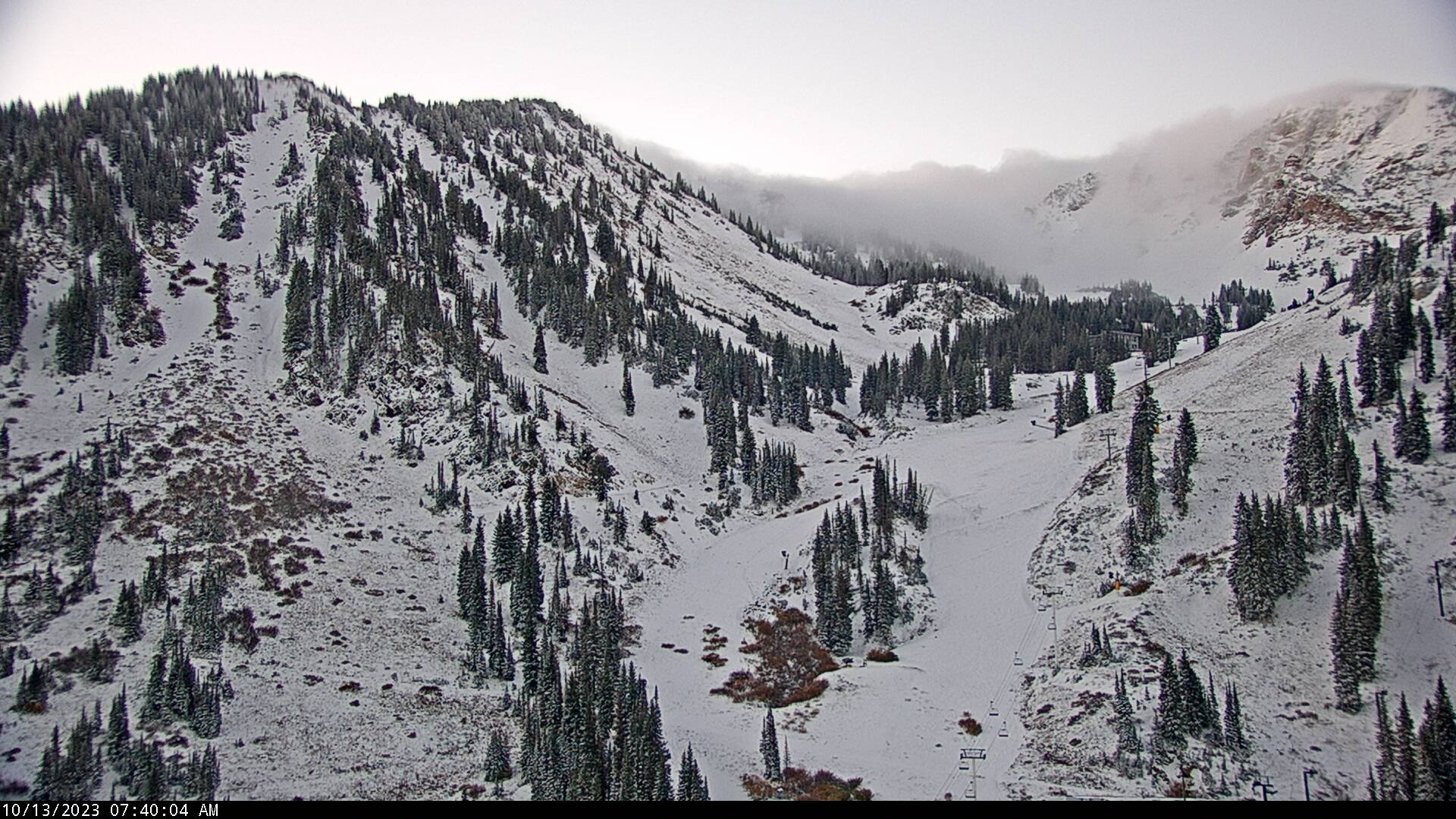
Friday, October 13, 2023

Purgatory

The storm is over.  Automated observations from Alta-Collins indicate a storm total of 15" and a settled snow depth this morning of 12".  The High Rustler cam shows it's white.  If I squint, I think I see some tracks on Nina's.  

By and large though, this puts us solidly in ski purgatory.  Enough snow to whet the appetite, but not really enough to ski.  I'm sure some people will get out, but the current snowpack situation is below my tolerance level and I'm not inclined to risk injury.  Additionally, the forecast looks ridgy.  The NAEFS downscaled ensemble forecast is pretty much a flatline for the next 6-7 days, although there is one plucky member that generates six inches.  


There is always hope.  

I suspect, however, that most of the snow on sunny aspects will melt out over the next several days.  It will survive on upper-elevation shadier aspects, but likely facet and weaken.  Expect heterogeneous avalanche conditions when the next storm comes, whenever that may be.  

Friday, May 5, 2023

LCC Gondola Plans and Avalanches

In the wake of this season's historical avalanche cycle, I was curious about the resilience of the proposed Little Cottonwood gondola to such an assault.

I haven't located gory details, but a basic summary is found on page 2-48 of the Little Cottonwood Canyon Environmental Impact Statement, Vol. 1.  I had assumed that they would locate towers outside of avalanche paths, but that apparently was not possible.  Instead, the report says that gondola alignment and towers avoided avalanche paths to the extent feasible.  Otherwise, the towers would be designed to be stronger and taller, the latter for cabins to avoid the powder blast.

Source: https://littlecottonwoodeis.udot.utah.gov/wp-content/uploads/2022/08/LCC_FEIS_Volume1.pdf

This season illustrates that this is a critical aspect of the gondola plans.  I obtained the image below from the Little Cottonwood Canyon Alternative Interactive Maps web site.  It shows the location of the angle station and, with a green square, two tower locations. The one up canyon from the angle station is tower #9 and it is located in the Tanners slide path.  


The Tanners path ran big and destructively this year.  Below is a photo of it that was taken late this season and generously shared with me by Joel Pavek. My best guess of the tower position is indicated by the green square. 


I'd be curious to hear how this and possibly designs for towers in other paths might have fared during this season's onslaught.  Were the original plans sufficient for the forces generated this year, or will redesign be needed?  

Below is an example from New Zealand of why this is important. 

Thursday, April 13, 2023

Hot and Dusty with Avalanches and Flooding

These are eventful times, and there is much to talk about today.

First let's talk about the temperatures.  The monster swing over the past 10 days or so is well illustrated by the graphic below which is produced by the National Weather Service Forecast Office in Salt Lake City.  It shows the range of average temperatures (1991-2020) in green, record highs (top of red), and record lows (bottom of blues).  The range of observed temperatures each day are the dark blue bars.  On April 4th, the high temperature was only 33˚F.  By April 11th, it was 83˚F, a record high for the date. 

Source: NWS

Yesterday was a touch cooler, although we still hit 78˚F, marking three days in a row above 70˚F and five days in a row above 60˚F.

As readers of this blog are well aware, this led to elevated avalanche hazard as we transitioned from dry to wet avalanches, a prolonged closure of Little Cottonwood Canyon, and regular afternoon closures of Big Cottonwood Canyon.  

My view is it's been too hot to ski tour, so I've been perfectly happy down in the valley dreaming of cool nights and warm (not hot) days for a good corn cycle.

Unfortunately, there is a fly in the ointment for that and that is the dust that was blown into the area yesterday.  Observations from the University of Utah snowed elevated PM2.5 levels, peaking at around 25 ug/m3 during the day yesterday. 

Source: MesoWest

This dust was kicked up and transported to the area by the strong southerly and southwesterly flow.  I had hoped that with such a wet season, we might escape without such dust, but alas, that's not to be. 

Finally, there was localized flooding in several areas of northern Utah yesterday.  In Salt Lake City, water was spilling out of the Emigration Creek fed Wasatch Hollow area and onto surface streets near 1700 East and 1700 South.  Much thanks to volunteers working to sandbag the area. 


The hydrograph for Emigration Creek, taken near Hogle Zoo, shows the flow peaking above flood stage at 155 cfs.  If the data I obtained from the NWS site is correct, the peak flow at this site is 164 cfs on May 13, 1984. 

Source: NWS/CBRFC

1984 is not a typo.  As much attention as 1983 gets because of the iconic photos of water flowing down State Street, 1984 was also a monster snowpack and runoff year.  At the Parley's Summit SNOTEL, for example, peak water equivalent in 1984 (blue line) exceeded that in 1983 (brown).  This year (black line) the peak was just above 1984.

Source: USDA

The good news is that we are cooling off today, and the expectations are for the flows on Emigration Creek, after dropping overnight, to continue to drop today.

Sunday, April 9, 2023

This Is Not a Goldilocks Season for Little Cottonwood

Watching the goings on in Little Cottonwood Canyon makes me realize that when it comes to snow, there is such a thing as too much of a good thing in a season as well as in a storm.

For Little Cottonwood, we have simply had too much snow this year and especially in the past few weeks.  Too many road closures, resort closures, etc. More importantly, too much risk for everyone working to keep the road open, the resorts open, services running, etc.  

We would have been better off if we had gotten say 700 inches of snow at Alta instead of 877 inches, especially if the spigot was slowed over the past few weeks?

Perhaps this year helps to delineate the upper boundary of the Goldilocks season in Little Cottonwood above which there is simply too much snow?

Let the debate begin.

Meanwhile, I've hung up the touring skis temporarily.  Yesterday I went skate skiing for the first time this season.  I've really missed it, although there are good reasons why I haven't been putting on the skinny skis.  It was incredible to see the deep snowpack at Round Valley, which must be close to all time if not all time.  There were places where you could tell the groomers were having trouble following the route and much of the sagebrush is buried.  

Mountain biking season can wait for now.