Sunday, January 29, 2023

Hanscom-Kelner Tours

In modern times, it is possible to get a good deal of beta for ski touring from various apps and online sources, but back in the day, the only option was the printed guidebook.

For what we call the central and northern Wasatch Today, the Dead Sea Scrolls of the Utah Backcountry is Wasatch Tours, Volume 2 – The Northern Wasatch by Dave Hanscom and Alexis Kelner.  

Dave Hanscom is a legend in the Utah Nordic Community who has been heavily involved with The Utah Nordic Alliance (TUNA) and Wasatch Citizens Series nordic race series.  I first met Dave in Japan in 1998 when the two of us were sent to the Hakuba Valley as part of the Salt Lake Olympic Committee advance team.  I liked him immediately and still enjoy running into him from time to time at Round Valley. 

I have never met Alexis Kelner, but his research on Utah ski history provided important material for my book.  The Wasatch Mountain Club conservation award is named in his honor, which tells you that he has been a stalwart for preservation of Utah's public lands.  

Wasatch Tours is not not a book for those who tour with beef boots and heavy metal skis.  It was written at a time when leather boots and long skinny skis were the norm.  You won't find a ski-descent rating system or talk about whippet poles.  What you will find are great photos and history and information about nearly every canyon from Lone Peak to Ben Lomond.  

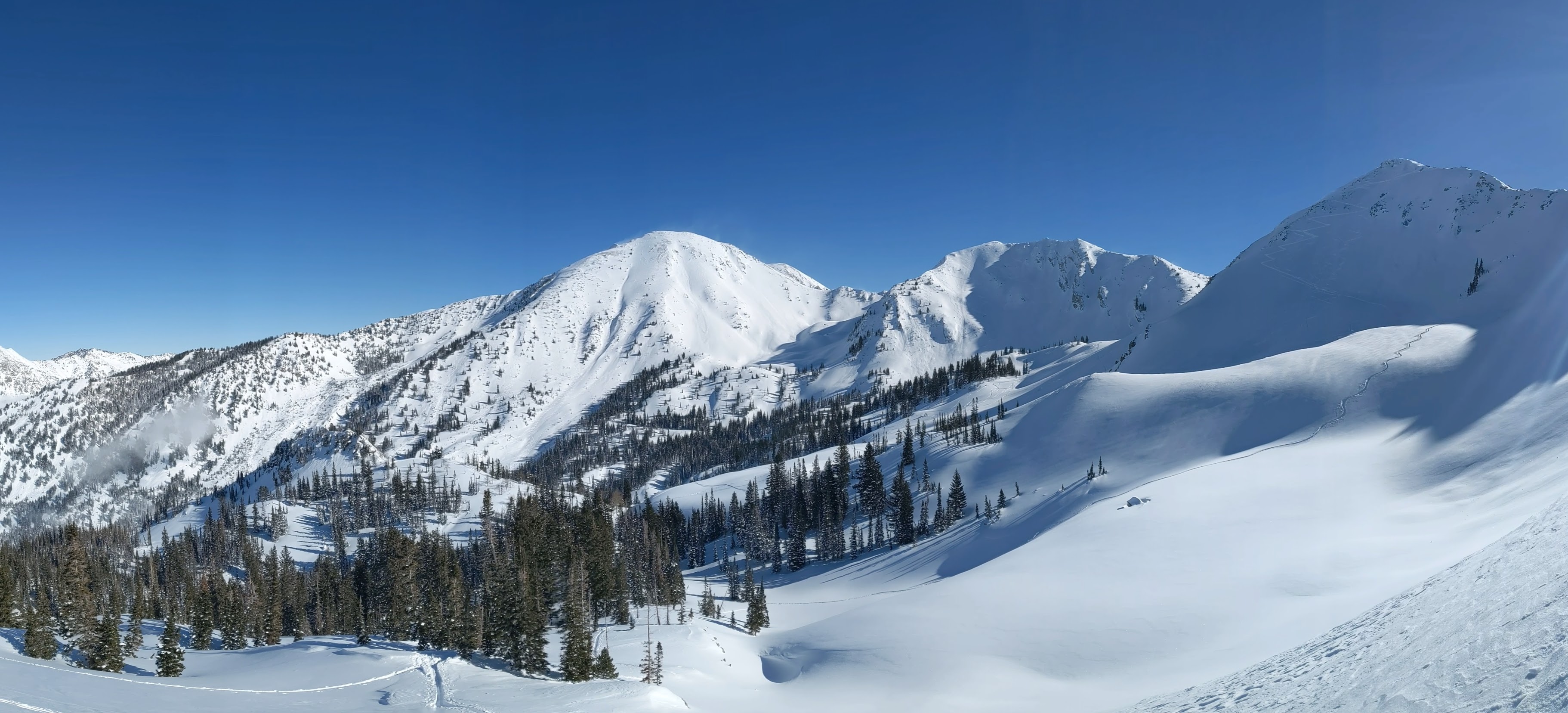
Most importantly, they cover an abundance of low- and mid-elevation touring possibilities that in recent years have been hard to ski.  

Pull out Wasatch Tours and you'll find information on tours in City Creek Canyon, the Foothills, Emigration Canyon, Parleys Canyon, etc.  Some of these tours are cross-country adventures.  Some require navigating through impenetrable scrub oak.  One of my favorite and often used quotes comes from Hanscom and Kelner's description of the Thomas Fork tour in Neff's Canyon:

"About 0.75 mile beyond this point, to the right of the jeep road, is a seemingly impenetrable oak grove located atop an ancient alluvial fan.  Leave the road here and head south almost directly into the grove. No ski area developers have cleared the willows and oak, so considerable ingenuity and determination are requires to get through the rush.  True cross country touring is, after all, a character developing and strengthening form of recreation."

I think of this quote frequently , including today as we exited at the end of our tour today, although the vegetation on our route was somewhat penetrable. 


So Cottonwood Refugees, think beyond the usual tours and take advantage of the remarkably deep snowpack we have with a low angle sun.  Things will be changing in the coming weeks as the sun angle increases.  

Saturday, January 28, 2023

Dribs and Drabs = Deep Powder

Several days ago, I thought the the period through this weekend looked sort of ho hum (see The Week Ahead).  The models were putting out some fairly modest snowfall amounts, equating to perhaps half of what we might expect climatologically.  Even most of the members of the the normally jacked NAEFS ensemble were keeping snofall totals near or below 15 inches through this morning (12Z 28 January).   

Fast-forward to this morning and let's see how things have turned out.  Per the Alta snowfall history, 10" on the 24th, 1" on the 25th, and 9" on the 27th.  Per the Alta-Collins automated snow depth sensor, another 3" yesterday and 10" overnight.  I'm not sure what period the Alta snow history covers each day to splice these together, but we're well above the projections of nearly all of the NAEFSforecast members, except one plucky one that was up around 30" by 12Z on the 28th.  

So, dribs and drabs in this case means deep powder.  What a season!     

Perhaps I should issue another pessimistic forecast as it seems to be working.

Wednesday, January 25, 2023

Recipe for a Surprise Storm

Nine inches of pixie dust fell at Alta-Collins last night.  At the same time, precipitation gauge observations measured only 0.20" of water.

That equates to a snow-to-liquid ratio of 45:1, or a water content of a paltry 2.2%.  

Precipitation gauges often do not collect as much snow as is falling, yielding higher-than-actual snow-to-liquid ratios.  Still, pretty likely that the snow was at least 35:1 or possibly 40:1, the latter a water content of 2.5%.  That's pixie dust by any measure.  

As discussed in my prior post, I expected "dribs and drabs" at times through today (Wednesday).  From a water perspective, 0.2" of water is a "drib."  At average snow-to-liquid ratios for Alta (12:1), that would translate to 2.4" of snow.  Yawn.

However, at 40:1, its 8" of snow and at 45:1 you get 9".  Voila!

Some meteorologists call snow with snow-to-liquid ratios of 25:1 or greater wild snow.  At Alta, about 6% of days with at least 2" of snow and 0.11" of water equivalent feature wild snow.  Scattergrams show that nearly all wild-snow events (above the dashed lines) happen at Alta when the 650-hPa (about 11,500 feet or just above mountaintop level) temperature is between -12 and -19˚C, the wind speed is between about 7.5 and 12.5 meters per second (about 15 to 25 knots), and the water equivalent is less than 20 mm (0.8 inches).  
Source: Alcott and Steenburgh (2010)

Temperatures between -12 and -19˚C are favorable for the formation of dendrites, snowflakes with tree-like arms (think Alta logo) that tend to stack in ways that leave lots of cavities for air rather than ice.  You really can't get wild snow without dendrites (at least I don't think you can).  Wind speeds also need to be light, so you don't see much strong flow wild-snow events, in part because winds break up and destroy dendrites, densifying the snow.  I'm not sure why there is a low wind-speed cutoff. Maybe it is a statistical oddity given the limited number of events.  Feel free to hypothesize.

Wild snow doesn't happen when the water equivalent is high because high water equivalent storms either occur with higher temperatures, which are less favorable for pristine dendrites, and tend to produce more compaction of the snow on the ground, making it harder to maintain large snow-to-liquid ratios.

Last night the winds on Mt. Baldy were actually moderately high, reaching as high as a sustained 35 mph with gusts as high as 54 mph.  These equate to 30 and 47 knots and seem to be outside the range above. Wind speeds at 650 hPa this morning were also above 25 knots.  Perhaps a larger sample size than we used above would broaden the range of winds for wild snow.  Additionally, the winds last night dropped off quickly below 650 hPa so just below crest level the flow was weaker.  

Forecasting these events is also exceptionally difficult.  They are statistical outliers.  Simple techniques for predicting snow-to-liquid ratio based on linear techniques don't even like to go much above 20:1.   Other approaches, including human interpretation, might get them from time to time, but with a lot of false alarms to erode utility.  It's a good problem for us to work on moving forward. 

Monday, January 23, 2023

The Week Ahead

The anticipated transition to a somewhat drier pattern appears to be underway, although the models are still advertising some snow showers this week.  I'll summarize with the 7-day GFS-derived forecast guidance for Little Cottonwood which shows a few dribs and drabs at times Monday night through Wednesday, then a break until the next system comes in on Saturday night.  Total water 0.6" and total snow 10", which would be about half of average for this time of year.  


Those numbers are in line with a super majority of the downscaled NAEFS ensemble members which are heavily clustered between about 0.25 and 0.6" of water and 5 to 12" of snow.  


There are, however, a few members going bigger.  There's always hope for more.  

The good news is it looks cool so ski conditions should remain generally good, even if a big refresh doesn't happen.  I confess that I feel very spoiled by the last several weeks and feeling a little disappointed.  Lol.

Saturday, January 21, 2023

Saturdays Weather and Snow Obs

It was a beautiful day today if you were above the stratus clouds that were hanging around in some areas and tonguing up Little Cottonwood Canyon.  Upper White Pine on a sunny day with a deep snowpack is as pretty as it gets.  

However, in the lower canyon and in Little Cottonwood, stratus lurked.  

Such clouds can develop in mountain valleys and canyons when a ridge builds in and produces an elevated inversion or stable layer that caps moisture at low levels.  Indeed that was the case today with a stable layer evident in the morning (5 AM) Salt lake City sounding between about 725 and 675 mb, which is just below crest level.  

This stable layer likely lowered some by mid morning.  In fact, during our tour we ate lunch right at the top of the cloud layer.  You could feel the temperature cool when the clouds moved in and then warm when they retreated.  

In addition, there was just enough humidity in the air to enable ice crystal growth.  Look carefully in the photo below and you can see the sparkling ice crystals. 

Here are a few of my dendritic friends on my glove. 

Meanwhile, on the Earth's surface, we have the best snowpack in a decade.  I have a friend visiting from Innsbruck and pulled out my 3-meter probe to impress him.  The bottom was not hit.  That's 120 inches in US units and of course the snow depth was deeper than that.  


In the short-range forecast, a cold trough is forecast to move southward right along the Nevada–Utah border tomorrow and tomorrow night.  It will bring a few snow showers to the Wasatch tomorrow, although accumulations are likely to be modest.  The 18Z GFS is putting out just under 4" of low density snow for Alta-Collins by Sunday evening and the normally exuberant HRRR a miserly inch.  Call it 2 to 4, hope for more, and pray we don't settle for less.  

There is, however, some potential of easterly flow including downslope winds on Sunday night and Monday morning.  Note the northeasterly winds in the GFS forecast over northern Utah at 0900 UTC Monday morning.  

Right now this looks like an enhanced but not severe easterly wind scenario, but keep an eye on forecasts if you live in canyon or downslope wind prone areas.  Napoleon and meteorologists know all too well that nothing good comes from the east.

Wednesday, January 18, 2023

Pattern Change

What an amazing winter that we are having.  Per the Alta Snow history, seasonal snowfall through yesterday was 426".  Daily totals over the four days prior to that were 11", 16", 12", and 15".  Looks like another six inches or so overnight too.  All of this on an incredibly fat snowpack.  

A change in the pattern is, however, underway.  The parade of storms slamming into California and moving into Utah is about to come to an end.  That parade of storms was associated with an extension of the Pacific Jet across the eastern Pacific and into California.  An example of this pattern from 0000 UTC 15 January (5 PM MST Saturday 14 January) is shown below.  


The GFS forecast for 1800 UTC (11 AM MST) Saturday, however, shows the development of a high-amplitude ridge off the Pacific Coast.  Instead of extending to California, the Pacific jet moves poleward over this ridge and into British Columbia.   

Utah remains in the northerly or northwesterly flow downstream of this ridge for the next several days.  Cooler weather will prevail, with weaker storms sliding down the downstream side of the ridge into the western U.S.  The first of these storms looks to affect northern Utah Thursday and Thursday night, although it's a weak system and we are on the northern periphery.  

The second comes in slides by to our northeast over the weekend.  It could be more of a Steamboat Special, giving more to the Park Range of Northern Colorado than to us.  

Summarizing using the GFS-derived forecast guidance for Little Cottonwood, temperatures remain cool (near or below 17˚F at 11,000 ft) and dribs and drabs of snow occur over the next week (totaling just over 0.6" of water and 10" of snow).  


Most NAEFS members are at or below 1.25" of water and 20" of snow, and I usually cut these a bit given the tendency for this product to be somewhat jacked at Alta.  


Although true deep powder days may be limited at the resorts, this pattern should otherwise maintain good ski conditions over the next week.  Backcountry snow conditions should remain outstanding, although clear skies might lead to some sun crusting on south aspects and there could be some wind damage in places with the trough passage over the weekend.  

Without a doubt, these are minor complaints after the season so far.  There are some suggestions that the ridge could be around for a while and, gulp, shift inland, but I'm not going to think such negative thoughts right now.  

Saturday, January 14, 2023

And Another Storm is Coming

Forecasts look good for another storm Saturday night and Sunday.  The latest GFS forecasts a healthy trough to be over Utah at 1800 UTC (11 AM MST) Sunday with precipitation across much of the state.  


The corresponding GFS time-height section for Salt Lake City shows a relatively dry low-level airmass this morning, with moisture moving ain at low levels after 0000 UTC (5 PM this afternoon).  Through about 1500 UTC, moist SSE to SSW flow prevails near and below crest level.  This is a good setup for precipitation not only in the Cottonwoods, but also on the Wasatch Back.  

The GFS forecasts the trough to move through between 1500 UTC and 1800 UTC (8 AM and 11 AM) Sunday, after which moist northwesterly flow prevails.  If you wanted to complain about this storm (and you probably shouldn't), the post-frontal northwesterly flow doesn't look especially unstable, although I'm not going to lose any sleep over that because this still loops like a decent storm. 

Let's look at some numbers.  The GFS is going for a Goldilocks storm with 0.95" of water and 13" of snow at Alta through Sunday evening.  Snow-to-liquid ratios increase with time, favoring a right-side up snowfall.  Wet bulb zero levels max out tonight at about 6200 feet, so expect snow levels to start out near or just above the benches and lower with time.  It's a tough call whether or not they will reach the valley floor (they get close) so if you need to drive Sunday morning or Sunday, suggest keeping an eye on the forecast.  


As has been the case the last few storms, the HRRR is a bit warmer, with the wet bulb zero perhaps 500 ft higher, and wetter, producing 1.75" of water and 20" of snow for Alta by Sunday evening.  That's more at the upper-end of the Goldilocks range.  


It seems like 0.9 to 1.8" of water and 10-20" of snow is a decent bet for accumulations through Sunday evening.  Sunday looks like a storm-skiing day with free refills at the resorts with the GFS and HRRR forecasting the trough moving through upper Little Cottonwood from 11 AM to 2 PM (note how the flow in the center left plots above shift from southerly to WNW.  Late-day red-snake potential looks high.  

Wednesday, January 11, 2023

Our Cup Runneth Over

Another day, another storm delivering in spades.  What a season!

The last 24 hours at Alta Collins is summarized below.  From 7 am yesterday to 7 am this morning a total of 22" (there are wipes of the interval board before 1700 and 0500 that reset the snow interval measurement) and 21" since noon yesterday, so we are quickly approaching the upper-end of my forecast range from yesterday (which was 14–22" through 5 PM today).  

Current radar imagery shows the northwesterly flow orographic precipitation machine is operating at full capacity as I write this at about 7:20 AM.  


The 12Z HRRR calls for this to taper off this morning, with little to no precipitation at Alta after 11 AM.

Do you think Mother Nature got that message?  Maybe not this year.  I'll call for another 2-4" this morning just be safe. 

Meanwhile, it's worth a look at just how fat the snowpack is currently across California, Nevada, and Utah.  Below is the current snowpack water equivalent percent of median *water year peak*.  Basically, how does the current snowpack compare to the peak, which typically occurs around April 1.  Most sites near or south of Lake Tahoe are at at least 90% of median peak, with some more than 130%.  Similarly, sites in the Ruby Mountains are at or above 90%.  In Utah, there are some sites now running at 90% or greater.  Some are in the 50-69% color range, but I looked at the raw numbers and most of those are at or above 60%.  

The State of California snowpack obs are late to come in, so there's no data from the south Sierra, but I took a quick look at the numbers yesterday and the snowpack is quite fat as well.  

At SNOTEL sites in the Jordan River basin, which covers the Cottonwoods through City Creek Canyon west of the Wasatch Crest and the eastern Oquirrh Mountains, the average snowpack water equivalent is 19.2".  This is about the equivalent of median snowpack in mid to late March.  

If Little Cottonwood Canyon opens this morning and you are able to ski steep terrain at Alta or Snowbird, you should hug each and every ski patroller, plow driver, UDOT snow safety specialist, and any public safety person that you see.  

Tuesday, January 10, 2023

Solid Delivery by Mother Nature

Some pretty solid numbers coming in for everyone in the Wasatch. Alta Collins up to 1.43" of water and 16" of snow through 7 AM, with the latter reflecting lower densities overall than I expected for this storm in Sunday's post.  A look at reports from around the area shows solid numbers from Sundance to Snowbasin, including the Wasatch Back, although the high snow level may have resulted in some mixed precipitation at the base of Sundance.

The time series of temperature and dewpoint from the base of Snowbasin shows the classic "ice cube" effect with temperatures hovering right near 32˚F throughout the period, a consequence of the melting of heavy snowfall preferentially cooling the temperature to the melting point.  

We are moving into a bit of a break this morning, although snowshowers may continue at times in the mountains.  The next storm moves in this afternoon and looks to continue into tomorrow.  

The next storm features a bonafide trough passage and possibly a frontal band pushing through northern Utah from the west.  The 12Z HRRR forecasts this band to be over western Utah at 6 PM MST this evening (0100 UTC 11 January).  

Our HRRR-derived forecast guidance for Little Cottonwood shows a total accumulations from 5 AM this morning until 5 PM Wednesday of 2.54" of water and 25" of snow.  If you deduct everything before this morning's break, the totals from about noon today through 5 PM Wednesday is 2.21" of water and 22" of snow.   

The GFS-derived product is from six hours earlier (the 1200 UTC GFS isn't available yet), but the totals from noon today until 5 PM Wednesday are 1.31" of water and 17 inches of snow.  

Much like yesterday and last night, this storm is still a mild one through this evening.  Snow levels will likely be near 6000 feet today, before dropping overnight to the valley floor.  Forecast snow to liquid ratios for the storm are generally in the 10 to 15 to 1 range for Alta-Collins, which is near average, with a trend toward higher values, meaning the snow is likely to be right-side up come tomorrow.  

Based on these model forecasts, I'm expecting an additional 1.25-2.25" water and of 14-22" of snow at Alta-Collins from noon today through 5 PM Wednesday.  

Backcountry trailbreaking tomorrow could be beastly and the avalanche conditions may be such that the safer low-angle terrain doesn't provide enough hill for good skiing.  Much may depend on how supportable last night's snow is and how right side up things are with the next storm.  These are definitely not Goldilocks conditions.  

Sunday, January 8, 2023

Two Storm Week Ahead

Our winter of wonder continues this week with two storms on tap.  

That's not counting todays small appetizer as a weak trough swings through and may give a few snow showers to the Cottonwoods this afternoon.  

The first of the two significant storms develops late Monday and Monday evening as an atmospheric river penetrates through southern California and Nevada to northern Utah (see lower right panel below). 

Monday night and early Tuesday morning look windy and mild.  Our GFS-derived forecast guidance shows peak gusts on Mt. Baldy over just over 70 mph in the early morning hours on Tuesday with the wet-bulb zero level peaking at just over 7000 feet (that would equate to a snow level near 6000 feet).  Water equivalent precipitation from 11 AM Monday to 11 AM Tuesday is 1.12" with 7" of high-density snow.  

The 12Z HRRR run is in and it's not quite as windy (peak gusts near 60 mph), but is is milder, with the wet-bulb zero getting up to just over 8000 feet.  The HRRR only goes through 48 hours, but from 11 AM Monday to 5 AM Tuesday it's putting out 1.32" of water and about 7" of high-density snow.  

The second storm is coming in on the heels of the first and expected to spread into the area on Tuesday night and extend into Wednesday.  This storm looks cooler, with lower snow levels and snow densities more typical of Utah.  After that, we may get a break for a couple of days with mild weather.  The models are not in good agreement for what happens next weekend, so we will need to see how that plays out.  

To summarize, a mild, windy storm is on tap for Monday night through Tuesday morning that will probably put down 5-10" of high density snow at Alta.  Then a cooler storm comes in for Tuesday night and Wednesday.  By and large another good week for snowpack and skiers if you are happy playfully surfing some higher-density snow in the first storm.  

Saturday, January 7, 2023

These Are the Days!

Pinch yourself because these are the days.  Current base depth at Alta 121".  Every SNOTEL station in Utah above median.  Mill D North 204% of median.  Snowbird 206%.  Brighton 184%.  Thaynes Canyon 181%.  Ben Lomond Peak 206%.  Timpanogos Divide 213%.  

As of today (January 7), this is the fattest snowpack we have had at Snowbird since the 2010/11 season.  We are in a virtual tie with 2005/06 and just behind 2004/05 and just ahead of 2003/04.  Compared to recent years, we have it awfully good.  

Low elevation backcountry access in many areas is in, with the main complication on many trails being some downed timber from the heavy snowfall.  

Typically heinous exits in many cases are remarkably well filled in.  

And we have the low-angle sun!  This is most definitely the most wonderful time of the year.  

The persistent weak layer from the November dry spell seems to be healing.  I am still not pushing it into big terrain, but hopefully we're getting closer to being able to do that more comfortably.  We will see how things go in the coming days. 

The forecast for late Monday and Tuesday looks optimistic.  Maybe we will take a peek tomorrow.