
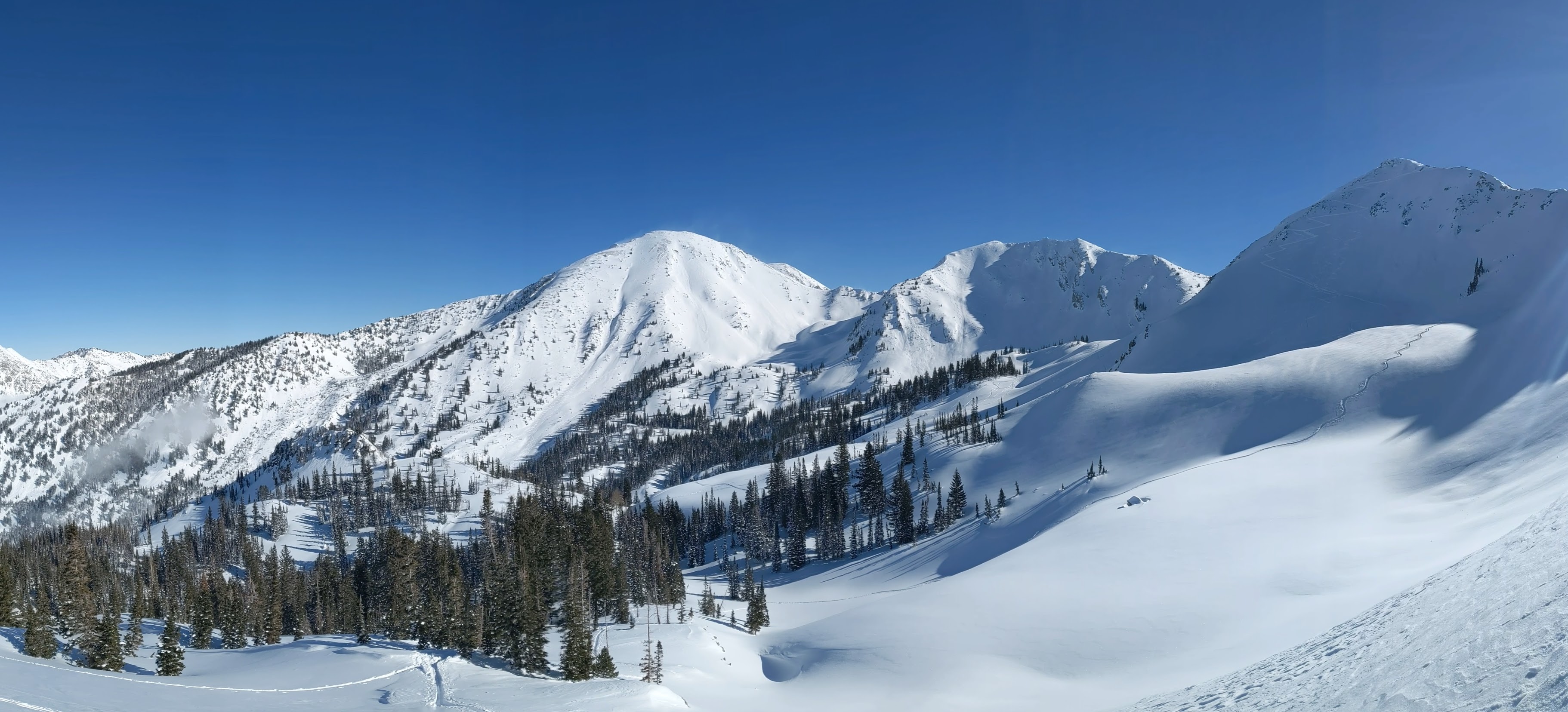
It was a beautiful day today if you were above the stratus clouds that were hanging around in some areas and tonguing up Little Cottonwood Canyon. Upper White Pine on a sunny day with a deep snowpack is as pretty as it gets.
However, in the lower canyon and in Little Cottonwood, stratus lurked.

Such clouds can develop in mountain valleys and canyons when a ridge builds in and produces an elevated inversion or stable layer that caps moisture at low levels. Indeed that was the case today with a stable layer evident in the morning (5 AM) Salt lake City sounding between about 725 and 675 mb, which is just below crest level.

This stable layer likely lowered some by mid morning. In fact, during our tour we ate lunch right at the top of the cloud layer. You could feel the temperature cool when the clouds moved in and then warm when they retreated.
In addition, there was just enough humidity in the air to enable ice crystal growth. Look carefully in the photo below and you can see the sparkling ice crystals.

Here are a few of my dendritic friends on my glove.

Meanwhile, on the Earth's surface, we have the best snowpack in a decade. I have a friend visiting from Innsbruck and pulled out my 3-meter probe to impress him. The bottom was not hit. That's 120 inches in US units and of course the snow depth was deeper than that.


"nothing good comes from the east" - do tell! Sounds like a great blog post title
ReplyDelete