
Forecasts look good for another storm Saturday night and Sunday. The latest GFS forecasts a healthy trough to be over Utah at 1800 UTC (11 AM MST) Sunday with precipitation across much of the state.
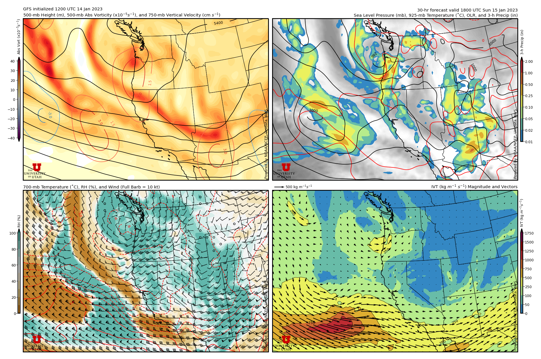

Let's look at some numbers. The GFS is going for a Goldilocks storm with 0.95" of water and 13" of snow at Alta through Sunday evening. Snow-to-liquid ratios increase with time, favoring a right-side up snowfall. Wet bulb zero levels max out tonight at about 6200 feet, so expect snow levels to start out near or just above the benches and lower with time. It's a tough call whether or not they will reach the valley floor (they get close) so if you need to drive Sunday morning or Sunday, suggest keeping an eye on the forecast.

As has been the case the last few storms, the HRRR is a bit warmer, with the wet bulb zero perhaps 500 ft higher, and wetter, producing 1.75" of water and 20" of snow for Alta by Sunday evening. That's more at the upper-end of the Goldilocks range.

It seems like 0.9 to 1.8" of water and 10-20" of snow is a decent bet for accumulations through Sunday evening. Sunday looks like a storm-skiing day with free refills at the resorts with the GFS and HRRR forecasting the trough moving through upper Little Cottonwood from 11 AM to 2 PM (note how the flow in the center left plots above shift from southerly to WNW. Late-day red-snake potential looks high.
"Late-day red-snake potential looks high."
ReplyDeleteWut?
The red snake of brake lights, endemic to the region known as Wasangeles.
Delete