Wednesday, October 31, 2018

Dirty Ridges and Upper-Level Waves

There's a little frost on the pumpkin this Halloween morning and, if you want something scary, talk of a dirty ridge

There is no official definition of a dirty ridge, but it is typically used by meteorologists to describe situations in which clouds and precipitation are found on the downstream (typically eastern) side of long-wave upper-level ridges.  This might be viewed as a surprising place to find clouds and precipitation since the area downstream of an upper-level ridge is typically associated with fair weather. 

Such a view, however, neglects to look at the entire weather picture.  Let us take the forecast dirty ridge as an example.  The situation this morning features an upper-level ridge centered west of California with an upper-level trough further upstream just east of the dateline (dashed line).


Waves in the upper levels have a mixture of wavelengths and meteorologists typically distinguish between long waves, which span perhaps a few thousand kilometers and short waves which span a shorter distance.  Long waves tend to move slowly, and short waves tend to move faster.  This results in an apparent "steering" of short waves by the long waves.  In other words, the short waves move through the long waves. 

This wave behavior is a consequence of the Earth's rotation, which has a greater influence on long waves than short waves and results in long waves progressing downstream more slowly than short waves.  At the extreme, long waves become stationary or move upstream.  The latter is known as retrogression

The forecast for the next few days provides an example of this and illustrates a classic dirty-ridge scenario.  Watch in the loop below how the short-wave trough that is initially upstream of the long-wave ridge centered off the California coast, moves through the ridge and is deflected initially poleward on the upstream side of the ridge and then equatorward on the downstream side of the ridge.  Although the ridge "flattens" as the short-wave trough moves through it, a comparison of the ridge position at the beginning and end of the loop shows little movement.  In other words, it remains stationary while the short-wave trough progresses through it and moves downstream. 


Critical for the ridge to be dirty are two factors.  The first is that there is a tongue of moisture laden air on the upstream side of the ridge at the beginning of the loop and ahead of the short-wave trough.  The color fill above is precipitation and you can see a band of precipitation that extends northward early in the loop and is associated with this moisture tongue.  The second is the existence of the short-wave trough, which provides the dynamics, or large-scale lifting, needed to generate clouds and precipitation on the downstream side of the ridge.  Note how the precipitation accompanies that trough as it moves inland across the Pacific Northwest. 

There are sometimes other mechanisms that can generate "lift" on the downstream side of a ridge and these often are at play in dirty-ridge scenarios.  This is one reason why it is important for meteorologists to consult numerical model forecasts and think in terms of physical processes rather than relying exclusively on rules of thumb and simple pattern matching.  The assumption that fair weather will happen on the downstream side of a long-wave ridge is not always a good one. 

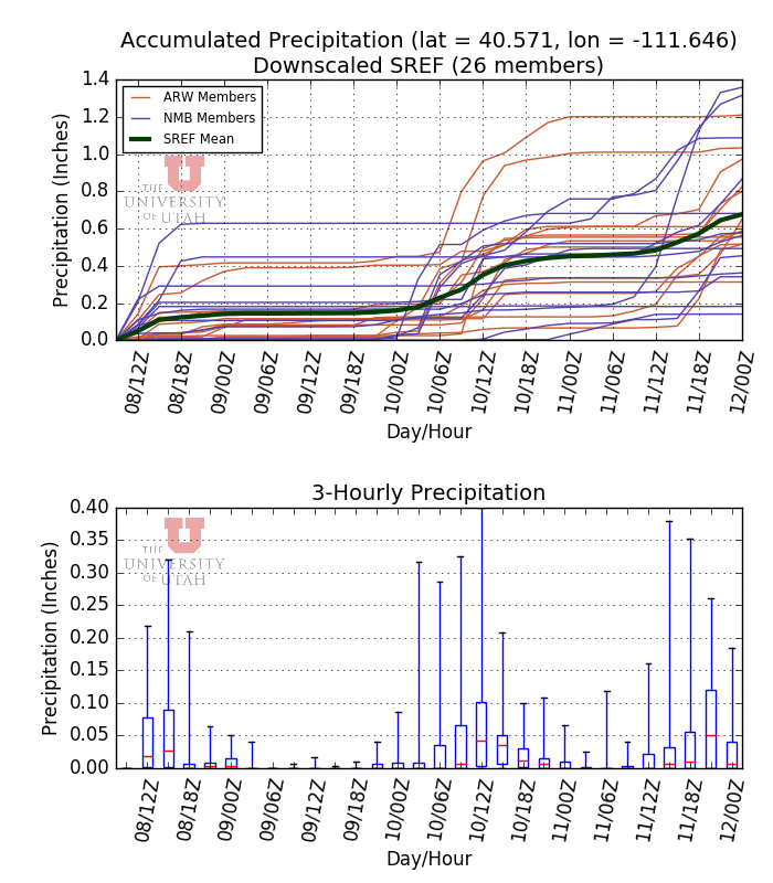
The short-wave trough that I emphasized above is a concern for the forecast late Friday and Friday night.  We have a weaker dirty ridge scanario for later today, tonight, and tomorrow.  The plus side is that having some clouds around this evening should slow the temperature drop at and following sunset for the trick-or-treaters, although temperatures in the valley will still be in the 40s, and as things look now, it will be dry this evening.  Clouds will thicken and we could see some showers later tonight and tomorrow, with snow in the upper elevations.  Sadly, this is spitty kind of stuff and it probably won't add up to more than an inch or three, with the flakes tortured by strong winds.  This is a scenario where riming will probably also occur. 

Dirty indeed. 

Tuesday, October 30, 2018

Pattern Change?

The phrase pattern change is pretty vague and it really doesn't tell you much.  For instance, it's a pretty crisp out there this morning, and one might describe this as a pattern change, but should you get excited for snow?

The weather over the past couple of weeks has been dominated by persistent ridging over western North America.  For example, the average 500-mb height pattern for 22-28 October shows this ridge, which was strongest over Canada and weaker to non-existent over northern Mexico. 
Except for the occasional trough that was able to slip through the net to give us a few showers, the pattern has been mainly dry. 

Over the past couple of days, that ridge moved downstream and the Pacific trough progressed into the western U.S. leading to the cooling we feel today. 


However, the phasing of that trough with moisture was insufficient to give us any precipitation, and we've been left high and dry while precipitation develops ahead of the trough as it moves across portions of Colorado and the high plains.  What a waste.

One difference that is evident in the medium-range guidance, however, is that the tendency is for ridging to be along the Pacific Coast (short term) or upstream over the eastern Pacific.  For example, the GFS forecast valid 1200 UTC (0600 MDT) 4 November shows the ridge over the eastern Pacific with Utah in northwesterly flow. 


My view is that this is an evolving pattern change, but most of the ensemble forecasts are still not bringing in a big storm over the next 6-7 days.  For instance, most of the members of our downscaled North American Ensemble Forecast System Product are producing 8 inches or less at Alta Collins, which is produced by the passage of three very weak systems.  There are a small number of Canadian ensemble members that are more excited, and we are always grateful for the love and support from our friends to the north. 

My read of the ECMWF ensemble through the 6th is that it has a similar distribution. 

Thus, the ensembles suggest it is more likely than not we won't see a big storm over the next week, although there's a slight chance that perhaps something can amplify on the downstream side of the trough and give us a bigger storm.  I won't push my luck looking further out in the future than that.

Sunday, October 28, 2018

Vote

Although I tread into political commentary from time to time on this blog, in general, I try to keep it relatively politics free, especially on topics that are outside my area of expertise. 

So today, I merely want to give a pep talk to everyone to get out and vote this year.  If you are registered in and live in Utah, you can do this by mail, at an early polling location, or on election day.  Complete information, including early and election day polling locations, is available at vote.utah.gov

Voter turnout in the 2016 election was around 56% for males and 60% for females.  It was lowest amongst the young (people 24 or younger) and increased with age. 


It would be great to see numbers that are even higher, especially from younger voters who are the future of our country. 

I've always considered voting to be more than a right and privilege, but a responsibility.  Especially informed voting.  National races, especially those in contested districts (e.g., Utah District 4 with Rep. Mia Love and Salt Lake County Mayor Ben McAdams in a dead heat according to polls) tend to dominate advertising and media coverage (sadly with little discussion of policy and a strong emphasis on negative ads).  However, local races matter too.  If you go to vote.utah.gov, you can input your address and access a sample ballot.  You can also access profiles for each candidate, including so-called third party candidates, impartial analysis of propositions and amendments, and arguments in favor or against those propositions or amendments.  I believe this is a great service, and I found it useful for getting out of my echo chamber and researching candidates and topics for which I felt the advertising and media coverage provided little substance. 

Voting takes time and you might be away from home or far from a polling place.  You might be saddled with heavy work or other responsibilities on election day.  But if you are registered and able, try to find the time for mail-in or early voting and, if you go to vote on election day and your eligibility is questioned, ask for and complete an provisional ballot. 

Let's do this.

Friday, October 26, 2018

Origins of the Phrase "Greatest Snow on Earth"

The print version of today's Salt Lake Tribune included a preview for the upcoming ski season.  It got me to thinking about a similar preview that was published a long time ago and introduced the world (or at least the region) to the phrase Greatest Snow on Earth

When I was writing my book Secrets of the Greatest Snow on Earth, I really wanted to include a section describing where the phrase Greatest Snow on Earth came from.  I figured there had to be a good story behind it.  I was aware that the Ringling Brothers and Barnum and Bailey Circus had sued the State of Utah over the use of the phrase (they argued it was too similar to Greatest Show on Earth), but the court ruled that Greatest Snow on Earth did not dilute their slogan.  I thought that the origins of the phrase would have been hunted down for that trial, but it wasn't.  Instead I had to do some digging.

I began by calling a friend, Dave Hanscom, who I met through our work for the 2002 Olympic Winter Games, is an author (With Alexis Kelner) of the Wasatch Tours Guide Books, and a legend in the Utah nordic skiing community.  I thought he could introduce me to Alexis, who wrote a great book on the history of Utah skiing in the 1980s, but Dave suggested someone else: Mike Korologos.

I had Mike's name in the back of my mind for several months thereafter as I continued to work on my book but procrastinated cold calling him.  In fact, I pretty much finished all but the first couple of paragraphs of the book when fate took hold.  I was at a function at the Natural History Museum of Utah.  There were about 1000 people there, but standing next to me was a man with a name tag that read "Mike Korologos." 

I introduced myself, mentioned my book, and asked him if he knew the origins of the phrase.  He told me "yes, my brother came up with it."  I put that in quotes, but it captures the spirit of his comment as I cannot remember the exact words. 

I was skeptical, so I Googled his brother, who looked fairly reputable.  He has his own wikipedia page, served as an ambassador to Belgium, worked for Senator Wallace Bennet, and worked closely with presidents and supreme court justices (for you youngsters out there, this used to be reputable work!).

He also began his career as a journalist with the Salt Lake Tribune. 

Mike put me in touch with Tom who told me the story.  He was preparing the special pre-ski-season insert for the Salt Lake Tribune.  The circus was in town.  Specifically the Ringling Brothers and Barnum and Bailey Circus.  He thought, Greatest Show on Earth....Greatest Snow on Earth...and one thing led to another.  He wasn't sure when he first used the phrase for the insert, but it was in the late 1950s or 1960s.

I spent an hour or two each morning for the next week or two scrolling through the microfilm in the Marriott Library (also for you youngsters out there, microfilm and a microfilm viewer are the pdf and Google of the previous century).  I finally found it.  The first published used of the phrase Greatest Snow on Earth, in the December 4, 1960 Home insert for the Salt Lake City Tribune.


And with that, I was able to finish my book. 

Subsequently, Greatest Snow on Earth was trademarked by the State of Utah, plastered on license plates, and became a remarkably successful outdoor slogan.  It has also spawned many myths, such as Utah snow being unusually dry, deserts drying out snow, etc.  Those topics are covered in greater depth in my book. 

I'd like to take this moment to thank Dave Hanscom, Mike Korologos, and Tom Korologos for helping reveal the origins of the Greatest Snow on Earth.

Wednesday, October 24, 2018

How Much Lake Effect Did Lake Bonneville Produce?

It is a question that I am asked frequently, how much lake effect did Lake Bonneville produce?

Lake Bonnevile was an ancient lake that existed during the last ice age and covered much of the Bonneville Basin of Utah, Nevada, and Idaho.  About 14,500 years ago  the lake reached its highest level, burst through Red Rock Pass, and flooded southern Idaho and eastern Washington via the Snake River, resulting in a drop in lake elevation to 300 feet.  The Great Salt Lake is a remnant of Lake Bonneville.

At high stand near the end of the ice age, Lake Bonneville was over 1000 feet deep and glaciers existed in 15 mountain ranges within its drainage basin.  The bulk of this glacier ice was in the Wasatch and Uinta Mountains.

Lake Bonneville at maximum extent (blue) with mountain glacier systems in transparent light blue.
Source: Laabs and Munroe (2016)
We don't really have much knowledge about the effects of Lake Bonneville on local climate.  Geological studies indicate that Lake Bonneville may have affected the glacier mass balance (likely through greater snow accumulation) in downwind mountain ranges, with glacier equilibrium lines being lowest in the Wasatch Mountains and higher upstream in the Deep Creek Range and farther downstream in the Uinta Mountains.  This pattern cannot be explained by the distribution of modern precipitation across the region.  

Reconstructed glacier equilibrium line altitudes.  Source: Laabs and Munroe (2016).
For those of you who miss the good old days, below are a couple of maps illustrating the ice extent in a heavily glaciated portion of the Wasatch Range and the Uinta Mountains.  This represents maximum ice extent, although evidence suggests that the terminus of glaciers in Little Cottonwood and Bells Canyons likely extended to the base of the Wasatch Range near the time of the Lake Bonneville high stand.  What a scene that would have been.  
Pleistocene ice extents in the Wasatch Range.  Source: Laabs and Munroe (2016)
Pleistocene ice extents in the Uinta Mountains.  Source: Laabs and Munroe (2016)


A few years ago, one of my students, John McMillen, stuck Lake Bonneville into one of our simulations of a Great Salt Lake effect snowstorm.


Not surprisingly, this results in a significant increase in the coverage and the intensity of precipitation, although in this northwesterly flow event, Salt Lake Valley and the south-central Wasatch Mountains around lower and middle Little Cottonwood Canyon, receive the most precipitation.  There are also some changes in storm characteristics, which we'll skip over here in the interest of time. 


That was all fine and dandy, but if we really want to understand the impacts of Lake Bonneville, we have to do quite a bit more since one event tells us little about what to expect over a season, decades, or centuries.  

First, we need to account for the different large scale circulation that existed during the last glacial maximum.  Global and regional climate models can be used to do this, although to my knowledge, this has never been done using regional climate models with sufficient resolution to adequately resolve the influence of Lake Bonneville and surrounding terrain.  

Second, we need to couple the regional climate model with a lake model that can simulate seasonal variations in lake temperature and potentially ice coverage.  The Great Salt Lake is a very unusual lake in that it is hypersaline, very shallow, and never freezes.  As a result, it warms and cools very quickly.  A large lake like Lake Bonneville would cool more slowly in the fall and early winter and warm more slowly in the spring.  This would shift the seasonal distribution of snowfall such that instead of maxima in lake-effect in the fall and spring, as occurs with the Great Salt Lake, it would instead be in December or January.

Third, we would probably need to include Lake Lohontan, another large lake that existed during the last ice age over Nevada.  Multi-lake effects are common in the Great Lakes and I hypothesize the could have been important over the Great Basin during the last ice age.  

Those are a few of the issues at play.  I have always been interested in a modeling project that would do this.  I confess that my motives are not purely scientific.  It simply sounds like fun.  Plus, one could take those model simulations and put together some amazing visualizations of what northern Utah looked like at the end of the last ice age.  What a hoot that would be. 

This is the kind of project that might be hard to get funding for, but is ripe to support with a magical discretionary account.  If you won the $1.6 billion dollar lottery last night, give me a call!

Monday, October 22, 2018

Last Gasp of the Monsoon

There is no obvious end of the monsoon, although in the southwest U.S., it is sometimes defined to be 30 September.  The monsoon, however, is sometimes slow to die, or rises from the dead in October, which seems fitting for a month that ends with Halloween.

Contrary to conventional wisdom, which views monsoon as a heavy downpour, the word monsoon is typically defined based on a seasonal reversal of the wind and is now used broadly to describe large-scale circulation and precipitation changes that occur due to differential heating of land and ocean/sea surfaces.  In North America, the cool-season over the southwest U.S. and Mexico is characterized by predominantly westerly flow, but during the warm season, the development of upper-level ridging over North America leads to mean easterly flow that spreads northward from Mexico into the southwest U.S. from June to July.  This easterly flow is typically associated with increased moisture and precipitation, although both are modulated by disturbances in both the easterly flow and the westerly flow to the north. 

The seasonal transition, however, is not necessarily abrupt, so monsoon-like patterns can persist or redevelop during the fall.  If we look at the large-scale pattern for 0300 UTC 21 October (9 PM MDT Saturday), for example, we see a pattern that is somewhat reminiscent of the monsoon with easterly and southeasterly flow at 700-mb (yellow vectors) extending from the Gulf of Mexico, across northern Mexico, and into the southwest U.S.  At the same time, a trough of low pressure off the California coast is aiding in the surge of high precipitable water air (color contours) into Arizona, Nevada, and Utah.


This morning, clouds and precipitation cover portions of southwest Utah, northwest Arizona, and southeast Nevada and are streaming northward into west-central Utah. 


Precipitation is expected to reach northern Utah later today, as illustrated by the HRRR forecast for 0000 UTC (6 PM) this afternoon.


It will be worth keeping an eye on the sky later today if you have outdoor activities planned.  Showers and thunderstorms are possible.  Snow levels will be about 10000 feet during periods of light precipitation, but could lower temporarily if precipitation is heavy. 

Sunday, October 21, 2018

Purgatory Ain't So Bad

With us sitting ski purgatory with an 11" of snow at Alta Collins enough to screw up high country mountain biking and hiking but not enough to enable early season skiing, we're fortunate that the weather over the past few days as simply been spectacular for hiking and mountain biking in the foothills.  Some scenes from the BST yesterday are below.


There is something rotten, however, in the state of Denmark (er, Utah), and that is increasing smog as we slowly approach what is known colloquially as inversion season.  Here's a view looking west yesterday.  The smog is most apparent when the sun is in front of (rather than behind) you.  This is a consequence of what is known as forward scattering of the visible radiation.  In addition, I suspect the particular matter concentrations are greater in the afternoon over the Great Salt Lake, western Salt Lake Valley, and Tooele Valley because the airmass over the Great Salt Lake this time is often cooler, resulting in less vigorous mixing through a shallower layer.  

Looking west from the BST above North Salt Lake
There is a slight chance of showers and thunderstorms later today, with scattered showers and thunderstorms possible tonight, Monday, and Monday night as the last gasp of the 2018 monsoon moves through.  After that, the ridge returns.  There's always hope that something slips through the net, and one can find an ensemble member or two that forecasts this to happen, but the odds favor a continued waiting game for the next big mountain snowstorm through the next week.  Remember that the Utah Snow and Avalanche Workshop is next week (info here). 


Wednesday, October 17, 2018

Impacts of a Shrinking Great Salt Lake on Wasatch Snowfall

How much does a shrinking Great Salt Lake affect Wasatch snowfall?  It is a question that I am frequently asked and one that of course has a complex answer.

To begin, we should instead ask the question, how much of the snowfall in the Wasatch Range is produced by lake-effect precipitation?  Conventional wisdom might suggest a lot, but the actual numbers are probably lower than most people think.

Kristen Schepel (née Yeager), Trevor Alcott, and I set out to answer this question several years ago as it hadn't been adequately answered previously.  The effort involved combing through a gazillion radar images over 12 cool seasons (mid September to mid May), identifying lake-effect periods, and figuring out how much precipitation at observing sites in northern Utah is produced during those periods. 

The results are below and indicate that in an average cool season, lake-effect periods (LEPs) produce about 60 mm (2.4 inches) of water equivalent at the Dry Fork SNOTEL (DRFU1) in the Oquirrh Mountains and the Snowbird SNOTEL (SBDU1) in the Wasatch Mountains [Left Hand Figure].  Of the observing sites we examined, these sites receive the most lake-effect period precipitation.  At the Dry Fork SNOTEL, this represents about 8.4% of the total cool-season precipitation.  At Snowbird, about 5.1%.  Not surprisingly the area south (Oquirrh Mountains) and southeast (Salt Lake Valley and central Wasatch) receives the most precipitation during lake-effect periods, however, this represents less than 6% of the total cool-season precipitation at all sites except those in the Oquirrh Mountains.  Note that estimates at some valley sites, such as Cottonwood Weir at the base of Big Cottonwood Canyon, are probably too low due to undercatch of lake-effect snowfall by gauges that are not shielded from wind effects. 

Source: Yeager et al. (2013)
It is worth noting a few caveats about this analysis.  First, we did not attempt to discriminate between lake-effect and non-lake-effect precipitation during lake-effect periods, and the two do occur in concert at times.  This would contribute to some overestimate of the total lake-effect precipitation.  On the other hand, the lake may at times contribute to some enhancement of precipitation features that don't necessarily look like lake-effect features, and we did not consider such effects. 

So, let's put those numbers into some perspective for skiers, beginning with Snowbird as a proxy for upper Little Cottonwood Canyon, which on average probably receives the most lake-effect precipitation.  If the lake were to disappear, and lake-effect ended, the average impact on cool-season snowfall would probably be a reduction of about 5% (lake-levels during the period we examined varied from above average to below average, so I'm assuming the lake-effect snowfall is generally representative of the long-term mean).  That equates to about 25 inches of snow assuming a 500 inch mean.  Elsewhere, the reduction would be smaller.  For example, Snowbasin and Park City/Deer Valley receive less lake effect, so the loss of the Great Salt Lake would have an even smaller impact.

For further perspective, we might also ask the question, with global warming, how much of the precipitation that previously fell as snow would instead fall as rain.  Estimates suggest that 4ºC of warming (about 7.5˚F), as is presently projected with continued greenhouse gas emissions, would result in a 20% decrease of snowfall at Snowbird (mid mountain estimate) due to more precipitation falling as rain (declines are greater at lower elevations).  The direct impacts of global warming on snowfall and snowpack remain the biggest threat to the Greatest Snow on Earth.  Changes to the Great Salt Lake are a secondary effect. 

However, there is something that I have swept under the rug in the analysis above and that is the importance of the seasonality of lake effect.  If one looks at Snowbird, for example, the peak in event frequency and amount of precipitation (snow water equivalent) produced by those events is in November. 

Seasonality of lake effect at Snowbird. Source: Steenburgh (2014)
The 1.2 inches of average SWE produced in October and November is quite significant when one considers how important just a little snowfall is for starting the ski season and for resort operations during Thanksgiving and even the Christmas Holiday.  On the other hand, that November total is strongly affected by two monstrous lake-effect events that occurred over Thanksgiving 2001 (and contributed to the famed "Hundred Inch Storm").  Basically, there are some years where we get a major lake-effect event and in those years, lake-effect makes an important contribution to the early season snowpack. 

To conclude, the contribution of the Great Salt Lake for Wasatch snowfall is frequently overstated, but that is not to say it is unimportant.  Events in the fall, especially larger ones that happen episodically (not necessarily every year), can be important for early season snowfall and the timely start of the ski season.  However, the 800-pound gorilla in the zoo is really global warming, and its direct impacts on Wasatch snowpack and snowfall remain the biggest threat to the Greatest Snow on Earth.

That being said, the Great Salt Lake is an absolute treasure, and it would be a damn shame if it, like other terminal lakes around the world, was condemned to a noxious dust-bowl future. 

Near Spiral Jetty, 15 June 2013

Sunday, October 14, 2018

First Snow Followed by the Coldest Day in Months

Last night we received the first snow of the season in the upper Avenues, with a coating of white on colder surfaces.


Radar imagery showed a band of precipitation passing through the area early this morning, which led to the snow.  That band was drifting southward and brought a little snow to the central Wasatch, although accumulations were likely less than in inch (the Alta-Collins data feed to Mesowest is currently down, so this is guesswork based on cameras). 


Today will probably be the coldest day of the season so far and the coldest day we have seen around here in months.  If my quick look at the records is correct, the last day we had here with a high below 50ºF was April 17 when it reached 49˚F.  If you continue to go back in time, the next day below 50ºF was March 26 (48˚F), which was preceded on March 25 by a high of 44˚F.  The forecast high for today from the National Weather Service is 47˚F.  It might be a good day to switch from flip flops to closed-toe shoes.

Friday, October 12, 2018

Looking Back at Michael

Editors note: This post has been edited to correct the category of Hurricane Micheal at landfall.  Due to a typo, it was incorrectly described as at the top end of category 5, when it was at the top end of category 4.

I never paid much attention to tropical meteorology until I moved to Utah and had to deal with the monsoon and occasional hurricane remnants.  Then my parents bought a house in Florida.  Hence, I take a peek south of 30ºN from time to time.

Hurricane Michael was easily the most impressive landfalling U.S. hurricane that I've ever observed.  My students and I followed it closely on Wednesday morning as it made landfall.  Meteorologists everywhere were watching it, and I highlight the women and men in the National Weather Service, including local forecast offices and the National Hurricane Center, who worked tirelessly to provide forecasts and updates for the public.  

A National Hurricane Center Public Advisory as Michael made landfall near Mexico Beach reported that data from NOAA and Air Force Reserve Hurricane Hunter aircraft indicated that the maximum sustained winds were near 155 mph, which put it at the top end of category 4, with a central pressure of 919 mb.  I have seen a number of rankings of Micheal's intensity based on either wind or pressure or both and whether or not all US landfalling or just Florida landfalling hurricanes are included.  Phil Klotzbach, a research scientist at Colorado State University, provided a full summary for the Capital Weather Gang/Washington Post that you can access here.  

The damage in Mexico Beach is catastrophic.  NOAA is doing aircraft overflights for imeagery that you can access here.  Below is a before and after comparison of a neighborhood in Mexico Beach.  


Those images illustrate just how damaging a category-4 eyewall can be.  I suspect the damage above reflects both wind and surge, although people with greater knowledge than I can provide a better assessment. 

Data from Tyndall Air Force Base just to the east shows a remarkable drop in pressure (Altimiter Setting being used here due to some bad sea level pressure data that was transmitted, although the differences at 2 above sea level are small) from 1010 mb to 922 mb in less than 24 hours.  As the eye approached, the pressure dropped.  The actual minimum altimeter setting was 922.11 mb at 1220 CDT.  The pressure fell 52 mb in the hour leading up to that time.  That's about the equivalent change in pressure you would get in benign weather if you climb 500 meters (1640 feet) in elevation in an hour.  

Source: MesoWest
I hear people say frequently that they have been through hurricanes before and it wasn't that bad.  Often, that reflects the fact that they did not experience the full force of the hurricane eyewall, which is located very near the center of the storm.  Winds in a tropical cyclone increase as you approach the eye, and do so over a very short distance.  This can be seen in the remarkable ramp-up of wind speed at Tyndall Air Force Base where the maximum sustained winds of 86 mph and peak gust of 129 mph occurred at 1219 and 1221 CDT, respectively.  Just one hour earlier, at 1120 CDT, the winds were sustained at 45 mph, gusting to 61 mph.  Still healthy, but that illustrates that the worst of the winds in a hurricane are often confined to very near the low center.  Thus, experiences in other regions of the hurricane do not necessarily translate to "the worse," at least as far as peak winds are concerned.  Surge is often more complex.


Inevitably, and a cause of heartburn for me, are claims that forecasters were caught off guard.  The New York Times, for example, ran an article yesterday with the headline Why Hurricane Michaels Power Caught Forecasters Off Guard.

It is argued in the article that "millions of residents were caught of guard as Michael escalated from a tropical storm to a major hurricane in just two days, leaving little time for preparations."

Curiously, nobody interviewed in that article is a forecaster or involved in emergency management.  

If one digs into the archives, you can find the following in the 4 AM CDT discussion issued by the National Hurricane Center at 4 AM CDT Monday October 8, more than 48 hours before landfall:

"This new official forecast brings the intensity to just below major hurricane strength in 48
hours, and since the storm will still be over water for a time between 48 and 72 hours, there is a real possibility that Michael will strengthen to a major hurricane before landfall.  Weakening is expected after landfall, but the system will likely maintain tropical storm strength after day 4 when it moves off the east coast of the United States."

The issue of hurricane intensification, especially prior to landfall, is a critical one that is of great interest to the science and forecasting community.  Precise predictions of intensity, especially at long lead times, pose serious challenges for a variety of reasons.  But the potential for a major hurricane was clear in the content issued by the National Hurricane Center.  Further, here is an interview of Florida Governor Rick Scott, given on the evening of October 9, stating that he has been traveling the state for 2 days asking people to get out.  

For more on this, see Marshall Shepherd's article in Forbes An Open Letter Thanking The National Hurricane Center For Plenty Of Notice On Michael.

Thursday, October 11, 2018

Deep Dive on Current and Future Drought in Utah

A recent article in the Salt Lake Tribune (Utah just experienced its driest year since scientists have kept records) strongly suggests that our recent drought is due to climate change.  While global warming is a contributor, drought has many drivers and it is essential that we recognize that fact as we plan for the future.

Drought is nothing new to the American southwest.  Historical records and proxies based on tree ring records show long-term fluctuations from drought (dry periods) to pluvial (wet periods) are characteristic to the region even before human influence on climate.

Tree-ring reconstructed streamflow for the Bear River. Drought and pluvial (wet) periods illustrated by black and grey fill, respectively.  Note that this graph is smoothed to illustrate slower climate variability. Source: DeRose et al. (2015).

That human influence on climate is, however, growing and expected to play an increasing role in drought over the American southwest.  It is, however, very difficult to disentangle the contribution of long-term global warming from weather and climate variability that cause variations in temperature and precipitation over periods of years or even decades.

Drought has many definitions.  Although it is frequently defined as a prolonged period of abnormally low rainfall it can also be defined based on water availability with drought being a period of natural water scarcity.  It is possible, for example, to have near average precipitation but below average soil moisture, snowpack, and runoff depending on the atmospheric conditions.  For example, as temperature increases, declines in the fraction of precipitation that falls as snow and the amount of precipitation retained in the end-of-winter snowpack, combined with increased evapotranspiration (drying of soils due to evaporation and transpiration by plants), can yield water scarcity even if precipitation does not change.

Drought conditions over the American southwest in recent years have been the result of both decreased precipitation and anomalous warmth.  At issue is how much each of these is due to long-term global warming vs. atmospheric circulations due to the slowly evolving climate system.  The bulk of the evidence today indicates that our precipitation drought at least partially if not primarily reflects the latter and is related to slowly evolving sea surface temperatures in the Pacific Ocean.  It is also possible that it partially reflects what is known as Hadley cell expansion, a northward expansion of an atmospheric circulation characterized by mean ascent near the equator and descent near 30º latitude, at least in the extreme southwest.

In addition, it is important to recognize that climate models project a complex picture of the change in annual precipitation with global warming.  For example, the median projection by 16 downscaled climate models calls for either very little change or a small increase in precipitation in the mountains of northern Utah depending on future greenhouse gas emissions.  Trends across the southwest as a whole, however, vary geographically.  They also vary by model, indicating a lack of a clear consensus and this leads to only low to medium confidence in these trends.

Source: Cayan et al. (2013)
Thus, I believe we should be very cautious about attributing the recent precipitation deficit over northern Utah to global warming and I have avoided making such a statement in public talks and discussions with the media.

On the other hand, it is clear that recent warmth over the American Southwest has enhanced the drought and increased water scarcity through increased evapotranspiration.  This warmth does appear to be largely attributed to global warming.  Thus, global warming is a drought enhancer.

Many of these issues are discussed in the report we prepared for Governor Jon Huntsman Jr's Blue Ribbon Advisory Council on Climate Change in 2007.  Below is an excerpt. I have preserved the italics, underlines, and bullets.
Ongoing greenhouse gas emissions at or above current levels will likely result in a decline in Utah’s mountain snowpack and associated changes to spring runoff. Year-to-year variations in snowfall will continue to dominate mountain snowpack, streamflow, and water supply during the next couple of decades. As temperature increases through the century, it is likely that a greater fraction of precipitation will fall as rain instead of snow, the length of the snow accumulation season will decrease, and snowpack loss due to evaporation will increase. Trends that are likely to emerge as the climate warms during the 21st century include:

  • A reduction in natural snowpack and snowfall in the early and late winter for the winter recreation industry, particularly in lower-to-mid elevation mountain areas (trends in high elevation areas are unclear).


  • An earlier and less intense average spring runoff for reservoir recharge.


  • Increased demand for agricultural and residential irrigation due to more rapid drying of soils.


  • Warming of lakes and rivers with associated changes on aquatic life, including increased algal abundance and upstream shifts of fish habitat.

Future water supplies are strongly dependent on long-term trends in precipitation. If average precipitation remains similar to that of the 20th century, the changes noted above will result in a declining water supply. This decline will be exacerbated if the region becomes more arid. An increase in precipitation is required to offset the changes noted above. Current climate models project a decline in summer precipitation across all of Utah. During the winter, projections indicate a decrease in precipitation over the southwest United States and an increase in the northwest. Utah is located in the transition zone between these regimes where there is low confidence in future precipitation trends. Although a shift to a wetter climate cannot be ruled out, it is more likely than not that water supplies in Utah and the Colorado River Basin will decline during the 21st century. In addition, since precipitation will continue to fluctuate from year to year, the threat of severe and prolonged episodic drought is real and ongoing.
Although we don't have high confidence in long-term trends in annual precipitation, we do have high confidence that we are going to see fluctuations in precipitation from year to year and decade to decade and that our future is going to be a warmer one.  That warmth will load the dice toward water scarcity (i.e., drier soils, declines in runoff) even if mean annual precipitation trends are flat or slightly upwards.  Droughts will be worse.  Pluvials less "productive."

What concerns me about attributing the recent precipitation drought to global warming is that we are going to see years and periods with above average precipitation in the future.  When that happens, we shouldn't be discussing if this is a long-term trend, if it suggests that we might have a wetter future with global warming, or whether or not projections of future change were wrong [Note: climate reports for the southwest are very cautious in projecting future precipitation trends given the low confidence and uncertainty that exists (e.g. Cayan et al. 2013)].  Instead, should be discussing how to take advantage of that bounty given a future in which the dice are loaded for more sustained and severe drought than we have experienced in the past.  The future of Utah is hotter and drier, even if we have a string of good precipitation years in the future and even if the long-term average of mean annual precipitation is unchanged or increases.

Wednesday, October 10, 2018

Release the Hounds!

"I'm going to go up and take a lap today, interested?"
- Text received 7:45 AM

Ski conditions in the upper Cottonwoods have improved dramatically since the lunatics below braved skiing Gunsight a couple of days ago.


The overnight storm came through in spades and as of 0800 MDT has delivered 0.59" of water equivalent and 14" of fresh at Alta Collins, bringing the total snow depth to 21 inches.  

Source: MesoWest
That should release the hounds today.  These are still very marginal snow depth, especially given the modest water equivalents (perhaps the gauge is underreporting some).  Painful as it is to say, I'm electing to sit today out, but might try a lap or two up Collins gulch once it is skied and perhaps packed out some by the cats.  

The latest radar imagery (ending 1440UTC/0840 MDT) shows ongoing post-frontal valley rain and mountain snow showers, with some likely lake enhancement.  


Water equivalent rates the last few hours have been light at Alta Collins (≤0.05 inches), but it's snow and it will add up some.  Snow showers will continue at times this morning before tapering off this afternoon.  Perhaps a couple more inches at Alta Collins.  Areas east of the lake might do better as the flow becomes more westerly this morning.  

We might get a little more snow tomorrow as a weak trough swings through.  Some models, like the NAM below, are generating a healthy band of precipitation along the trough, but Alta is right on the edge.  Much will depend on the details.  


I hate to say this, but the extended range forecasts are pretty much a disaster as a monster blocking pattern sets up along the west coast.  The GEFS 180-hour forecast ensemble below shows all members with a monster ridge along the west coast.  


There's a chance something might sneak down the back side of the ridge or push up here from the south if we can get a closed low to setup just right over the southwest.  The latter, however, would probably be a relatively warm event.

So, enjoy your pig wallow today.  Friday marks the return of fall, the start of the melt on south aspects, and the beginning of the rot on shady north aspects.  

Tuesday, October 9, 2018

Trending Snowy for the Mountains

Compared to yesterday, this morning's (0900 UTC initialized) SREF is much wetter for Alta, with  a mean water equivalent of nearly an inch through 1800 UTC (1200 MDT) tomorrow (Wednesday), with a range of about 0.35 to 1.25 inches. 

My impression surveying the various deterministic models (NAM, GFS, FV3) is that the pattern is looking healthier as well.  The time-height section from the NAM shows high relative humidies through a deep layer from later today through mid day tomorrow.  About all that is missing in that forecast is a full shift of the winds to northwesterly.  For the most part, they stay WNW. 


Numbers from that model run for Alta show 1.03 inches of water and about 11 inches of snow through 1200 MDT tomorrow. 


Bottom line is that this is now looking like a healthy early-season storm.  Something in the 8-16 inch range for Alta-Collins is looking likely through tomorrow afternoon.  It will be interesting to see how this unfolds.  If it can come in big, my interest in getting a lap in will increase markedly. 

Monday, October 8, 2018

Update from Purgatory

Snow accumulations in the Wasatch Mountains are probably starting to give snow-safety professionals heartburn, especially considering the forecast.

Automated snow depth measurements at Alta Collins show 8 inches on the ground as of 6 AM MDT this morning.  At the Daybreak measurement site at 9250 feet above Canyons Village at PCMR, its up to 10 inches.  It's tough to say how much to trust these early automated snow depth sensors, and they may or not be representative, but given the persistent easterlies over the past couple of days, I would not be surprised if the upper-elevations of the Park City Ridgeline had a snow depth similar to that at comparable elevations in upper Little Cottonwood.  Certainly the camera at Crescent Ridge is looking snowy this morning.

Source: Park City Mountain Resort, downloaded 8:07 AM MDT
Higher up, at the top of Collins, Alta is looking wintery.


Will we get more?

Sure.  Perhaps a few more snow showers today in the central Wasatch, although accumulations will probably be less than an inch.  The next significant storm will be Tuesday night and Wednesday.  This shows up well in the middle of the SREF plume below.  Most members produce 0.2 to 0.5 inches of water equivalent for the event (about 2-6 inches of snow depending on density), but a few are more excited.


There is another system on the heels of that one for later in the week, although that may be more of a southern Utah event (but too soon to say with confidence). 

My take on all this is that the odds favor continued Purgatory this week with snow depths being insufficient to really allow for skiing (I'm sure that won't stop some of you).  There's a chance that we do well in the two storms and I'll be out skiing by the weekend, but I'd say the odds of that are less than 20%.

A good question concerns what will happen to this snow after this week.  I don't like to look much past 7 days, but the models suggest drier weather, which means we may be stuck in Purgatory for a while.  A longer dry stretch will probably result in most of the snow on south aspects melting out, persistent muddy trail conditions in some melt-out areas, and lingering snow on shady north aspects.  Like I said, heartburn for snow-safety professionals.  

Sunday, October 7, 2018

Salt Lake in the Lee of the Wasatch Range

If you were in the Salt Lake Valley and looked toward the Wasatch this morning around 8:30 you may have noticed that there was a cloud sitting several kilometers west of the Wasatch Range (note darker band of clouds below).  The cloud sat several km west of the Wasatch Range and didn't extend into the mountains.  Over the mountains, it was snowing, but not very hard.  


What you are seeing is a consequence of easterly flow.  There is a band of precipitation that currently extends from from SW to NE across the region, but this is embedded in easterly flow.  If you look carefully at the image below, the radar reflectivities at 8:18 AM were actually higher east of the Park City Ridgline (look along the border between Salt Lake and Summit Counties) than on the Cottonwood side of the Wasatch.  


So, in the photo above, the snow in the mountains is spillover.  Then, a harder, darker cloud base exists where a lee wave is producing rising motion.  This is something akin to that illustrated in the picture below, except there is more extensive cloud cover due to the precipitation band being generated on the north side of the close low that exists at upper levels to our south.  


Evidence for the easterly flow can be found in the morning sounding from the airport.  The low-level flow in the Salt Lake Valley is northerly, but there's northeast to east to southeast flow from 700 to 300 mb.  


Friday, October 5, 2018

Forecast Tools on weather.utah.edu

With winter approaching (conditions currently and over the next few days are really just a teaser), it seems a good line to discuss some of the forecast products that we have available on weather.utah.edu.


All products available on weather.utah.edu are based on computer models run by the National Centers for Environmental Prediction (NCEP), a part of the National Weather Service.  We download and process this data, producing a variety of plots, graphs, and tables that can assist in the preparation of a weather forecast.  Really, what we provide on weather.utah.edu are not forecasts but guidance, which is defined by the National Weather Service Glossary as computer generated materials used to assist the preparation of a forecast. 

Output is available from the Global Forecast System (GFS), North American Mesoscale Forecast System (NAM), High Resolution Rapid Refresh (HRRR), North American Ensemble Forecast System (NAEFS), and the Short Range Ensemble Forecast System (SREF).

Data from these models is downloaded anywhere from 2 to 24 times per day depending on run frequency.  We also download the data at different grid spacings (a.k.a., resolution) depending on the application.  Here is a breakdown:

GFS-0.25 degree: Global Forecast System data provided on a 0.25º by 0.25º latitude–longitude grid.  Used to produce all plan view (horizontal) plots under the GFS-0.25deg tab in the left-hand nav bar.

GFS-13 km:  Global Forecast System data provided on a grid with cells approximately 13 km on a side.  This is essentially a native resolution product.  I like this to examine the precipitation and wind forecast at the highest resolution possible. 

FV3-13km: These are experimental forecasts produced by the next-generation version of the Global Forecast System, based on what is known as a Finite-Volume Cubed-Sphere Dynamical Core.  The FV3 acronym comes from Finite-Volume (FV) and Cubed (3).  Essentially, this is the next generation GFS.  This is essentially a native resolution product with grid cells approximately 13 km on a side.  The FV3 will become the operational GFS probably in early 2019 and this product will go away. 

NAM-12km: Essentially a native resolution product from the operational NAM with grid cells approximately 12 km on a side. 

NAM-3km: Essentially a native resolution product from the high-resolution NAM conus nest, a high resolution grid covering the continental United States with grid cells approximately 3 km on a side. 

HRRR: High Resolution Rapid Refresh data provided on a native-resolution grid with cells 3 km on a side.  Forecasts are produced to 18 hours every hour.  Although operational HRRR forecasts are extended to 36 hours at 0000, 0600, 1200, and 1800 UTC, we're not accessing data past 18 hours yet. 

NAEFS-Downscaled: This is a unique product based on the North American Ensemble Forecast System (NAEFS).  The NAEFS is based on the GFS-based Global Ensemble Forecast System (GEFS), which produces 21 forecasts with an effective horizontal grid spacing of about 33 km, and Canadian Ensemble Forecasts produced by their GEM model (also 21 forecasts).  Precipitation forecasts produced by the NAEFS are downloaded on a 0.5ºx0.5º latitude–longitude grid, but downscaled to much higher resolution based on climatological precipitation analyses.  We also estimate snow density from additional NAEFS forecast fields to produce a snowfall forecast. 

SREF-Downscaled:  Based on the Short Range Ensemble Forecast System with 26 members, with precipitation downscaled similar to the NAEFS.  We haven't incorporated a snow density estimate yet to produce a snowfall forecast, but hope to do that in the future. 

Time Heights and Soundings: Time height diagrams and soundings are available for some locations under the GFS-0.25deg and NAM-12 tabs.  These are produced using special vertical profile data (known as BUFR) from the nearest model grid point at the highest vertical and temporal resolution possible.  The time-height sections are fairly unique.  I don't know of any other sites that provide them, but I stand to be corrected.  They are quite useful for precipitation forecasting in complex terrain.

Little Cottonwood Guidance: A tab at the top of weather.utah.edu provides access to tabular guidance for upper Little Cottonwood Canyon based on the nearest model grid point from the NAM-12km, GFS, and NAM-3km.  This includes the wet-bulb zero level (height where the wet-bulb temperature drops below 0ºC and useful for estimating snow level); snow-to-liquid ratio; snow water content; temperature, relative humidity, and wind at the elevation of Mt. Baldy (11,000 feet); precipitation amount (1-hour and total); and snowfall amount (1-hour and total).  The wet-bulb zero, Mt. Baldy temperature, and Mt. Baldy relative humidity are based on the model forecast temperature and moisture profile.  The Mt. Baldy wind is derived from model winds based on a simple algorithm trained with past data.  The 1-hour and total precipitation amounts are taken directly from the model, but snow density, snow water contents, and snowfall amounts use the snow-density algorithm described by Alcott and Steenburgh (2010) and developed using past observations at Alta. 

Note that meteograms for Alta available under the GFS-0.25deg and NAM-12 tabs are based on this data. 

Lake-Effect Guidance:  A tab at the top of weather.utah.edu provides access to tabular guidance for lake-effect precipitation that is based on model data, recent Great Salt Lake temperature observations, and techniques described by Alcott et al. (2012).  Emphasis is placed on the likelihood of lake-effect precipitation and its location.  Amounts are not predicted.

Caveats: With a few exceptions noted above, weather.utah.edu provides access to model guidance without bias correction.  This is one reason why these products are called guidance and not forecasts.  Even the downscaled products, while accounting to some degree for terrain effects, exhibit biases, especially at individual locations.  Model bias is also highly dependent on location and model grid spacing, so the 3-km NAM has different biases than the 12-km NAM and those biases vary depending on location.  Gowan et al. (2018) examines the performance of many of these models at high altitude SNOTEL sites, but does not provide statistics for individual stations.  Caveat emptor (buyer beware).  A good carpenter knows their tools.  For official forecasts, use the National Weather Service, and for snowpack information, the Utah Avalanche Center. 

Thursday, October 4, 2018

Potential "Purgatory" Week Ahead

Fall Break for the University of Utah is this coming week and this year there won't be much time spent lazing by the pool if you are recreating in Utah.  Unseasonably cool weather is coming and will predominate for most of the break period.

Forecasts from the GEFS show the situation fairly well and illustrate some of the uncertainties at longer forecast lead times.  The forecast for 1200 UTC (0600 MDT) Friday 5 October shows an upper-level trough moving across the western United States with the axis over Utah. All members are in strong agreement of the passage of this system, which will likely give us our first coating of white in the upper elevations (more on this in a minute).

Source: Penn State E-Wall
However, that is just the first of a series of troughs that will affect the western U.S. and the beginning of a pattern in which large-scale troughing predominates in our region.  The next trough moves into the western U.S. and is centered over the Great Basin at 1200 UTC (0600 MDT) Sunday 7 October.  Note that while there is general agreement on the large-scale pattern, there are differences in the strength of the trough. 

Source: Penn State E-Wall
Following that, a third trough drops into the long-wave trough.  However, although all GEFS ensemble members call for a trough over the western U.S. at 0000 UTC 10 October (1800 MDT Tuesday 9 October), there are major differences in the pattern over the western U.S.  Thus, we can expect it to remain unseasonably cool through at least the middle of next week (possibly longer), but the timing and intensity of precipitation has a wide range of possibilities. 

Source: Penn State E-Wall
Focusing initially on potential for snow tonight, the models are in good agreement with regards to the passage of an upper-level trough and surface front tonight.  This is a colder system than the one that came in Tuesday night.  The NAM forecast below shows 700-mb temperatures (lower left-hand panel, roughly 10,000 ft elevation) at 0ºC over the central Wasatch by 0900 UTC (0300 MDT) Friday morning. That would probably equate to snow down to about 8000 or 8500 feet, lower if the intensity is high. 


Thus, the expectation for today will be for showers and thunderstorms, with more widespread precipitation and thunderstorms tonight during the frontal passage.  Additionally, snow levels will be falling.  For Alta Collins (9700 feet), the NAM puts out about 0.8 inches of precipitation during the frontal passage and about 6 inches of snow based on our snow density algorithm. 

Source: weather.utah.edu
This is a situation where the temperature contrast across the front is not huge, so much is going to depend on how quickly snow levels drop with the front.  In the central Wasatch I expect snow below 7000 feet to be pretty scant and probably less than an inch.   Snow totals will increase above that elevation, especially from 8000 to 10000 feet, with perhaps 4-8 inches of creamy snow at upper elevations by tomorrow morning when this event should be ending.  This looks like an event that will shut down quickly, but there are low lake effect probabilities (about a 1 in 6 chance) tomorrow morning. 

While waking up to snow covered peaks will probably result in pandemonium, the reality is that we may be stuck in Purgatory after this storm.  The forecasts above all favor a relatively deep trough over the western U.S.  That will give us colder weather and some periods of mountains snow, but Utah really needs a more progressive pattern for things to go big. 

The downscaled NAEFS forecast plume for Alta-Collins shows dribs-and-drabs of precipitation and snowfall in the coming week.  It slowly adds up, but most members end up with 20 inches of total snowfall or less (note, this is total snowfall, not the depth of snow on the ground).  A few members of the Canadian ensemble go for large totals, but each of those members produces storms at different times. 

Source: weather.utah.edu
Thus, the odds favor Purgatory, with some snow on the ground in the upper elevations, but not enough snow to ski.  There are lower (but non-zero) odds of something delivering more, so keep an eye on forecasts as they evolve over the next few days.  

I'll be honest, I don't know what to root for at this stage.  It is very early in October.  It would be better if we can hold this stuff back until late October or early November and then open up the spigot.