Our spring roller coaster ride continues this week. Yesterday we cracked 70˚F for the first time this calendar year at the Salt Lake City International Airport. It also hit 50˚F at Alta-Collins (9662 ft). Today we will add high clouds and wind to the mix, but will remain mild.
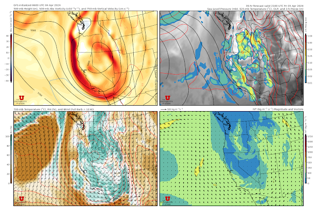
The weekend though will be colder. Much colder. The change happens on Friday with the arrival of a deep closed low and cold front. The latter looks to sweep across Utah during the day, putting is in cold, southwesterly flow tomorrow afternoon. You read that right: cold, southwesterly flow. This is a trough that digs southward along the California coast, bringing cold air with it. As a result, as seen in the GFS forecast below, the cold air initially moves into Utah with southerly and southwesterly flow at 700-mb (crest level) tomorrow.
It takes a while, but we eventually see cold westerly and northwesterly flow once the trough has moved downstream late Saturday.
For Alta-Collins, the GFS has two major periods of precipitation, one during the day tomorrow roughly with the frontal passage, and then during the day Saturday and Saturday night with and in the wake of the upper-level trough. There are a few dribs and drabs between those two storm periods.


No comments:
Post a Comment