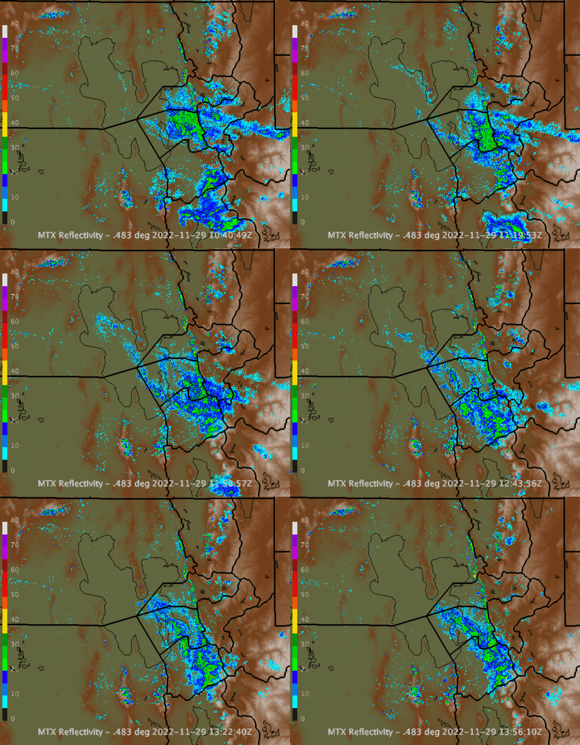
Things came together nicely yesterday and continue this morning in the form of lake effect to give us a pretty good storm for the central Wasatch. The Utah Avalanche Center reports totals in the central Wasatch of 10-15" of cold smoke (5-6% water content) through 5 am. Through 6 am, the Alta-Collins automated snow-depth sensor has recorded 14", Canyons-Daybreak 15", and Deer Valley-Ontario 10". To the north, Snowbasin-Boardwalk is clicking in with 11". Perhaps Mountain Dell has gotten enough that with some effort the Nordic track can be set. I'm always amazed at what the groomers can do there.
At around 11 UTC (4 AM MST), precipitation features began to form over the Great Salt Lake (apologies for the old lake outline in the loop below) and began to train off into the north Salt Lake/east Salt Lake Valley area. The lake effect continues through the end of this loop at 1356 UTC (0656 AM MST).
My expectation is that these lake-effect snow showers will eventually taper off this morning.
Another storm for Thursday night/Friday. Consider yourselves blessed.


Wanted to donate today for giving tuesday but no easy route to facitate that. Looks like the AFC will get the $..
ReplyDelete