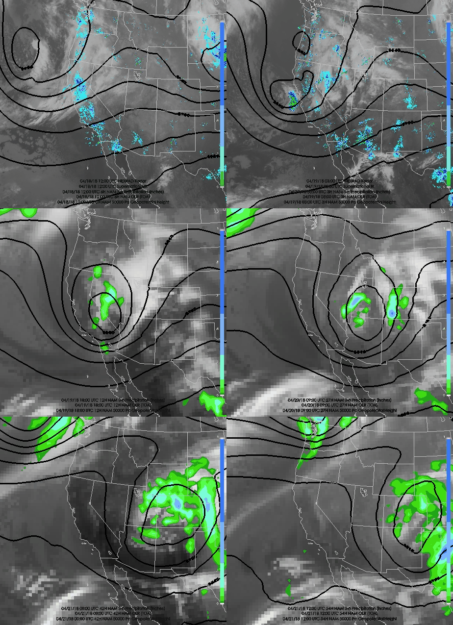
Interesting forecast situation through Friday night as a closed upper-level low, which rumbles like a bowling ball across the American southwest, moves along the Utah–Arizona border.
If you look at the 3-h NAM precipitation forecasts above (color fill) you can see that northern Utah misses out on the action initially, but does get some after the low enters Colorado thanks to so-called wrap-around precipitation. In the NAM forecast above, that precipitation primarily affects northeast Utah, especially the Uinta Mountains. The Wasatch are at the edge of the action and in fact Alta gets no precipitation from the forecast above (but it is right on the edge of it).
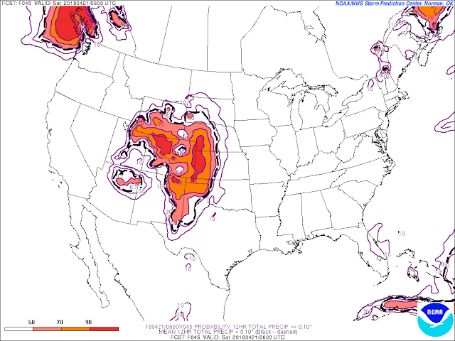
The strong contrast in precipitation probability from west to east across northern Utah is better illustrated by the probability of more than 0.10 inches of precipitation during the 12-hour period ending at 0600 UTC 21 April (0000 MDT Saturday) based on forecasts by the Short Range Ensemble Forecast System (SREF). Note the sharp gradient from about Antelope Island to the western Uintas.
Indeed, if we downscale those SREF runs to account for local terrain effects, we see large spread at Alta, with members producing anywhere from 0 to 0.7 inches of water. This would fall mostly as wet snow above 8000 feet, with snow levels possibly flirting with 8500-9000 feet Friday night should precipitation linger.
My take is that thisI is that we may see a few snow showers Friday and Friday night, but accumulations will likely be 1-4 inches. A skunking is perhaps more likely than a surprise dump. The latter would require the wrap around to extend further westward than indicated by most of the models I'm looking at this morning.
After Friday night, the forecast for the weekend looks warm and pleasant. If we do get a decent dump Friday or Friday night, it will turn to mank quickly on Saturday if it isn't already mank at sunrise.


No comments:
Post a Comment