
Really, conditions overnight were only marginally better for orographic precipitation generation than they were yesterday. The 0000 UTC (5 PM MST Saturday) sounding still showed stable conditions at mid level with strong wind shear from 700 to 600 mb.

The morning sounding is a bit better with northerly flow through depths and colder temperatures aloft, although a weak stable layer remained just above 700 mb.

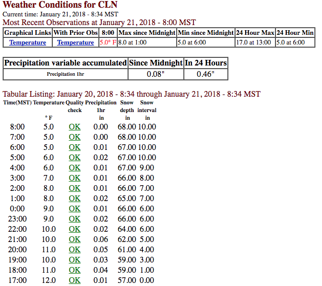
But the secret to the overnight dumpage wasn't large orographic precipitation enhancement. There was some enhancement, but .32" of total water and a maximum water equivalent rate of 0.05" per hour isn't much. The secret was the huge snow-to-liquid ratio. If the snow-to-liquid ratio for this storm was Alta's average of 13-to-1, the snowfall would have been 4 inches. But at 31-to-1 you get 10 inches and the stuff that Kodak moments are made of. Yup, this was a snowfall that will bring smiles to skiers, but continue to give water managers, who need to see higher water content dumpages, heartburn.
No comments:
Post a Comment