Monday, June 30, 2014

Forty Years of Progress in the Atmospheric Sciences

Source: National Geographic, April 1972
Recently, one of my former graduate students came up on a 1972 National Geographic Article by Walter Orr Roberts, then President of the University Corporation for Atmospheric Research (UCAR) in Boulder, CO.  UCAR is a consortium of universities (including the University of Utah) focused on research and training in the atmospheric sciences, and manages the National Center for Atmospheric Research.

I always enjoy articles like these not only because they show the tremendous accomplishments of my profession, but also some of the areas where we were overly optimistic.  Some highlights from the article:

  • At the time, there was considerable optimism concerning likely improvements in weather forecasting, and I think it is safe to say that has come to fruition, although we still have work to do.   
  • Satellite imagery was still in it's embryonic stages in 1972, with considerable excitement about future prospects, "Some of the new devices will even measure water vapor at different heights, and others may report on the total levels of such pollutants as dust, carbon dioxide, nitrous oxide, and sulfur dioxide."  This has come to pass and satellites are now doing all sorts of things including tracking changes in the mass of the Greenland and Antarctic ice sheets [FYI that NASA's Orbiting Carbon Observatory (OCO-2) is scheduled for launch tomorrow].  
  • Efforts were underway to advance understanding of global weather processes, but it was noted that future progress hinged on: (1) the development of "electronic computers that efficientialy perform hundreds of millions of mathematical operations per second", (2) the development of mathematical models of the processes that generate our weather, and (3) the development of a truly global network of weather stations.  We have made considerable progress in all three of these areas, if you include satellite data as a subset of (3). 
  • For global observations, it was argued that Ghost balloons (global horizontal sounding techniques) might be useful for proving more observations around the globe, but this has never come to pass, although the idea in some way shape or form is occasionally "floated" again from time to time.  
  • At the time, there was considerable optimism regarding cloud seeding.  Although such seeding is still done in parts of the western U.S. today, its effectiveness remains unclear.
  • One area where the article was clearly off the mark was in the area of future climate change, where it suggested that cooling might be in our future.  Roberts emphasized the findings from a recent paper by Rasool and Schneider (1971) that overestimated the cooling influence of pollution and was quickly shown to suffer from flaws in equations and data.     
If you are interested in a blast from the past, you can have a look for yourself by clicking here

Saturday, June 28, 2014

Lightning and Topography

Given that this is lightning week, it seems quite appropriate that a paper examining the influence of topography on lightning strikes came out this week in Monthly Weather Review (Vogt and Hodanish 2014; paywalled, but I'll hit the highlights).

Specifically, they used data from the North American Lightning Detection Network (NLDN) operated by Vaisala to document the characteristics of 12.5 million cloud-to-ground lightning strikes over Colorado from 2003–12.  The topographic map below highlights some of the key topographic features that influence lightning strikes within the state.
Source: Vogt and Hodanish (2014)
The map below shows the stroke density during the warm season (1 April to 31 October).  One can clearly see the influence of elevation, but also some important geographic effects.  Stroke densities are highest in the high terrain encompassing Pikes Peak, the southern Front Range, and along the Palmer Divide east of east of Pikes Peak.  High densities are also found in the high terrain near the southern Sangre de Cristos and along Raton Mesa.  Low densities are found in the San Luis Valley, as well as lower elevations regions along the Gunnison and Uncompahgre Rivers near and southeast of Grand Junction (not shown in the above map), far northwest Colorado, and along the I-25 corridor in northern Colorado. One can clearly see the influence of local terrain throughout the western half of the state, but with this color scale it is especially apparent in the San Juan Mountains.

The influence of elevation and topography is summarized nicely in the graph below, which shows the stroke density as a function of elevation. There is a peak at 5500–6000 ft that reflects the high stroke density of the Palmer Divide and Raton Mesa (point D), a minimum at 7500–8000 ft that reflects the low stroke density of the San Luis Valley (point D), and then a very clear increase above 10,500 feet reflecting the increasing stroke density in the high mountains of the state.
Source: Vogt and Hodanish (2014)
Now is a good time to mention that low stroke density doesn't mean no stroke density. Climatological stroke densities may be lower along the northern I-25 corridor than in the Front Range to the west, but you wouldn't catch me golfing or mowing the lawn there if there was a storm nearby.  Ditto in the San Luis Valley and other broad lowland regions.  If you are in the mountains, you can minimize risk by moving to lower elevations, but if you can, it's still best to seek shelter in an enclosed building or hard-topped vehicle.  If you are car camping in a valley and you hear thunder, best to be in the car than your tent.

It would be great to see a product like this produced for Utah.  For you atmospheric sciences undergraduates out there, producing such a map would make a great senior capstone project.

Friday, June 27, 2014

Problems with the "Law of Averages"

The month of June has been quite interesting with regards to weather variability.  Temperatures were near or above average for two stretches, one through June 13, the other from June 20 to 25.  However, the statistics from the month are also influenced by two pattern shifts, one mid-month that really dropped our temperatures (surely you remember that great rain/mountain snow storm on June 17), and the one we are enjoying today (its great to wear a sweater in late June!).

Source: NWS
In the net, we're running less than a half degree below average.  Basically, the month has produced an average temperature very near the long-term (30 year) average for June.

This tendency for weather (and other) events to even out over time is sometimes called the Law of Averages.  June has worked out nicely in this regards, but of course that's not always the case.  Large-scale circulation features can sometimes lock you into a pattern that is unusually cold or warm.  Ditto for precipitation.  For the Law of Averages to work, one typically needs a fairly long sample size.

However, we have a problem when it comes to weather: climate change.  The statistics of weather are changing.  The National Climatic Data Center now updates their "climate normals" every 10 years so that they better reflect more recent climatic conditions.  For instance, the "normals" you see on the news each night are currently averages for 1981–2010.  If you go back a few years, they would have been for 1971–2000.  Sometime after 2020, they will be updated using data for 1991–2020.  So, when you hear a day was near normal on the news, that really means near average for 1981–2010.

So, over short time periods, the Law of Averages often doesn't work well due to the small sample size.  Over long time periods, it will also prove problematic as the climate warms during the 20th century.
  In some parts of the world, it can also be a problem at intermediate time periods of say a decade.  For example, the law of averages hasn't helped much with the Southwest drought over about the past decade.  Sometimes things simply don't average out, at least in a timely fashion as one might hope.

Thursday, June 26, 2014

Lightning Safety

Being that this is Lightning Awareness Week, and that we have a good chance of thunderstorms today, the time is ripe to do a post on lightning safety.

The national statistics of lightning fatalities are both sobering and revealing:
  • 261 deaths by lightning strikes from 2006–2013
  • A breakdown by activity includes 30 fishing, 16 camping, 14 boating, 14 ranching/farming, 13 beach, 12 soccer, 12 yardwork, and 8 golfing. 
  • Males accounted for 81% of the fatalities and more than 90% of the deaths in fishing and sports categories.
In Utah, there have been 65 lightning fatalities since 1950, more than any other thunderstorm-related hazard.  Others have survived, but have suffered debilitating injuries.  

In many ways, lightning safety is similar to avalanche safety.  Education and awareness help, but one ultimately needs to recognize the risk and take appropriate action.  Monitor the forecast and keep an eye on the sky.  If a storm is approaching or you can hear thunder, move to a completely enclosed building (picnic shelters are not good enough) or a hard-topped automobile.  If you are recreating, get off the water, get below timberline, find the lowest spot possible, etc.  One note of caution: the lowest spot possible could expose you to a flash flood, so do the best you can to minimize the risk.  

Peer pressure and other factors can be hard to overcome in many circumstances.  I've attended little league soccer and baseball games where there was a rumble or two of thunder and the inertia to keep the game going was very high.  In these instances, everyone should be moving to hard-topped vehicles until the threat has passed.  Ditto if you are at an outdoor concert or event (see Gratz and Noble 2006 for some sobering reading, although I suspect that the awareness of stadium and venue managers has improved some in recent years).  

Source: Bulletin of the American Meteorological Society
I know from personal experience that in practice lightning safety is often challenging.  Nobody likes to crawl out of their tent and move to their car at 2 am.  Further, many Utah storms only produce a few bolts of lightning, so adjusting plans for a rumble here or there is difficult.  In these instances, resist the temptation to push it (especially you males out there) and move indoors or into a hard-topped vehicle.

Wednesday, June 25, 2014

New Eye Candy for Wasatch Storm Lovers

A great new web cam has been installed at the Neil Armstrong Academy that has a great view of the central Wasatch.  Here's a couple of hours of animation from this afternoon.

I'm pretty excited about this development as we will finally have high resolution (time and space) resolution movies for examining the development of clouds and precipitation in the central Wasatch.  Essentially, there will be no reason to work on storm days next winter!

Tuesday, June 24, 2014

Nearing the End

Source: MesoWest
The snow depth at Alta-Collins is sitting at about 17 inches and will reach zero in about a week.  As we have discussed previously (see The Insidious Loss of Snow during the Past Month), the snowmelt this year was remarkably steady and persistent, although Mother Nature finally did throw a late storm at us last week (you can't miss it in the graph above), which probably extended the duration of the snow cover season at this site by 2 or 3 days.

A week from today is July 1, so that would be a nice psych point.

Monday, June 23, 2014

Snowstorm Carnage

Last week's snowstorm left an impression on the forests and fauna of the Wasatch. The beaten-down foliage gave Butler Fork a jungle like feel over the weekend.  Fortunately, we found no snakes or gorillas.


Some of the aspens took a beating.


What a shame, although perhaps this creates a few more openings to take advantage of next ski season.

Saturday, June 21, 2014

Virtual Parking Passes: Opportunities for a Sustainable Future

The U is getting rid of the old-fashioned hangtag permit
system, but will it seize opportunities to reduce car commuting?
The University of Utah will be moving to a virtual parking pass system for the Fall semester.  This is great news because it opens up a world of opportunities for reducing car trips to campus, including during poor air quality periods.

With the new system, your license plate serves as your permit.  Such an approach will certainly be more convenient, although commuter services also claims that amongst the benefits of doing this is a savings of 650 pounds of paper and 450 pounds of plastic.


That's nice, but there are more significant opportunities.  As we have discussed previously (see Setback for Sustainability at the U), the U essentially has "all or nothing" parking permits.  You pay $348/year (~$1.50/day assuming 230 work days) for an A "permit" if you are faculty or staff.  Students can get similar permits to park in E or U spaces.  Although U faculty, staff, and students get a free pass to ride transit, once someone has purchased a parking pass, there is no financial incentive other than the cost of gas to encourage people to take transit.

With a virtual system, however, commuter services could do the following:
  • Create a system where instead of purchasing an annual permit, you pay by the day (say $2/day).  Every time they scan your plate, your credit card is charged.  You just sign up at the beginning of the semester.  This incentivizes multimode commuting to campus.  Such a system has worked at other universities.  
  • Add a surcharge for parking on campus on yellow or red burn days.  On these days, if you park on campus, it costs an extra $2.  Exceptions could be made for low or no tail-pipe emission vehicles and individuals who need to drive for medical reasons.  Perhaps something could be done for carpoolers, but that might be more difficult to enforce, although carpooling would be partly incentivized since it would be cheaper to park one car on campus than two or three.
The U talks a good game about sustainability, but we need to move away from minor improvements such as saving 650 pounds of paper a year.  In terms of our local environment and quality of life, pollution is probably everyone's biggest concern and vehicles are a major source of that pollution.  Let's pursue opportunities and policies that can make a more significant difference.

Wednesday, June 18, 2014

Graph of the Day

Source: NWS
Yesterday's high at the Salt Lake City airport of 53ºF was lower than the average minimum for the day (57ºF).  The resulting graph of the observed daily temperature range each calendar day this month (blue bars above) shows how the bottom fell out.

Pity we can't store this cool air somewhere.  Next week we'll be wishing we could tap into it.

Tuesday, June 17, 2014

Aftermath

The post-frontal pot o' gold is at the mouth of Big Cottonwood Canyon.
Rocky Mountain Power, please bury your power lines!
Quite an event.  If only we could get a storm that exceeds expectations during the winter!  Maybe this is a positive sign for next ski season.

Check out these numbers from Alta-Collins.  Looks like it was cold enough for precipitation to fall as snow beginnin at 9 or 10 am.  The automated snow-depth sensor is a big squirrelly, but if we go with 27" as the pre-storm depth and 39" as the current depth, that gives us a storm total 12" (ignore the interval stake which doesn't operate in the off season).  It might be a bit less or a bit more, but we'll call it a cool foot for a deep powder day tomorrow.

Source: MesoWest

Afternoon Storm Update

It has been a very interesting storm thus far.  A very nice frontal precipitation band developed over northern Utah with a roughly 50-mile wid band extending from the West Desert across the northern and central Wasatch Front over the past hour or two.


At Snowbasin, there's a nice contrast in weather between the base and the Needles Lodge where it looks like an inch or two may have accumulated.

Source: snowbasin.com
Snow is falling from base to summit at Snowbird, although I suspect that accumulations thus far are still under an inch since the meat of the band has remained just to the north.


Source: snowbird.com
The frontal precipitation band should move very slowly southeastward across the Salt Lake Valley and the central Wasatch Mountains over the next few hours.  Looks good for a few inches in the upper Cottonwoods.  The next few hours look to be wet in the Salt Lake Valley.  The weather for the Red Butte concert tonight looks pretty iffy for the 7 PM start.  Concert goers should hope the back edge slides through and things taper off during the show.  I'd be prepared for a cold rain and even the possibility of a thunderstorm. 

Memories of a Big June Storm

Sixteen years ago this month, my son Erik was born.  Sixteen years ago today, Alta was pounded by a mid-June snowstorm.  I remember it well because I went to Alta and retrieved some of the fresh sow to bring home for a proper powder baptism the following day.  It was a stormy scene at Alta that day and, although I didn't make turns, I jealously looked up the mountain at others who were getting face shots.

On that day, the weather was dominated by a deeper, colder trough than today that moved directly through Utah.
Source: NOAA/ESRL
700-mb temperatures reached -4ºC.

Source: ESRL
So today's weather is a big shift from what we've had the past few weeks, but we've seen deeper, colder troughs in mid June.  No need to declare an end to global warming.  

Nevertheless, it looks like we'll get some mountain snow at upper-elevations today.  Travel over high-elevation roads like the Mirror Lake Highway might be quite difficult.  For Alta, I'm sticking with my forecast of a couple to a few inches.  For a bigger dump, we'll need the frontal precipitation region expected to intensify over northern Utah this afternoon to setup over the central Wasatch and be quite productive.  We'll see how things play out.  

Monday, June 16, 2014

Wax the Skis?

The models were hinting at a cool trough to move into Utah early this week when I last looked at things a few days ago, but it is now forecast to come in with some shiver my timbers weather.

It's snowing this morning at Paradise Ranger Station (~5400 ft) on Mt. Rainier (for some discussion, see the Cliff Mass blog).


That airmass is on its way to Utah, although it will modify and warm a bit before it gets here.  Nevertheless, it's going to get cold and by noon tomorrow we're below 0ºC at 700 mb with some snow at upper elevations in the mountains.


700-mb temperatures eventually drop to -3ºC or -5.5ºC on Tuesday night, depending on the model.  For June, a -3ºC 700-mb temperature is about 2 standard deviations below the mean.  In everyday lingo, that means it's somewhat cold for this time of year, but not exceptionally cold.  
Climatology of 700-mb temperatures by month in northern Utah.  Source: NWS
In northern Utah, we see an airmass like this in June about every 2–5 years.  By July, they are virtually unheard of.

The time series below is extracted from the NAM model, which is one of the colder models.  Temperatures on Mt. Baldy (11,000 ft) drop just below 20ºF, with about .32" of snow water equivalent yielding just over two and a half inches of snow.


Right now things look a bit to dry in the post-frontal environment to do much better than a couple to few inches, but hey, you never know.  Those with a passion can look at the photo below and scout out their routes for a Wednesday dawn patrol.

Source: alta.com

Thursday, June 12, 2014

The Fire Season Is Upon Us

The most recent National Interagency Fire Center wildland fire outlook projects that Utah will have a "normal" wildland fire potential this summer.  Although that sounds good, a normal wildland fire season in Utah is still one with a significant threat of major fires.  As I see it, there's no such thing as a good fire season in Utah and this year certainly has the potential to be problematic.

Drought conditions for most of the state range from abnormally dry to severe (exceptions include the Bear River Range and a few other locations in extreme northern Utah that saw considerable midwinter snowfall).  Although other portions of the southwest have even more extreme drought conditions, we're still running dry.
Source: http://droughtmonitor.unl.edu/

The drought in the southwest and most of Utah reflects both long-term conditions (e.g., the dry winter, especially in California and Utah) and short-term conditions.  During the past 3 months, nearly the entire western U.S. has seen below average precipitation.

Source: http://water.weather.gov
In Utah, nearly the entire state has seen below average precipitation during the past 3 months, and much of the state saw 75% or less of average (scale for the image below same as above).

Source: http://water.weather.gov
The irony in that map is that we probably got just enough precipitation at just the right times to allow for a heathly wildland grass crop, which is now drying out as we head deeper into June.  In the Salt Lake Valley, we haven't had measurable rain since May 24th and the last major dousing was on May 9th when the airport recorded 0.45 inches.  Although we may see some thunderstorms today, it is very dry in the low levels and we probably won't see much precipitation reaching the ground.  

Looking at the medium range model forecasts, I don't see much hope of a significant precipitation event.  Thus, it looks like we will be quite dry and vulnerable as we head into late June and the 4th of July holiday approaches.  Let the insanity begin. 

Wednesday, June 11, 2014

Savor This Weekend's Cool Airmass

The dog days of summer are almost upon us.  In my view, July is a four letter word in Utah.  Too hot for my blood.

Now that we're in the heart of June, it is essential to savor every cool airmass that slides into the state as you never know which one will be the last before the relentless monotony and heat of July is upon us.  It looks like we will have one visiting this weekend.  The models (both the GFS and the ECMWF) are pulling in cooler air late Friday and Friday night, dropping 700-mb temperatures to 0ºC by Saturday morning.

 
The impact of this cold-air intrusion will likely be a high on Saturday in the low 70s.  The last time we saw a high temperature below 75ºF was May 24th, so what a heavenly change it will be.

Monday, June 9, 2014

The Insidious Loss of Snow during the Past Month

Albion Basin and Greeley Hill, 8 June 2014
Loss of snowpack in May and June is pretty much the way things work in Utah, but this year, the decline has been remarkably steady and consistent.

On May 11th, the snow depth at Alta-Collins sat very near its maximum for the year at just under 120 inches.  At that time, the snowpack was fairly consolidated and ripened, meaning it has warmed to 0ºC throughout its depth, so additional energy input from above freezing temperatures and solar radiation would result in snowmelt.  

Source: MesoWest
Indeed, it was just a couple of days later that temperatures popped up to near or above average and, despite some ups and downs, they have stayed there for nearly a full month.  

Source: NWS
Indeed, since May 15, there hasn't been a single day at Alta with a below average maximum temperature and only one day with a below average minimum temperature (and that was only by a degree).  We've also had little in the way of cloud cover during this period, and most of the energy that melts snow comes from the sun.  Basically, if you want to melt snow in Utah, it's best to have above average temperatures, lots of sunny days, and dirty, dusty snow.  We have all in spades this year.  

This has led to a non-stop decline in snow depth at Alta–Collins.  If you look carefully at the graphs above, you can also see that the rate of snow depth decline increased around May 25th, which is also when there was somewhat of a step up in the temperatures (especially the maximum temperatures).  Since that day, we've been losing about 2.8 inches of snow a day.

On May 19th, I guestimated Alta-Collins would lose all its snow around June 27th.  That's still looking like a decent guess, although the current melt rate would bring an end to snow cover at that location at around June 25th.  

Sunday, June 8, 2014

The Last Run

Final turns of the 2013-14 ski season
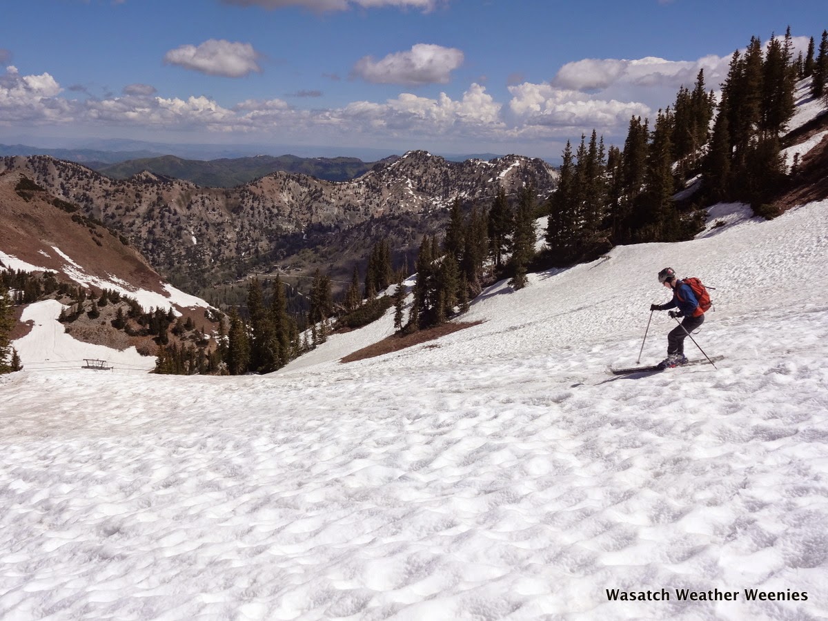
With a trough dropping temperatures just a bit and the hopes of getting one last day of continuous skiing to the car, my son and I hit Alta today for what I'm sure will be our last turns of the year.

As suggested by the photo below, we probably could have pieced together a continuous non-stop run to very near the base on the Collins side.


However, Alta was asking people not to park on the Collins lot.  It was Sunday, and we figured it couldn't hurt if we did, but being good neighbors we elected to go from Albion instead.

That was painful.  It's remarkable how much snow has melted in the past seven days.  My son was here on Monday and said skiing to the car wouldn't have been a problem.  Today, one had to skip from snow patch to snow patch in the lowest couple hundred vert.


Conditions improved above 9000 feet.  Things looked pretty grim up in the Supreme area (except perhaps Catharines), so we went up to Sugarloaf Pass.  It was a gorgeous day to be on skis and, with temperatures in the 40s, pretty comfortable.


It was really cool to start skiing in a winterscape, but look down at a summery scene in Albion Basin.


Conditions featured everything from bone rattling suncups (near the top, see above photo) to decent corn to snirty sandpaper.  We squeezed out what we could.


That's it for me.  I'm done until the powder starts to fly in the fall.

Friday, June 6, 2014

The D-Day Weather Forecast

Assault troops approach Omaha Beach, D-Day, June 6, 1944.
Source: National Archives and Records Administration.
Know the enemy, know yourself; your victory will never be endangered. Know the ground, know the weather; your victory will then be total. - Sun Tzu, The Art of War, c.400-320 b.c.

Today marks the 70th Anniversary of D-Day.  Perhaps the most important weather forecasts ever issued were for the invasion, which required a full moon, clear skies, light winds, and low tides.  The window of opportunity was small and there were no second chances.  Think about the technology at the time.  Numerical weather prediction wasn't yet invented.  There was no Internet (gasp!).  No satellite imagery.  No weather radar.  Few upper-air observations.  No computers to plot data.  Three groups on the Allied side provided forecasts, with Norwegian Sverre Petterssen playing a vital role in the successful forecast.  Nevertheless, as is often the case with history, there is disagreement amongst the participants concerning the actual events and contributions.

James Flemming, a professor of science, technology, and society at Colby College provides a brief summary in his paper, Sverre Petterssen, the Bergen School, and the Forecasts for D-Day.  It's a quick read for history and weather buffs.

Another option is Sverre Petterssen's book, Weathering the Storm: Sverre Petterssen, the D-Day Forecast, and the Rise of Modern Meteorology.


Finally, thanks to a post at the Capital Weather Gang, I just learned about another perspective from John Ross, The Forecast for D-day: And the Weatherman behind Ike's Greatest Gamble.


Personally, I'm partial to Petterssen's account, but only because he was a skier :-).

Thursday, June 5, 2014

Why This Is Not a Rainbow

Yesterday's spectacular display is an example of a halo, not a rainbow
Yesterday's spectacular display of colors in the noontime sky caught the attention of many people in the Salt Lake Valley and was widely covered by the media.  Upon further reflection, I'm thinking this was a classic circumhorizontal arc rather than an infralateral arc.  In either case, the phenomenon is an example of a halo and not a rainbow, despite the rainbow-like color spectrum.

Rainbows are produced by the interaction of visible light with water droplets, typically rain drops, although it's fairly easy to make a rainbow using the mist a garden hose if the sun is behind you.  As the light moves through these droplets, it is bent and reflected in a way that yields the classic red-to-violet color spectrum.

Halos are produced by the interaction of visible light with ice crystals.  In the photo above, the fibrous nature of the cloud that contains the halo is an indication it is comprised of ice crystals.  In contrast, clouds that are comprised primarily of water droplets usually have a smoother, harder appearance, as is the case for the alto-stratus cloud further to the left (east) in the photo.  Typically the cloud needs to be thin to produce a halo, as is the case above.  In addition, the ice crystals must have smooth faces – which means they are usually hexagonal plates, hexagonal prisms, or needles (click here for further discussion).  

Wednesday, June 4, 2014

A Gorgeous Summertime Halo!

There was beautiful halo with rainbow colors sitting over the University of Utah campus at noon today.


I believe this is either a circumhorizon arc or an infralateral arc, which form only when the sun is high in the sky (higher than 58º).  As a result, these types of arcs form only near noon from about April to early September at our latitude.  In this instance, I suspect it was an infralateral arc because it curved up slightly from the horizon.  More info at Atmospheric Optics.

Like Park City in July

The weather in the Salt Lake Valley is incredible right now.  Yesterday's high and this morning's low were 85ºF and 56ºF, respectively.  I even felt a little chill when I went out on my morning run.  In addition, here's the National Weather Service forecast through the weekend:


It doesn't get much nicer than that.  In fact, what Salt Lake City is experiencing right now, including the green, wildflower covered foothills, is pretty much Park City's summer.  In Park City, the average high in July is 84ºF.  The lows there tend to be a little cooler (48ºF in July), but I'll take the mid 50s as forecast the next few days.

So, enjoy the Salt Lake Valley in the coming days as eventually you'll need to escape to Park City to experience weather like this.

Tuesday, June 3, 2014

Reducing Carbon Emissions

A few people have asked me what I think about the Obama/EPA plan to reduce power-plant carbon emissions.

I believe it is essential that society transform to low carbon energy production and it is clear that we have dithered away much time over the past two decades arguing about whether or not climate change is real and caused by humans. However, my training is in the atmospheric sciences, so ultimately my views on the Obama/EPA plan are based on my more shallow understanding (if one exists) of politics, economics, and energy.

The plan seeks to reduce power plant emissions by 30% by 2030, but this is relative to 2005 emissions.  This basically gives everyone a head start since carbon emissions in the United States peaked in the mid 2000s.

Source: http://www.c2es.org/facts-figures/us-emissions/co2, original source EIA (2012).
The graph above is for all sectors, whereas as I understand it, the Obama/EPA plan addresses only power plant emissions.  Since 2005, power plant carbon emissions are down about 13%.  That decline represents a shift from coal to natural gas for energy production (natural gas is more efficient and produces more power per unit of carbon) and a sluggish economy.  Getting the additional 17% will probably involve some increase in renewable energy production and a shift to natural gas.  Of course, that assumes the plan survives political challenges in the coming years.

Ultimately, however, addressing climate change requires not only modest reductions in carbon emissions but technological breakthroughs needed to make fossil fuels obsolete (as soon as possible).  The former represents the low-hanging fruit, whereas the latter is a much more difficult challenge, as discussed in this editorial by Steven Cohen, executive director of the Columbia University Earth Institute.  The US could play a leadership role in this area, and it would facilitate a shift to non-carbon energy sources worldwide.  My concern is that modest reductions through cap-and-trade will not spur the innovation needed to produce the stampede to non-carbon energy sources needed to put the brakes on global warming.