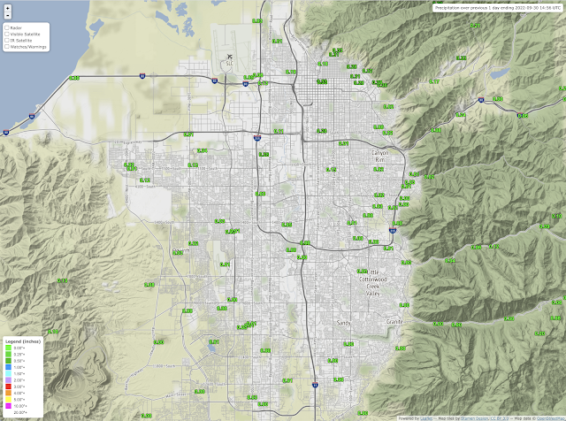
Excuse the gloating, but yesterday's thunderstorms favored for once my are with the Avenues, downtown Salt Lake, and the University of Utah coming in with the highest precipitation totals in the Salt Lake Valley.
Observations for the 24-hour period ending this morning show several sites reporting accumulations of around 0.3 inches.
 |
| Source: MesoWest |
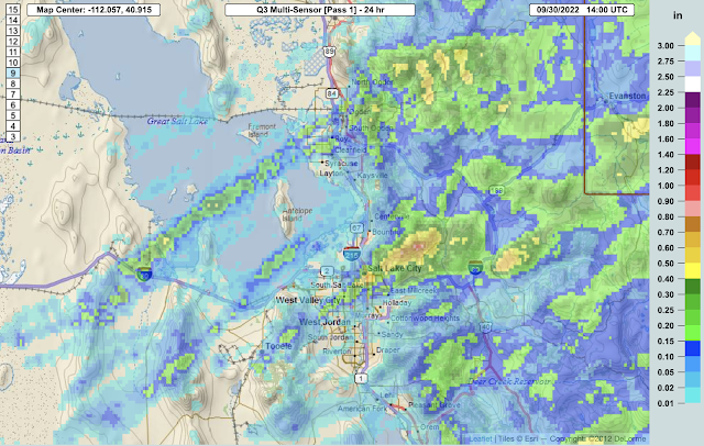
Multisensor precipitation estimates of 24-hour accumulated precipitation show a band of precipitation extending from West Valley City across the Salt Lake Valley and into the Avenues Foothills. This pattern primarily reflects three thunderstorms systems that developed and intensified in the southwesterly flow as they moved across the northern Salt Lake Valley. The heaviest precipitation was actually in the mountains northeast of Salt Lake City.
 |
| Source: https://mrms.nssl.noaa.gov/qvs/product_viewer/ |
The first system moved across the northern Salt Lake Valley from about 4:30 to 5:30 PM MDT, interrupting my mountain bike ride through the avenues foothills. I just barely beat it back to the house. The second moved across the valley from from about 7:30 to 8:30 PM MDT. The third developed over downtown Salt Lake City at around 8:50 PM MDT and moved into the Wasatch Range by around 9:15 PM MDT. As can be seen in the precipitation analysis above, there were a few other cells in other areas that developed and moved northeastward in the southwesterly flow, including one that moved across the Great Salt Lake and affected the Ogden area.
Thanks Mother Nature. My plants appreciate it.

No comments:
Post a Comment