Skiers, snowboarders, and snow lovers have much to be thankful for this Thanksgiving. Twenty-four hour snow totals reported by the ski resorts this Thanksgiving morning include 22" at Powder Mountain, 23" at Snowbasin, 19" at Brighton, 17" at Alta, 15" at Snowbird and Solitude, 7" at Deer Valley, and 4" at Park City. I'm a little surprised the totals on the Wasatch Back aren't higher as the flow has been persistently southerly to southeasterly at upper levels and they did well earlier in the storm. Perhaps the position of the precipitation band was a bit too far west. The snow depth sensor at the Thaynes Canyon SNOTEL is indeed consistent with the totals reported by the resorts, showing an increase from Tuesday to about 21 inches this morning.
 |
| Source: MesoWest |
As I type this, the Utah Avalanche Center has not yet updated their forecast for the Salt Lake Area Mountains, but they did issue a
backcountry avalanche warning this morning at 5:34 AM for the central Wasatch, northern Wasatch, and western Uintas.
 |
| Source: NWS |
Although in effect through 6 AM tomorrow (Friday) morning, I would not be surprised to see it extended through Friday or longer. Stoke is high, but recognize that a combination of old, weak snow, heavy new snow, and wind are creating remarkably dangerous early season avalanche conditions.
There have also been some impressive lowland and mountain valley totals, although most of these reports are old and haven't been updated since yesterday and include 16" at Liberty through 8 PM Wed, 13" at Eden through 6 PM Wed, 13" at Stansbury Park through 10 PM Wed, 12" in Plain City and Pleasant View through 4 PM Wed, and 11" in Magna through 5 PM Wed.
Radar at 0722 MST (1422 UTC) this morning shows that not much has changed from yesterday on the large scale. A north-south oriented band extends through northern Utah and is bringing snowfall to much of the Wasatch front from Salt Lake/Tooele northward.
 |
| Source: NCAR/RAL |
How about a peak at a couple UDOT cams from Bangerter Highway and Legacy Parkway.
 |
| Source: UDOT |
 |
| Source: UDOT |
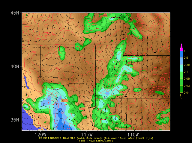
Model forecasts, such as the one from the NAM below, show this band moving slowly eastward today.
I'll be spending my day giving thanks, watching football, and monitoring snow reports. Mountain storm totals will continue to increase today as the band moves across the central Wasatch. For building an early season base, this storm is indeed looking like the game changer we've been hoping for, although it is creating backcountry avalanche problems and will pose challenges for road maintenance and resort operations.


No comments:
Post a Comment