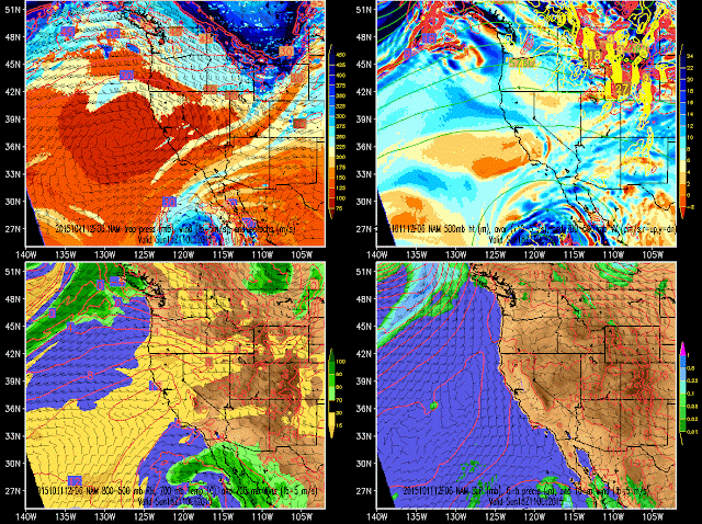
Today's "excitement" involves a trough passage across northern Utah. It's pretty much cloud free, so we need to dig deep to notice the change.
The NAM forecast for this afternoon shows the trough axis at all levels just past Salt Lake City with westerly or northwesterly flow in its wake.
The impact on temperatures is quite pronounced as we've been nearly flatlined late last night and for much of the day today. This is an indication that the transport of cold air into northern Utah, or what meteorologists call cold advection, is nearly perfectly balancing the rise in temperature from solar heating.
 |
| Source: MesoWest |
That's our weather excitement for the weekend. Yes, things are boring, but hopefully Mother Nature is storing it up for November.


Have you guys tracked how dust is stirred up on days of high winds at the Point of the Mountain? I live in Draper and we are fighting Geneva Rock proposal to rezone more ridgelines for gravel mining and wondered if you had anything? Division of Environment quality has no monitoring stations out here and much of the dust is of the PM2.5 and PM10 variety and is Silica (a known carcinogen).
ReplyDeleteWe have not done any work in that area.
Delete