Posts

The Formation of Drizzle and Freezing Drizzle

Image
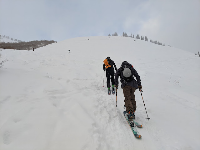
This post is dedicated to everyone who came out to break trail for me today.  So many people turned out.  Your dedication and efforts are greatly appreciated.  I need all the help I can get at my advanced age.   If you happened to be one of those ski tourers in upper Little Cottonwood today, you may have experienced drizzle (below the freezing level) or freezing drizzle (above the freezing level).  Let's take a look at what these are and how they form.   Drizzle is a form of liquid precipitation comprised of small water droplets.  Scientifically, drizzle droplets are larger than 100 nanometers and less than 0.5 mm in diameter.  If the droplets are smaller than 100 nanometers, they are cloud droplets.  If they are more than 0.5 mm they are rain droplets.   Freezing drizzle is drizzle that freezes on impact with the ground or other objects.  It occurs when drizzle forms and collides with the ground or other objects at...
How about Something Different

Image
Mother Nature has been generous so far this year with 50" of snow so far at Alta and the Snowbird SNOTEL station up to a very solid 5" of snowpack water equivalent.  Skiing conditions yesterday were very good.  A few people elected to get out.   Most of the snow we've received so far this season has been produced by slow moving or stalled cold fronts or cold, postfrontal flows.  That will change with our next system.    Below is the GFS forecast valid 1800 UTC 5 November (1200 MDT Saturday).  Strong west-northwesterly upper-level flow extends from the eastern Pacific across the Pacific Northwest to northern Utah (upper left panel).  Strong (by interior western US standards) water vapor transport extends inland across the northern Great Basin into northern Utah (lower right) with moist, westerly flow at crest level (lower left).  700-mb temperatures (lower left) are fairly mild and near -3.5˚C.  Forecast precipitation along a weak su...

Ten-Day Snow Potential

Image
The next ten days have tremendous potential to transform the early season skiing potential in the central Wasatch Mountains.   We've already been blessed with a good October. The Snowbird SNOTEL sits at 3.9" of snowpack water equivalent, which is 390% of median. The warmth of the past few days has caused some snow losses on south and west facing slopes, but has also probably limited depth-hoar formation, which may help us stave off a persistent weak layer (note that I was not in the field yesterday or today so this is not an observation and it does not mean that surface facets, near surface facets, or other weak layers could prove problematic when the snow begins tomorrow).   A best-case scenario now is for the snowpack to deepen, opening more terrain for touring and giving us some additional insurance against depth-hoar formation.   Tomorrow is looking good.  A cold front is expected to stall over northern Utah, giving the central Wasatch a prolonged ...

Opening Day

Image
Yesterday (Saturday) was the opening day for ski season for me with a warm up lap up Collins Gulch at Alta to shake off the rust and see what needs to be fixed or replaced.   There were a few people that had the same idea as me.   And plenty of entertainment to be had.  Look carefully and you can see the 22-degree halo.   One change on the Mt. Baldy skyline is the addition of Wyssen Tower Avalanche Control Systems.   I find their presence on Mt. Baldy unsightly, but understand why Alta is moving to them as they attempt to reduce and sunset the use of the 105 mm Howitzer, which has enormous risks.   If you haven't seen these towers in action, here's a video. I'm not sure if these are UDOT's, Alta's, or some combination of both, but the deployment boxes for the Wyssen Towers and O'bellx pods were sitting in the Wildcat lot just ready to be loaded and then flown in by helicopter.   A lot happens so you can go skiing on a powd...

Pretty Good October But Not All Time

Image
We're off to a good start for October, although conditions are not "All Time."  The Snowbird SNOTEL record begins in 1990, so the discussion below is only of the recent history since then.  The current (October 29) snowpack water equivalent at that site is 3.9" (black line).  That rates as the third highest on that date since 1990, topped only by the 2005 and 2022 water years.  Other water years close to this one are 2011 and 2020.   Source: NRCS "All Time" since 1990 is undoubtably October 2004 (plotted above as the 2005 water year), which had an October 31 snowpack water equivalent of 10.8".  The Halloween lake-effect storm that laid down 2 feet of cold smoke on an already quite healthy early-season snowpack that October created epic backcountry skiing conditions that some of the Wasatch backcountry cognoscenti ultimately rated the best of the year.  Since 1990, October 2004 is undoubtably the gold standard for early season powder skiing.  ...

Lead Time Matters

Image
After a dry spell for the rest of October, a deep upper-level trough is expected to develop along the west coast of the US.  We can be reasonably confident of that, but the details of its amplitude, movement, and accompanying precipitation features are still very murky and uncertain.  As a result, the North American Ensemble Forecast System (NAEFS) plume for Alta Collins is a big mess of spaghetti for November 2nd and 3rd with a range from 0 to 2.4 inches of water and 0 to 40 inches of snow.   If you want good news, about half of the members produce more than 10 inches of snow.  If you want bad news, about half are less than that (through 0000 UTC 4 November).  The various ensemble members have not converged around a favored solution. In a couple of days, perhaps they will.  For example, forecasts for the storm last weekend also exhibited a great deal of spread when the storm was about 5-7 days out.   However, they began to cluster and give i...

Storm Break

Image
The storm yesterday and last night added another 8" of new snow and .65" of water at the Alta-Collins site bringing the total snow depth up to 27." These are solid numbers for late October and I hope to get out and make some turns soon.   Other than maybe a few more flurries this morning, the forecast looks dry for the next few days as we return to more fall-like weather with the storm track to the north.  The NAEFS plumes below are flatlined between last nights storm and November 2nd when a few members begin to show some action.   At that time, the GFS and many other models or ensemble forecast members are advertising a deep trough to develop over the Pacific Coast.   Until then, enjoy the return to fall weather, make a few turns, do some rescue practice, and hope the spigot turns on again in early November.