
Pretty pathetic forecast covering at least the next 10 days or so. Essentially a flatline for mountain and valley precipitation in some models. Shall we start with the ECMWF for a change of pace? Total accumulated precipitation in the central Wasatch a big goose egg over the next ten days, with just a skiff of snow in the western Uintas and Bear River Range.
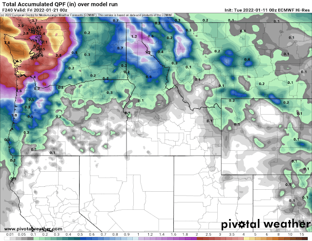 |
| Source: Pivotal Weather |
GFS? How about a tad over a trace for the Wasatch Crest.
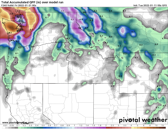 |
| Source: Pivotal Weather |
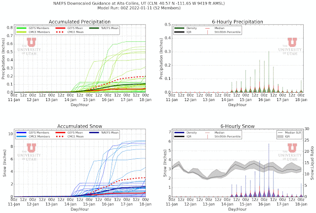
Cutting back to 7 days for our NAEFS ensemble product, there are 7 members (out of 52) that generate 4-9 inches of snow, mainly from a weak trough that rolls over the ridge and affects Utah late Thursday and Friday. The rest of the members are 0-3 inches of snow.
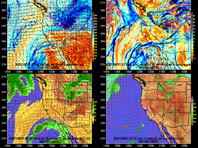
About the only positive is that trough later this week comes close enough to stir up the inversion and mix out the pollution. The GFS forecast below valid 0600 UTC 14 January (11 PM Thursday) shows decently strong northwesterly flow at 700-mb and temperatures that will probably be just cold enough to mix things out.
At least that's something.
Ahhh come on. No need to be negative. You see that southern oscillation bottoming out?! You see the NAO and EPO going negative?! I smell a "Tyson" type walloping for the end of January. Upper cuts, jabs, combos; starting around January 25-26. Feb 1-3, 50-60 hour interlodges. Historic avalanches. YOU SHOULD BE EXCITED!!! Enjoy the rest! Tits about to get CrAzY!!!🎉🎉🎉🎉
ReplyDeleteThis comment has been removed by a blog administrator.
ReplyDelete