
As anticipated in Monday's post, a messy storm has arrived in northern Utah.
Let's start with the big picture. The 6-hour GFS forecast valid at 1200 UTC (5 AM MST) this morning shows high integrated water-vapor transport (IVT) values associated with an atmospheric river curving anticyclonically (clockwise) from near Hawaii over a high-pressure system off the coast of California and across Oregon and Idaho towards Utah.
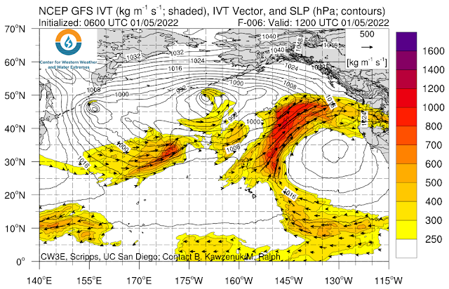 |
| Source: CW3E |
A closeup for the western U.S. shows atmospheric river conditions extending into northern Utah.
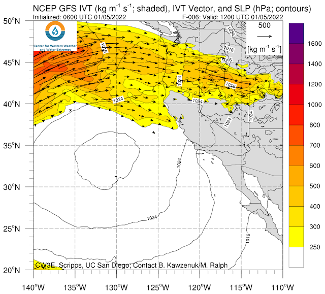 |
| Source: CW3E |
This pathway across Oregon and southern Idaho is one of two key ones for atmospheric river penetration into northern Utah as it minimizes water vapor loses to precipitation over high barriers such as the Sierra Nevada. The other key pathway comes up the lower Colorado River Valley and through western Utah.
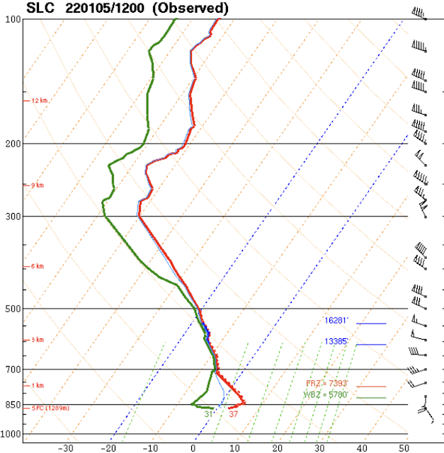
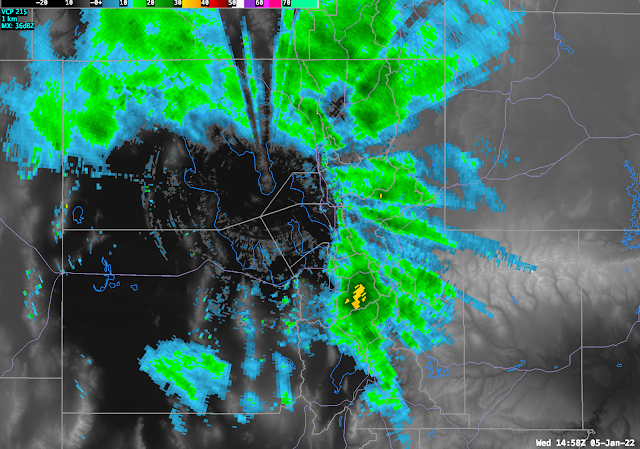
This morning's 1200 UTC (5 AM MST) sounding from the Salt Lake City airport shows saturated conditions near and above 700 mb (about 10,000 feet), but drier air below that level, Thus, moisture transport has come in aloft over the drier air that was resident over the Salt Lake Valley and Great Salt Lake Basin.
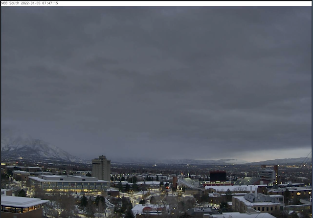
This is consistent with the view looking south from the University of Utah this morning which shows layered clouds based at about 9000 or 10000 feet above sea level. Note also the transition from west (right) to east (left) with the mountains becoming obscured, a tell-tale sign of orographic precipitation enhancement as the flow moves over the mountain barrier.
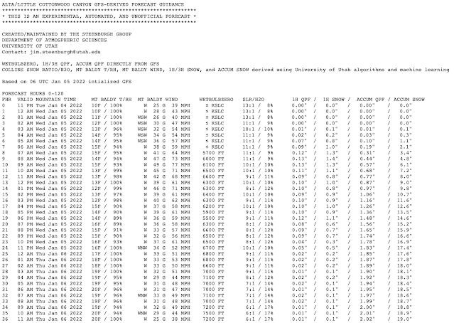
Precip rates look pretty good in the mountains. Alta has had 1.02" SWE in the last five hours, which fell as 6" of snow. That's Cascade Concrete. No complaining though...we need all the water we can get.
ReplyDeleteAlta-Collins at 94 inches and counting... can we make Steenburgh Winter before the end of this storm cycle???
ReplyDeleteThe snow is so dense that we are crawling upward. Hard to say if we will get there by tomorrow. Maybe Saturday. If we don't by then, we're going to have to wait.
DeleteAt least it is a DENSE 94 inches. Well settled and capped by Cascade concrete. I have been thinking of converting Steenburgh winter to something based on snowpack water equivalent, but that might eliminate some of the fun.
Jim
In Ogden Valley, 0.67" overnight (6-8" snow) another 0.3" water today, and you nailed it - rain with occasional snowflakes at 5500 ft. Miserable to shovel . . . . But all snow at resorts. Yay!!
ReplyDeleteGut punch for mountain dell last night, yikes.
ReplyDeletePer Snowbird's tweet, looks like this was a major rime event at higher elevations in LCC
ReplyDeletehttps://twitter.com/Snowbird/status/1479211618093436936