
This isn't exactly breaking news, but change is coming in the form of a cold front this weekend.
Until then, we will have a splendid run of dry, fall weather. Ideal for mountain biking or hiking if you can get out. The situation this morning is characterized by a strong, high-amplitude ridge centered over central Idaho. 
This ridge will weaken during the work week, but we should see mainly sunny weather through at least Thursday. On Friday, there may be a few high clouds, but no biggie.
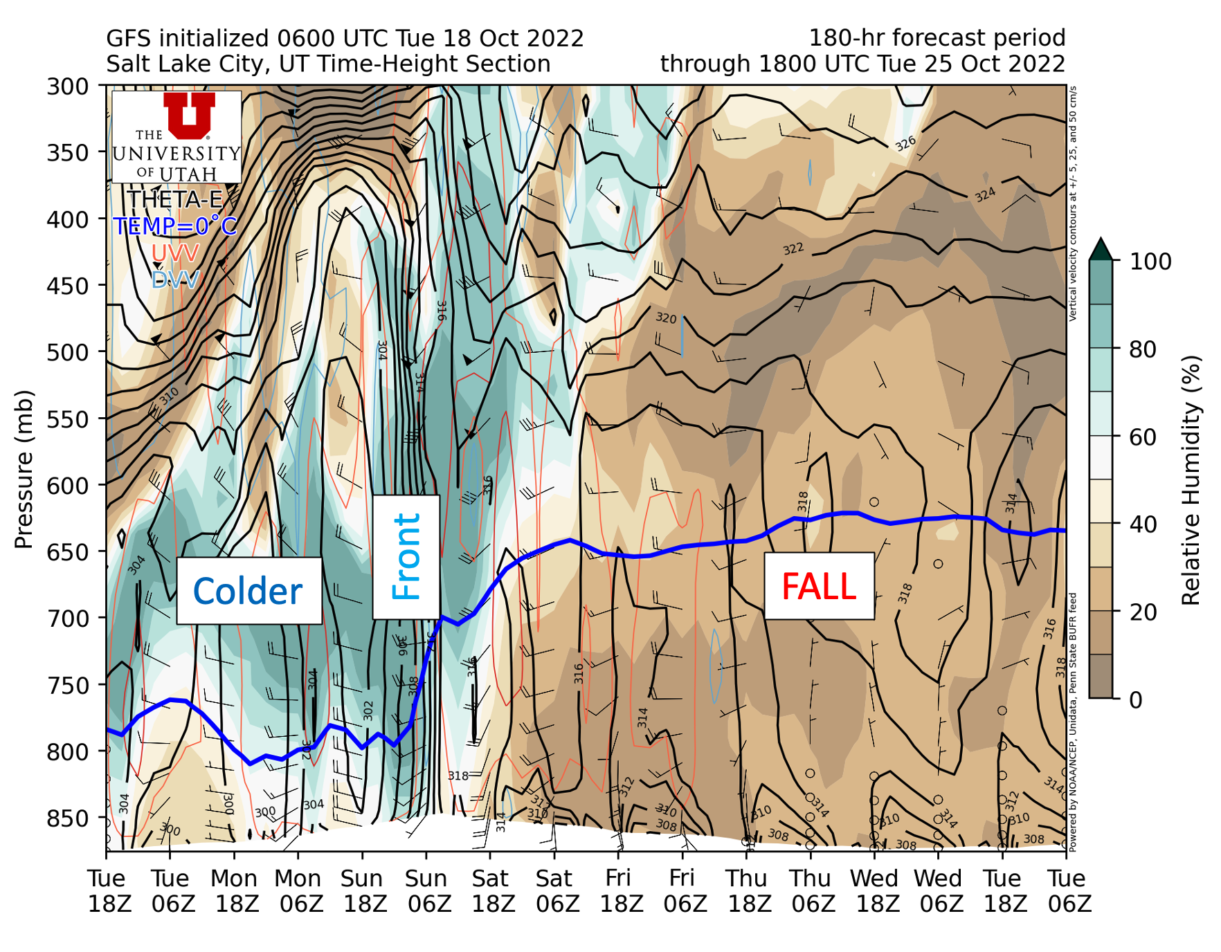
During the weekend, an upper-level trough digs into the western United States. The latest GFS forecast below shows the associated cold front over northern Utah at 0000 UTC 23 October (6 PM MDT Saturday).

The GFS time height section shows very low humidities over Utah and wonderful fall weather through Friday morning (a reminder that time increases to the left in the plot below). Some higher humidity air moves in aloft ahead of the front which may give us some high clouds on Friday. Then the bottom drops out with the cold frontal passage, with freezing levels dropping to about 800 mb (7000 ft) and moist, northwesterly, post-frontal flow moving in.
No comments:
Post a Comment