
Upgrades to products on weather.utah.edu continue. Today I added new hourly and total precipitation graphics for the GFS-13km dataset.
There are actually products available on weather.utah.edu from three GFS datasets. Products under GFS-0.25deg are based on a GFS dataset with quarter degree by quarter degree latitude/longitude grid spacing. Products under GFS-13km are based on a GFS dataset with 13-km grid spacing. Finally, the GFS-Downscaled products are downscaled here at the U to 800-meter grid spacing from the quarter degree GFS dataset.
Confusing? Try being me.
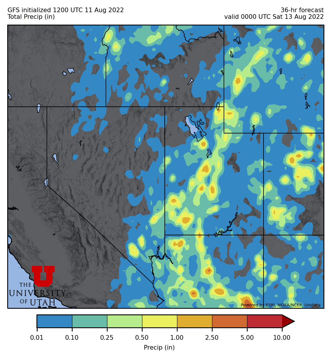
Most people don't bother with the 13-km dataset for a few reasons. Perhaps the main one is that it doesn't include many atmospheric variables, limiting its use for forecasting. I don't know why this is, but it mostly includes land-surface variables. Even precipitation is not provided except as a mean precipitation rate, which to make things complicated has varying intervals depending on the forecast hour. It's not fun to deal with and I have to do a lot of algebraic manipulation of the data to extract hourly and total precipitation. The math is straightforward, but it is easy to make mistakes in code.
However, I personally like using the high-resolution precipitation in these models, although during the monsoon, the GFS precipitation is still fairly unrealistic looking. Below are examples of the GFS-13km hourly precipitation and total precipitation from this morning's GFS run.


I’ve always been confused as to why they would choose to make the grid spaced by a fraction of the lat/Lon grid as in the case of the .25 degree. I suppose here it’s not too big a deal with grid boxes being 3:4 rectangles or so but why would it be advantageous to make grid boxes get more and more rectangular as they go poleward? Intuitively I would expect model performance to degrade when the grid box becomes narrow and long
ReplyDeleteI may be misinterpreting your comment, but the eaual lat-lon grids are are model output grids, not the native model grids. The native model grid has been interpolated to the lat-lon grid. The equal lat-lon grids are convenient for plotting in some cases, although they are inconvenient at the poles where the grid points converge.
DeleteThe native GFS is based on the FV3 dynamical core which is summarized at https://www.gfdl.noaa.gov/fv3/. Most people don't want to deal with such a complex distribution of grid points for plotting.