
Lenny Kravitz doesn't ski. I know because he played the closing day concert at Ischgl Ski Resort in Austria in 2019 and said so. Perhaps he's learned by now. If not, he could think about taking advantage of the return of winter to Utah.
We start with the situation yesterday when spring was full on. Knowing we were going to see cooler temperatures and stubbornly firm snow this weekend, I spent a few hours running laps at Alta. Conditions were about as good as they get for spring skiing with firm but very carve-able groomers at the opening bell and very few people on the hill through the morning, enabling one to ski at maximum warp.

By about 1 PM, things were getting softer and crowds were picking, but by then my foot and ankle had enough. I suspect the skiing was fun in the afternoon, especially on steeper off piste that for the most part was relatively bump free.
This weekend we are trending cooler. It will take a while longer to soften up today and you may need to seek out south or west facing terrain for that to happen. Tomorrow looks like a slap in the face with 700-mb (~10,000 foot) temperatures dropping to about -13˚C tomorrow morning leading to a very hard freeze. I'm not sure there will be much softening on the snow tomorrow. Perhaps on south or southwest aspects, but it will be a struggle.
Then a real spring storm comes in for late Monday into at least Tuesday. Temperatures rebound in southwesterly flow on Monday and by late in the day it appears mountain snow showers will be developing. The GFS forecast for 0000 UTC 12 April (6 PM MDT Monday) shows a strong cold front draped across northern Nevada and southeast Idaho, with the prefrontal showers over the Wasatch and Uintas.

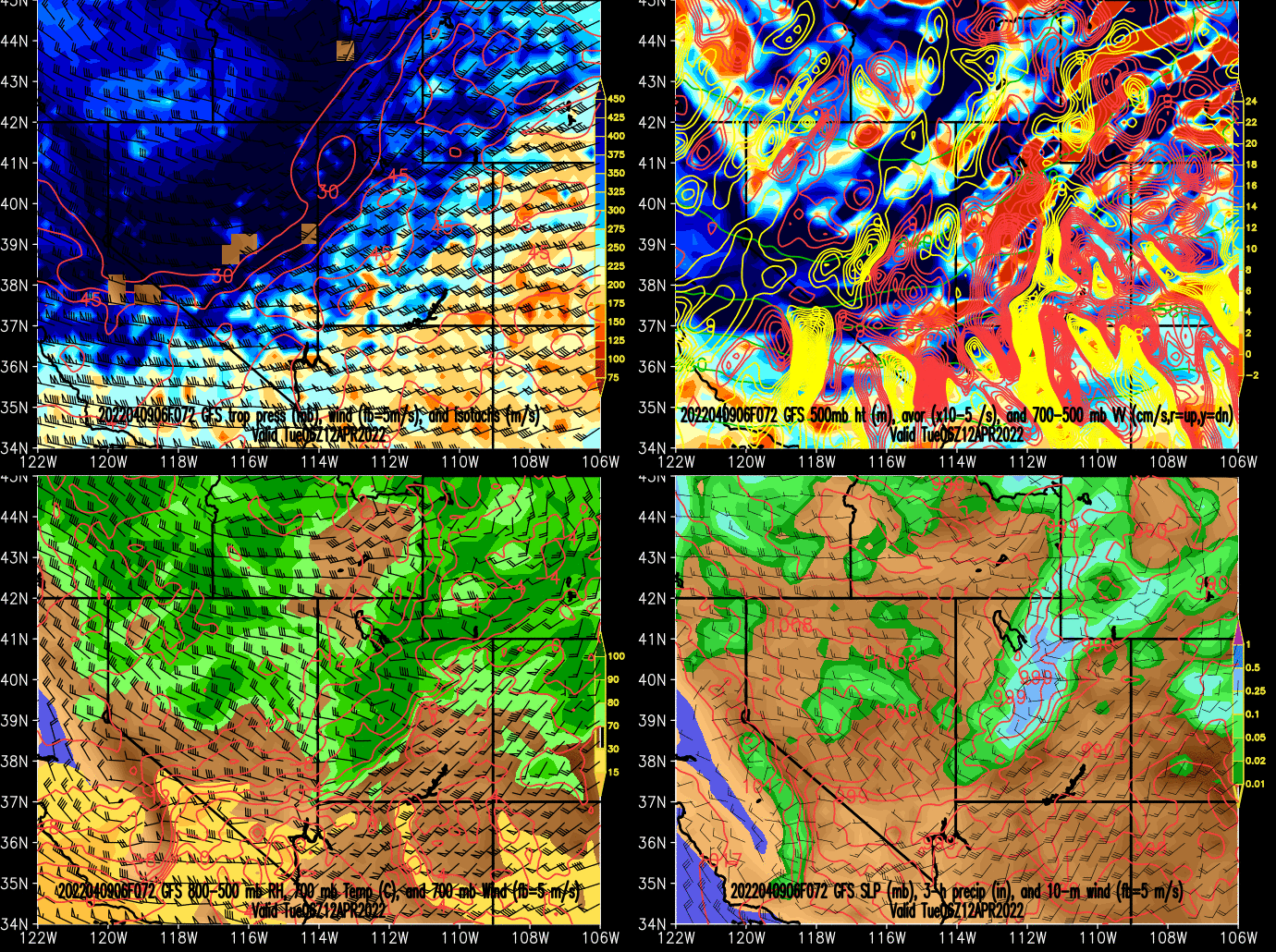
By 0600 UTC 12 April (0000 MDT Tuesday), the GFS is all in for heavy frontal snowfall over the Wasatch Range and has temperatures cold enough for precipitation to be changing to snow on the valley floor.
This is followed by a period with heavy post-frontal mountain snowshowers, and probably some valley snow as well. Below is the GFS forecast for 1800 UTC 12 April (1200 MDT Tuesday).

Our GFS-derived forecast over the next week for upper Little Cottonwood is below. Mt. Baldy (11,000 ft) temperature drop through Sunday morning, bottoming out at 2˚F, recover ahead of the front, and then drop during and following the frontal passage. Heavy snowfall accompanies the front Monday night and continues through Tuesday. Totals by 0800 MDT Tuesday morning are 1.25" inches of water and 15.5" of snow for Alta Collins. By 0000 MDT Wednesday morning, the GFS puts out another 0.32" of water and 6.4" of snow.

The SREF is also pretty excited. A few members produce some light snowshowers later today or tonight. Adjusting for that, the range of forecasts from all 26 members is 8 to 25 inches of snow for Alta Collins for the Monday night/Tuesday period.

By and large, this looks like a pretty good April event. Don't hang up the skis yet. It ain't over 'til it's over.
Addendum 9:21 AM Saturday:
Seeing some photos from this morning suggesting we didn't get much of a freeze up there last night. Perhaps we can maintain spring conditions today. It will be a race between the sun and the transport of colder air into the area as the front is now through.
No comments:
Post a Comment