Saturday, February 28, 2015

Fascinating Micrometeorology in Little Cottonwood Today

My son and I spent the day at Alta today and enjoyed some really great lessons in mountain microclimates.

The crest-level flow today was out of the southeast.  You can see this southeasterly flow in the 1700 UTC (10 AM MST) plot below, which shows southeasterly flow at the top of the Snowbird Tram, Mt. Baldy, and Top of Collins.

Source: Mesowest
As this flow ascended from American Fork Canyon, it formed a pronounced orographic cap cloud over Snowbird and Alta.  The flow then descended into upper Little Cottonwood Canyon, confining the cap cloud to over the upper reaches of Alta and Snowbird.  I have sketched out my guestimate of the flow looking up Little Cottonwood Canyon at about 10 am.  I suspect that the flow is crossing the barrier both within and above the cap cloud, but only the lower level airstream is moist enough to form a cloud.  Warming of the airstream as it descends and compressionally warms over Little Cottonwood Canyon results in the cloud evaporating.


The influence of the orographic cap cloud was readily apparent while skiing in the morning and afternoon.  Prior to about 11 am, snowfall was very limited and one could see the cap cloud hanging over Mt. Baldy and upper Collins Gulch from the Wildcat chair.  In upper Collins Gulch, the light was quite flat and it was very windy.  In contrast, on the lower mountain, the light was considerably better.


Late in the morning, snowfall began to increase as a larger-scale precipitation band moved over Little Cottonwood from the south.  Snowfall was light, but clearly increased from the lower to upper mountain, at least through our departure at 3 PM.  There can be many causes of such contrasts in snowfall, but I suspect crystal growth in the cap cloud that was embedded in the larger-scale cloud shield was a contributor.

The weather geek highlight of the day was provided by the ice crystals that were falling during the late morning, many of which were beautiful stellar dendrites.  Oh it's great to see my stellar friends again!

Friday, February 27, 2015

I Need Some "Forecaster Friend"

What I wouldn't give for a slam dunk, strongly forced, relatively high predictability snowstorm over northern Utah.  We keep getting these amplifying and digging upper-level troughs with hit and miss snowshowers and snowbands that are tough to anticipate.  In times like these, I find myself consuming a few too many of these.

Forecaster's Friend was brewed by Utah Alum Kyle Tietze.  Kyle was a great student who
passed away unexpectedly a few years ago.  We miss him greatly.
The loop below shows the NAM forecast of 500-mb heights, clouds (b/w), and precipitation (color fill) through Sunday morning.  The main upper-level trough digs down the California coast and were mainly dealing with periods of snow showers that eventually concentrate in a snowband over central Utah on Sunday morning.  


Direct NAM model output for Alta-Collins shows a few snow showers later today (tallying about an inch), dry conditions overnight, and then more snow showers tomorrow adding up to another 3 or 4 inches.


The challenge with forecasts like this is that that the location and intensity of these snow showers and snowbands are somewhat chaotic, and that increases the uncertainty of the forecast for any specific location.  This also explains why you may have noticed some jumpiness in the forecasts for this weekend.  In addition, this is low density snow, so it stacks up fast, further exacerbating the challenge of forecasting snow amounts.

As things stand now, I'd probably call for 0-2 inches today, 0-1 inches tonight, and then 3-6 inches late tomorrow and tomorrow night in the upper Cottonwoods.  Given how little snow we have had this year, your best option is to go and ski and take advantage of whatever comes whenever it comes.  After Tuesday, we could be dealing with winter interuptus again.

Thursday, February 26, 2015

Snow Returns!


I was unusually excited about the inch or two of snow that fell at the U today.  It's amazing what a snow drought will do.  In case you are wondering, two inches so far at Alta-Collins (as of 2 PM).

I have a busy day today, so consult with our students at utahskiweather.com for a forecast.

Wednesday, February 25, 2015

Utarado Snowpack Comparo

In a bad year like this, I sometimes feel jealous of my friends to the east in Colorado as I hear they are having a good year, and then I look at the data and I don't feel so bad.

Below is a comparison of the  year-to-date long-term median and 2015 snowpack snow-water equivalent (SWE) at Snowbird and selected SNOTEL stations in Colorado.  Snowbird is on the left after which they are ordered in terms of descending median snowpack SWE.  I have included some of the snowier SNOTELs in Colorado along with a few from selected locations near major resorts.


You can see why I jokingly say that a bad year in Utah is better than a good year in Colorado (or, more correctly, a bad year in Little Cottonwood is better than a good year at the resorts near and along I-70).  Although we are running well behind median at the Snowbird SNOTEL, we are still ahead of the SNOTELs near and along I-70 (Loveland Basin, Vail Mountain, Berthoud Summit, Copper Mountain, Beaver Creek Village), despite the fact that the latter are running near median.

Of course, one can see from this chart that there are some areas in Colorado that do get some decent amounts of snow climatologically (see the median bars, red).  One area is in the Park Range and Zirkel Mountains north of Steamboat Springs (i.e., the Tower and Zirkel SNOTEL stations).  Tower in particular, located at Buffalo Pass, always generates some big numbers and I've often thought of visiting the area just to check it out for confirmation purposes.  There are also the usual suspects in favored areas of the San Juan Mountains (Wolf Creek Summit, Cumbres Trestle), as well as Schofield Pass in the Elk Mountains.  The San Juans and Elks are running farther below average, but will do some catching up over the next few days.  In fact, depending on how things play out the next few days, my friends in Colorado may be asking for an update of this post.

Tuesday, February 24, 2015

Possible Ice and Snow Records: East and West

It's been a remarkable winter and we have the potential for ice and snow records in both the east and the west in the coming days.

East: Great Lakes Ice Cover

The snow and wintery weather back east have gotten quite a bit of press, but I haven't seen a lot on the Great Lakes ice cover.  Modis imagery from yesterday shows Lake Erie to be frozen over and Lakes Superior and Huron to be predominantly frozen over.  Lake Michigan is still hanging on with some open water (and producing some lake-effect clouds and snowfall), as is western Lake Ontario.  If you click on the image to enlarge it, you have a great view at the complexities of pack ice, especially on Lake Huron where large leads (cracks with open water) and openings can be found as the ice is pushed around by wind and currents.


The NOAA Great Lakes Environmental Research Laboratory has some great products for monitoring the ice cover of the Great Lakes (available here) and allowing for comparisons back to the early 1970s.  As of yesterday, the median ice concentration across most of the lake surfaces, with the exception of portions of Michigan and Ontario, exceeded 90%.  I've been watching these analyses over the past week and have noticed both Michigan and Ontario are slowly but surely seeing the median ice concentration increase in their open regions.  They peg the Great Lakes total ice cover at 85.6%.


Last year the ice cover peaked at 92.5% on March 6th, the 2nd highest since the early 1970s (the highest ice cover of 94.7% occurred in 1979). If we compare yesterday to last winter on the same date (below), we find that we are currently running ahead of last year's pace.


Given the cold weather expected over the next several days, it will be very interesting to see if we can take a run at the post-early-1970s record.

West: Alta Snowfall

Despite the snowstorm this weekend, we're still flirting with record low snowfall at Alta for the month of February.  Before proceeding, I need to note that I don't have access to the official records for the Alta cooperative observer site, so there is some uncertainty in this analysis.  However, records at the Utah Avalanche Center suggest that the minimum February snowfall at Alta Guard is 34 inches.  I can access unofficial snowfall records for that site and it appears they've had 19 inches so far this month.  The ski area snowfall history reports 25 inches for the month.  I've been looking at the model runs for the next few days and it appears we will miss a storm passing to our east of us on the 25th, have a weak system coming through on the 26th,  and then are on the fringes of a storm that digs down the Pacific coast and penetrates into southern Utah on the 27th and 28th.  The net impact of this is that in the latest (0600 UTC) GFS, the heaviest precipiation through the end of the month falls to our west, south, east, and north and we're left in a low precipitation region.  If this forecast verifies, we'll probably see some snow before the end of the month, but perhaps not enough to avoid the record.  On the other hand, a shift in storm track or intensity and we might do better, and avoid the dubious honor.


Of course there are the usual problems with snowfall records (see Limitations of Long-Term Snowfall Records), so in the end, there still might be debate about whether or not February 2015 was indeed the worst snow month on record.  The combination of forecast uncertainty and observational uncertainty should make for lively discussions around the office over the next few days!

Monday, February 23, 2015

Easterly Winds

As Napoleon learned all to well, all bad things come from the east.  A walk on campus this morning is a bit more challenging that it has been in a few weeks given the cooler weather and the blustery winds.  Here are a few peak gusts since 11 PM last night from around the area:

Farmington/I-15: 68 mph
Mouth Parleys Canyon: 62 mph
Centerville: 54 mph
Bountiful Bench: 54 mph
University of Utah: 53 mph
Hill Field: 52 mph
Fruit Heights: 51 mph

Pretty much everyone is getting in on the action in this one. [Addendum @ 11:08 AM: Everyone along the east bench of the Salt Lake Valley and the northern Wasatch Front - JS].

The time series from the Mouth of Parley's is quite interesting.  Winds have been steadily out of the east since late Saturday.  Although it is not unusual to have strong easterly flow at this location at night and in the morning, note that the easterlies persisted through the day yesterday, and then reached their maximum strength this morning with a peak gust of 62 mph (right hand side of the graph).


 Note how the speed goes down and the wind direction becomes erratic from around noon to 1600 yesterday.  The surface heating and associated turbulent mixing acts to weaken the strength of the downslope flow in these events.  As a result, they often reach their maximum intensity overnight and in the early morning and slacken during the day.  

More information on this phenomenon can be found by examining our previous posts on downslope winds

Sunday, February 22, 2015

Limitations of Long-Term Snowfall Records

This snowfall measurement brought to you by The Home Depot
In a season in which we are seeing seeing remarkable snowfalls in the east (a lot of snow) and in the west (not enough), I've been dealing with a number of questions concerning long-term snowfall trends and records.  Answering these questions is sometimes complicated by the warty nature of our long-term climate records.  We have a saying in meteorology that all observations are bad, but some are useful, and this is especially true for snowfall observations, which are probably the worst of the lot.

Here are just a few things that affect snowfall observations:
  1. On what surface was the snow depth measured?
  2. How frequently were observations taken?
  3. Was the measurement taken right after the storm or a couple hours later?
  4. Was the measurement taken right after the precipitation changed to sleet/freezing rain/rain or a couple of hours later?
  5. How hard was the wind blowing?
  6. Was the measurement location sheltered or wind affected?
  7. Was there any tree or building intercept?
  8. Who collected the data?

And, when we compare contemporary observations with those in the past, changes in observing techniques and site characteristics can make a big difference and in some (most) cases, these changes are poorly documented.  In addition, when one goes into the distant past, the measurement techniques can be far removed from what we do today, at least at some locations (e.g., Looking Back and the World 24-Hour Snowfall Record)

Based on the long-term record at the Utah Avalanche Center, we are making a run at the lowest February snowfall at Alta-Guard.  Those observations are collected today by the Utah Department of Transportation, and in the past by USFS Snow Rangers like Monte Atwater (Note: These are not equivalent to the ski area observations which, at least in recent years, have been collected independently).  The previous record is 34 inches in February 1950.  We are still below that, but have some potential to climb closer depending on how things play out the next several days.

Ultimately, comparing the two Februaries is perhaps not an apple to oranges comparison, but a bit of a gala to Braeburn comparison since the details of the snow measurements in February 1950 are probably lost in the sands of time (one of you historians should do some digging).  Assuming we get no more snow, we can probably say with some confidence that February 2015 was worse.  If we do get more snow, and we end up within a few inches of 34, it will be less clear which February is the "winner."  

Saturday, February 21, 2015

Large Snowfall Contrasts

Some large snowfall contrasts were observed last night in the Wasatch Range which are the result of the spotty nature of the precipitation and the relatively low density of the snow (~6% water content).  The latter allowed a relatively modest amount of snow-water equivalent to produce some fairly significant snowfall totals.

From about 0100–0600 MST (0800–1300 UTC) Alta-Collins picked up a quick 8 inches of snow.  During the same period, Snowbasin's Middle Bowl observing site got about 2 inches.  Ski area reports from this morning generally show totals of 9-12 inches in the upper Cottonwoods, 4-5 inches on the Park City side and around 2 inches at Snowbasin. Reports from the Cottonwoods might seem a bit uneven, and I suspect this may simply reflect when they took their observations this late last night or early this morning as that was a period of fairly rapid accumulation.

The radar loop below shows the spotty nature of the snowfall overnight and early this morning.  The Cottonwoods (southernmost red box) did especially well due to the persistent triggering of precipitation features over the Salt Lake Valley, which trained off into the central Wasatch.  If you watch the loop below, they were getting something for much of the period.  In contrast, at Snowbasin (northernmost red box), there's only a brief period where they are in the action, hence the lighter accumulations.


It's good to see things coming in a bit higher than expectations for once.  It will be interesting to hear how well this low-density fluff skis given what it is falling on.  Add a comment and let me know as my balky back is not permitting me to go up and sample today.

Friday, February 20, 2015

Are the End Times Near?

Natives awoke this morning to fear and pandemonium as a geologic feature that has bordered the Salt Lake Valley since the beginning of human settlement was......GONE!


That's right, the Wasatch Mountains were obscured entirely from view.  What sort of immortal could pull off such a magic trick?  Well, it turns out that this has nothing to do with supreme beings or the end times, but instead an extremely rare phenomenon known as snow.

Chances are you haven't seen snow before.  It's a strange substance comprised of frozen water (known as ice) that can take many forms.  There is the famed stellar dendrite, an endangered species once known for providing sublime ski conditions.  There's also graupel, a styrofoam like ball that is soft and spongy.  Photos taken from an ancient time show the remarkable diversity of different types of snow that can fall from the sky.  We're talking wizardry here!

Source: http://www.inscc.utah.edu/~tgarrett/Snowflakes/MASC.html
The ancients tell stories about how one could travel downhill through snow on long wooden, fiberglass, or carbon-reinforced planks called skis.  People liked it so much that they would either climb all day or shell out thousands of dollars for helicopters to transport them to the top of mountains just to take a few runs.  Just imagine!

In this case, the government weather wizards who control our weather are just trying to get a rise out of us.  The latest moving pictures show the band is moving quickly through northern Utah.  What a pity!


The weather wizards, however, claim we will se some snow showers at times through the weekend.  They say it won't be enough for us to experience something called deep powder skiing, but there might be a few inches for dust on crust.  Apparently these snow showers can be somewhat hit or miss, so they say to keep expectations low and hope for the best.

Wednesday, February 18, 2015

Predictable or Not Predictable, That Is The Question?

After a warmup for today and tomorrow, it's fairly predictable that Mother Nature will be bringing cooler weather to northern Utah this weekend, but determining how much snow she will bring to the mountains, aye, there's the rub.

We have seen this movie a few times in the past several weeks.  An upper-level trough digs into the western United States on the downstream (eastern side) of the long-wave "death ridge."  The models do a reasonable job with the long-wave pattern, but the challenge predicting the strength and structure of the upper-level trough and how it impacts precipitation over northern Utah.

There are a number of ways to examine the difficulties of forecasting an event like this. One way is to examine a series of model forecasts all valid at the same time [in the loop below, 1200 UTC (0500 MST) Saturday].  Note how in the upper panels there is considerable variability in these model solutions with regards to the structure and strength of the upper-level trough.  This in turn leads to quite a bit of variability in the coverage and intensity of precipitation, a situation that is further exacerbated by the fact that this is a pattern in which the precipitation tends to be somewhat scattered, making specific local prediction more difficult.


Another perspective is provided by examining a forecast ensemble, in this case the North American Ensemble Forecast System initialized at 0000 UTC (1700 MST) yesterday (yes, I know this is a bit old, but the 1200 UTC run won't be available for some time). The lower right hand panel is a spaghetti diagram, basically a plot of two selected 500-mb height contours from each of the NAEFS ensemble members.  If those contours overlap or are very close, the ensemble members are in agreement.  If they are spread apart, that's a sign of uncertainty.  Note how there is generally good agreement with regards to the long-wave pattern with a ridge over the eastern Pacific and the trough over the interior west, but quite a bit of spread with regards to the position and strength of the trough.
Source: NWS
If we then take the precipitation output from the NAEFS and downscale it based on local precipitation climatologies, we can get a forecast for Alta-Collins.  As shown in the plot below, there is considerable "spread" in the ensemble members.  A few produce very little precipitation ( .25 inches of water equivalent or less) whereas there are a few others that produce over an inch.  There are also differences in when that precipitation falls.  The average is a total accumulation of about .75 inches.  I'd probably shift these accumulations down just a bit since this is a situation where I expect our downscaling technique might be overdoing it a bit.


Of course, the best ensemble to examine is the ECMWF ensemble and it seems to be in the ballpark of the NAEFS.

With such a wide spread, it's quite difficult to pick a winner at this time.  In my view, the odds of 3-6 inches total accumulation through Sunday in the upper Cottonwoods is perhaps as good as rolling a seven with two dice, but as in craps, other outcomes are possible.

Tuesday, February 17, 2015

Some Weather and Climate Tidbits

Mother Nature clearly is taking it out on eastern North America.  Punishment for Ottawa and Washington D.C. not taking leadership on addressing global warming?  I don't know, but check out the map below, which shows the departure of yesterday's average temperature from average.  Super cold in eastern North America and western Greenland, whereas it is near or above average across most of the rest of the northern Hemisphere (notable exception in northwest Russia).
Source: ESRL

Meanwhile, on the other side of the continent, check out the graph below which shows the average February temperature in Salt Lake City from 1928 to this year, the latter through yesterday.  You want to talk about an outlier, well here it is.  Average temperature so far this year is 48ºF.  Next warmest is 1995 (42.3ºF).  However, I just looked at the latest forecast models and it looks like we're going to be losing some of that lead by the end of the month.

Source: ACIS
It's easy to have a western U.S. bias, but really the patten across the entire Northern Hemisphere has been wacked for quite some time (wacked is of course a scientific term).  The average 500-mb (below left) and departure from average (i.e., anomaly) for the past 30 days shows the high-amplitude pattern is pretty much a hemispheric phenomenon.  Yeah, there's the persistent ridge/trough over North America, but also a high amplitude ridge over the North Atlantic, trough over Europe, etc.  For those of you who like the alphabet soup of climate modes, you've got what looks to be a positive North Atlantic Oscillation (NAO), positive Pacific North American (PNA) pattern, and positive Arctic Oscillation (AO).   Everything is positive except the snow situation in the west.

Source: ESRL
As such, we conclude today with a little Bob Dylan.  Yup, everything is broken.


Monday, February 16, 2015

Boston Is Killing Us!

I've always been fairly apathetic when it comes to Boston, but they are really starting to tick me off.  Although I didn't like it, I could live with the Patriots beat the Seahawks in the Superbowl.  However, being trounced by them in the snowfall department is entirely unacceptable.

Here are a couple of graphs for you.  The first is the accumulated snowfall at Boston's Logan Airport (green line) compared to climatology (brown line) since January 22nd.  Total accumulation 90 inches compared to an average of 10.

Source: NOAA
The second is for Alta for the same period.  Total accumulation 11.5 inches compared to an average of 67 (note scale change).

Source: NOAA
In addition, the 90 inches that Boston has received exceeds the average for Alta in the period.  Crazy stuff.

Sunday, February 15, 2015

The West Without Water (Again)

This is a repost of a book review from last summer.  Seemed appropriate to do again.

Available at Amazon in hardcover and kindle editions
For those of you with an interest in climate change in the western United States, pick up a copy of The West without Water by B. Lynn Ingram and Frances Malamud-Roam.

It is easy to assume that our knowledge of climate is confined to the so-called instrumented period (extending back about 150 years except at a couple of locations), but geologists, oceanographers, ecologists, and other scientists have learned a great deal about climate change, variability, and extremes  (floods and droughts) through the study of climate proxies – ice cores, tree rings, lake and ocean sediments, and other clues left behind by mother nature.

The West without Water lays out the remarkable story that these climate proxies tell about the climate of the western United States, with emphasis on California and the adjoining southwest region. California is a great setting for this story for three reasons.  First, thanks to its extensive higher-education system, considerable research has been done on past climate change in the state.  Second, California probably experiences a greater range of climate extremes (flooding and drought) than any other state in the nation.  Third, extensive water-resource development to support a population of almost 40 million and an agricultural industry that provides 55% of all fruits and vegetables in the United States, makes California extremely vulnerable to floods and droughts.

As I like to say, we're not adapted to the climate of the past 1000 years, let alone the rapidly warming climate of the next 100 years, and the book lays out the case for this very well.  Using climate proxies, it illustrates that the western U.S. has pretty much had a free pass with regards to climate extremes since western settlement began in the late 1800s.  Since then, the extremes of both droughts and floods, have been far less severe than the so called mega floods and mega droughts found in the paleoclimate record over the past 10,000 years, and the book does a wonderful job describing what we now about these mega floods and droughts and how we've learned about them.

Personally, I found the discussion of megafloods to be quite enthralling.  Although droughts are amongst the costliest natural disasters, being a weather guy, I've always found floods to be far more interesting.  And, in this regard, the extended view of California's past climate is terrifying.

The closest modern experience with megaflooding in the west occurred during the Great Flood of 1861–62.  Likely produced by a series of atmospheric river events over a multi-week period, the Great Flood left the entire Central Valley, an area 250–300 miles long, underwater.  Portions of southern California, including the Mohave Desert, were also inundated.  At the time, California was sparsely populated, but estimates suggest that if a similar flood occurred today, damages and expenses would reach $0.5 to $1 Trillion.  Yes, that's Trillion, with a capital T. (The book actually uses $750 billion, but that somehow doesn't seem to bad, so I've used a range estimate here from other studies).  The West without Water examines these megafloods in depth, and an argument is made that floods as large or larger than the Great Flood of 1861–62 occur with a return interval of 200 years, including an extraordinary event in AD1605 that has been detected in climate proxies throughout California.

One quibble I is that the author's frequently generalize their findings for a region they describe as the American West.  For example, they state that "The American West faces a climate future that is predicted to become generally warmer and drier."  Such a statement is true for the Southwest, but not the Northwest.  I kept wishing that they used American Southwest instead.  Of course, this doesn't mean that the Pacific Northwest won't have it's own share of problems.  There is also a strong emphasis on California, but that seems appropriate given the data available and the extremes of vulnerability.  They do venture inland from time to time, including discussions of flooding in southwest Utah.

The bottom line is The West without Water is an excellent read for anyone interested in learning more about the past climate of California and the southwest and our potential vulnerability to mega droughts and floods.  Available in hardcover and kindle editions at Amazon.

Friday, February 13, 2015

Could This Be a Record Low-Snow February?

All the skiers in our mountain meteorology group are catatonic.  Some of what I heard them mumbling about as they looked at the computer models today:

"The GFS run is the worst I've ever seen."

"We're on to 2015/16."

"I'm going to the desert."

How bad is it?  Well, here is the total accumulated precipitation for the next 384 hours (16 days) through March 1st from today's GFS.  Much of Utah has no precipitation, with just a sliver of the northern portion observing something between 0.01 and 0.10 inches.
Source: NCEP
Even the chances of snow this Sunday and Monday are evaporating before our eyes.  The models have shifted the trough eastward and are generally keeping the precipitation to our east.  Perhaps we'll get a few snow showers in the mountains, but not much more.  Here's our downscaled NAEFS ensemble forecast for Alta-Collins for the next 7 days.  Most of the ensemble members give us nothing.  A handful call for a couple of inches Sunday to Monday.  Then there's an outlier member of the Canadian Ensemble giving us nearly 20 inches.  I guess there's always hope, but counting on that ensemble member to come through is like hitting on 20 when the dealer has two face cards.  

It's a bit dangerous to look at that GFS forecast above and assume we'll be skunked for the rest of the month.  These ultra-long-term forecasts have limited skill, but nearly all the models are calling for the "death ridge" to remain in control for the period.  Just for kicks, let's suppose we really do get skunked for the rest of the month.  In fact,  I'm going to assume this is going to happen just so that the forecast gods get ticked off and throw a big storm our way just to prove me wrong.  The Alta National Weather Service Cooperative Observer has recorded 9.5 inches of snow so far this month, roughly 25% of average through Feb 13.  According to records at the Utah Avalanche Center, the lowest snowfall ever recorded at Alta previously during February is 34 inches in 1950.  So, we could be heading into rare territory.  In case you are wondering, the lowest winter-month snowfall at Alta is 1 inch in Jan 1961.  Assuming that's not a typo or bad report, we're at least not going to touch that.  

Thursday, February 12, 2015

A Northwest Ski Disaster

Even if the pattern shifts and starts producing heavy snowfall, the winter of 2014-2015 will probably go down as one of the worst if not the worst snow years in Pacific Northwest history.

The ski season has been an unmitigated disaster.  Snoqualmie Pass is home to four ski areas, all with base elevations near 3,000 feet.  Here's what it looked like at the Summit Central ski area this morning.

Source: http://www.summit-at-snoqualmie.com/
How bad is this year?  Data collected by the Washington Department of Transportation shows that Snoqualmie Pass averaged 400" of snow the past five winters.  The average accumulation by February 10th was 205".  This year they've had 79" and obviously a lot of that snow has melted.

If you have a season's pass for the Snoqualmie Pass ski areas, Crystal Mountain will let you ride for free, but if you go there, here's what you'll find.

http://crystalmountainresort.com/
Yup, no snow at the base.  What's open?  The upper mountain Green Valley Express chair, with access provided by the Mt. Rainier Gondola.  The upper mountain doesn't look half bad, but the photo above looks more like late May than mid February.

Paradise Ranger Station on Mt. Rainier is one of the snowiest places in the world, but not this year.  SNOTEL data from Paradise shows that they've had plenty of precipitation (compare black and grey lines) and are actually a bit above average since the start of the water year on October 1st.  However, much of that precipitation has fallen in the form of rain and the amount of water retained in the snowpack is well below average (compare blue and red lines).

Source: NRCS
There is actually a remarkably long record of snowfall kept by the National Park Service at Paradise Ranger Station.  The record low snowfall is 313" in 1939–40.

Source: NPS
I haven't been able to quickly find their snowfall for this year (i.e., since July 1st like the data above) and am wondering if there is some potential to break that record.  I would guess that they might be near 200".  Please add a comment if you hunt it down.

A lot of snow can fall in a hurry in the Cascades if the pattern shifts, but if this death ridge continues it's grip on the west, this will be one of the most dismal Pacific Northwest ski seasons on record.

Wednesday, February 11, 2015

Pattern Shift, but No Powder Promises Yet

Our computer models are hinting at a significant shift in the large-scale pattern over western North America.

For some time, we've had a ridge locked in over us.  We had a modest cool down with the frontal passage on Monday, but temperatures have remained well above average.  The forecast below from the ECMWF is for 5 PM tomorrow and it shows what we have seen for some time — a high-amplitude ridge over western North America.


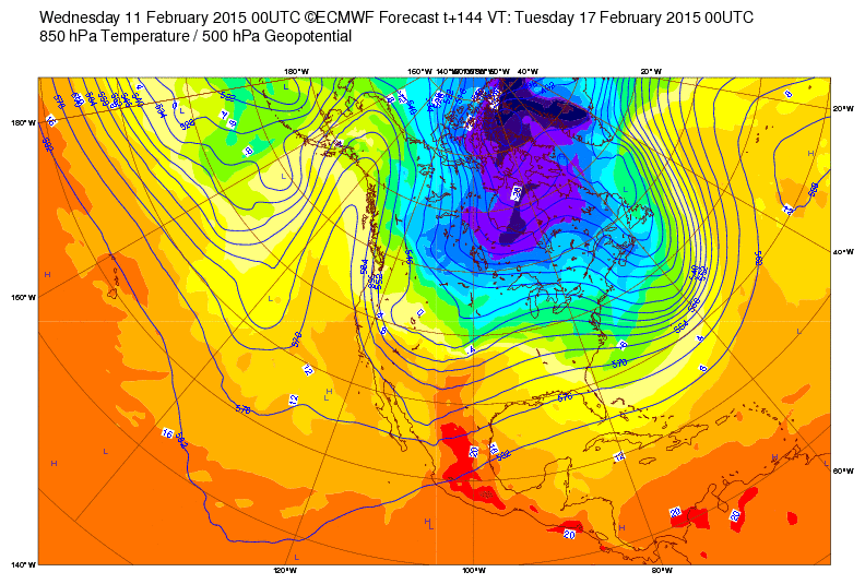
The models, however, are calling for that ridge to weaken late this weekend and early next week, with a new ridge forming further west over the eastern Pacific.


This is a fairly significant shift for our weather as it will mean a return to more seasonable temperatures, at least temporarily, and I think we can be fairly confident that cooler weather will be here early next week.  The pattern is not one in which we typically see a lot of moisture, so I'm not overly excited about deep-powder prospects, but the models are hinting that we may get a little snow and there are a few ensemble members calling for some higher amounts.

We will have to see how this all comes together.  Keeping ones hopes low is the key to happiness if and when we do get something.

Tuesday, February 10, 2015

No Steenburgh Winter (Again!)

Where are you Steenburgh winter?
A few years ago I coined the phrase "Steenburgh winter" to describe that period of the year during which there is both a deep snowpack and a low-angle sun (see Last Day of Steenburgh Winter from February 2011).  The idea was to highlight the part of the winter that provided the creme-de-la-creme snow conditions for backcountry skiing.  Steenburgh winter begins when the Alta-Collins stake hits a 100 inch snow depth as that's when nearly all of the backcountry becomes skiable.  There are many areas I won't tour until there's that much snow on the ground.  It ends on February 10th, which is when the sun is beginning to become increasingly caustic to snow, certainly on south aspects and, as we progress into spring, other aspects as well.  There is certainly great skiing to be had outside of Steenburgh winter, but the idea here is to describe that period during which there is both abundant snow cover and the ability to ski most aspects even well after storms.

Coalpit Headwall on a day with 115 inches on the Alta-Collins stake and look at those rocks!  
The last Steenburgh winter was during that amazing 2010–11 season when we reached 100" at Alta-Collins on December 20th, giving us over 50 days of deep snowpack and low angle sun (and even great powder all the way to Memorial Day).  We haven't seen a day of Steenburgh winter since.  Today is February 10th and Alta-Collins sits at 70 inches this morning.  Granted, it's a dense 70 inches, but we also haven't seen a deep-powder day (10 inches or more) since January 12th.  Near as I can tell, this year we've had two Novembers followed by April and May.  Maybe January will return in March.

Ah, the good old days.
Perhaps Steenburgh Winter has simply moved east?  Below are the latest snowfall numbers for southern New England.  Check out those Boston and Worcester totals and their climatological ranks.


Wachusett Mountain here I come...

Bloggers Note: This post has been updated to correct a Brian Williams memory lapse.  After checking, the snow depth at Alta-Collins on the day the Coalpit Headwall photo was taken was 115 inches, not 200 as originally indicated.  Snow always gets deeper with time in my memory...that's why we have data!

Monday, February 9, 2015

This Pattern Is a Wicked Pissah!

Yesterday, Andrew Freedman of Mashable described the forecast for today for Boston as a "Wicked Pissah" and I like that so much that I'm going to hijack it and use it to describe the overall pattern that is currently dominating the weather over North America.

We could call this a high amplitude pattern, but for today, it's simply a "wicked pissah!"
In the far west, this pattern is a wicked pissah for everyone who loves snow or watering their lawns in the summer.  The snowpack in the Sierra and Cascades is dire.  Further inland, Montana, Wyoming, and Colorado are sitting near or slightly above climatological snowpacks in the upper elevations, but the Wasatch are struggling.  Alta-Collins this morning sits at 66 inches.  More on that in a minute.  

Back in Boston and along the eastern New England coast this is quickly turning into a winter for the ages as multi-day snow accumulations and snow depth on the ground are near, at, or above all-time marks at numerous locations.  As of this morning Boston has recorded over 60 inches of snow in 17 days.  Measured snow depths as of yesterday evening include 53 inches in Bangor, Maine, which ties their all-time record.  The mountains of northern New England are missing out on the heart of the action in the latest storm, but nevertheless, Mt. Mansfield sits at 76 inches, 10 inches ahead of Alta!

And of course, it is snowing across much of New England this morning.

Source: NCAR/RAL
The silver lining here in Utah is that we don't have an inversion and we're at least able to enjoy the warm sunny weather even in the valley.  I walked to the bus this morning without a jacket, which seemed preposterous.  The overnight low at the base of Alta was 37ºF.  There is a weak front coming in for today, so don't let the bluebird morning skies fool you.  We'll get some valley showers and some mountain dust on crust in the high elevations starting later this morning.  There's a slight threat of showers through tomorrow morning, but other than that, we should be dry through the work week and likely the weekend.

Saturday, February 7, 2015

Is This A Long Term Trend?

A lot of people have been asking me if the warmth and poor snow this year (especially at lower elevations), as well as the string of poor snow years since 2010-11 is a long-term trend.  The answer to that question is probably not, but with a few caveats, and here's why.

The climate history of the western United States is one characterized by large variability.  In other words, fluctuations from wet periods (sometimes called pluvials) to dry periods (droughts) within seasons, from winter-to-winter, or even from decade-to-decade, is the way the climate behaves in the west.

If we look at the November to April snowfall history at Alta, for example, we see large ups and downs from year to year. Most years fall between about 380 and 600 inches, although there are some that are drier and some that are snowier.  If you look carefully, you might even notice a bit of what we call decadal-scale variability with the early part of the period being less snowy, the 80s and 90s being quite snowy, and then a modest decline in recent years.

November-April Snowfall at Alta-Guard.  Source: http://utahavalanchecenter.org/alta-monthly-snowfall.
The last three years have been fairly lean for snow (and this year we might add a fourth, although it is not in the bag yet).  The only comparable period of lean snow is from about 1958-1959 to 1962-1963 when the Nov-Apr snowfall ranged from 326-401.5 inches.  And to think the phrase Greatest Snow on Earth was coined in that period! (See chapter 1 of my book.)

Tree rings and other "proxy" climate indicators allow us to take a look at the climate farther back in time.  The plot below shows estimates of the 25-year running mean flow for the Colorado River at Lees Ferry.  The key thing to note here is that are some periods when the variability is relatively low (e.g., 1650-1800), and other periods with considerable fluctuations, including some extended periods of drought (e.g., 1100s).

Source: Steenburgh et al. (2013).  Adapted from Meko et al. (2007).
The main point of all this is to show that the climate of the western U.S. does experience wide variability.  Therefore, for me as a meteorologist, I don't find a few poor snow years to be all that surprising or necessarily indicative of a long-term trend.  I also don't feel the extreme warmth this winter is indicative of what we should expect for the next couple of decades (in italics for a reason, keep reading).

However, I said that there were a few caveats, and here are a few.

The first is what is meant by "long-term trend."  If we mean a trend over say a period of a decade, then I have to plead ignorance.  We do see decadal scale fluctuations in the climate of the western United States and we have made some progress in identifying the large-scale patterns that produce them and some (but less) progress in understanding their causes.  We know, for example, that ocean conditions in the Pacific (including El Nino/La Nina) and Atlantic play a role, but we have a ways to go until we can reliably predict these decadal scale fluctuations.  Thus, I don't really know if we are in a relatively dry period that will persist or not (those of you with an interest in this area can see the article Decadal Scale Prediction: Can It Be Skillful?, by Meehl et al.).

If, however, we mean a trend over say a century scale or longer (in other words global warming), things get more nuanced, leading to caveat two.  Let's focus first on temperatures.  In my view, the extreme warmth this winter is primarily a reflection of the extremely anomalous large-scale pattern that exists over North America, as discussed in an earlier post [see This Winter (Dec–Jan) Is Not Unprecedented].   As such, I wouldn't expect what we've experienced this year for temperatures to be the norm for the next couple of decades.  That being said, global warming has and will increasingly shift the odds toward warmer winters and a greater fraction of lower-elevation precipitation falling as rain instead of snow.  What you are experiencing this year will become more common eventually.  December and January averaged 5.7ºF above the 1981–2010 average. You can put that into the context of future greenhouse gas emissions (Very Low to High) and the range of model projections based on those emissions (30-year periods centered on the date below with 50% of the model projections given by the lines and the extreme outliers as dots) using the plot below for the temperature change in the central Wasatch relative to 1976–2005.  It lies just above the average projected for the 30-year period in 2060 under the moderate emissions scenario and near average under the high emissions scenario.
Climate model projections for the central Wasatch relative to 1976-2005.  Courtesy Court Strong.
Let's suppose these estimates of warming are overdone.  Maybe we only warm 2ºF by 2060.  That's fine, but the odds and frequency of years like this are likely to increase even under that scenario.

Gosh this post has gotten onerous!  I still haven't discussed precipitation, but I need to get some cross-country skiing in before the snow is gone, so I need to conclude.

The bottom line is that we should not panic for the short term.  The extreme warmth this year is not going to be the norm for the next couple of decades.  If we're in a bad period, so be it, but I'd still rather ski here than many other places.  That being said, warming is in our future and eventually it is likely going to have a growing influence on the low-elevation snowfall and snowpack.  For more details, and discussion of the upper elevations, see Chapter 9 of my book.

Friday, February 6, 2015

Crazy Warm (Again!)

The Heat Miser is in total control over northern Utah.  Source: RankinBass
Yesterday's high of 65ºF at the Salt Lake City Airport was not only a record for the day, but the earliest 65ºF observed for the calendar year.

We'll make a run at records again today.  The record for the day is 63 and anything above 65 would also be a record earliest observed for the calendar year.

I've been in DC all week participating in a winter weather forecast experiment being run by the National Weather Service.  It's been cold with no snow here.  Looking forward to returning to valley warmth and mountain snow, even if the latter isn't of our usual high standards.

Thursday, February 5, 2015

This Winter (Dec–Jan) Is Not Unprecedented

It has been a warm and dry winter (December to January) this year in the central Wasatch, but there have been similarly "bad" years in the past.

If we look at the average temperature at Alta, for example, the largest outlier is not this year, but December 1980 – January 1981 (hereafter just 80–81).


There's a lot of missing data in the record for Alta, so I thought it might be wise to look at another site, in this case, Silver Lake Brighton.  Indeed, it is 80–81 period that is the warmest on record.


The large-scale patterns for the two periods are actually pretty similar.  80–81 featured a western North American ridge and a deep North American trough.

The pattern is similar in 14–15, although it's not quite as amplified over the continental U.S.
If we look at the 700-mb temperatures over northern Utah, what we find is that indeed it was warmer in 80–81 than 14–15 by about 2–3ºC.

So, it was a warm December to January period this year, but there has been warmer.  Perhaps not surprising giving the strong ridging, the snowfall in 80–81 was also low, totaling 107 inches for the two months at Alta-Guard, just a bit more than the 102 inches observed this year.

A number of people have asked me if I think the bad snow years of late are a long-term trend.  I don't think that they are for a couple of reasons.  One is that there is a lot of variability in the climate system, so we need to expect some bad years and strings of bad years.  Such years are in the instrumented record, as well as tree-ring reconstructions.  A second reason is that although the warmth of this December–January and its impact on lower and mid elevation snow are consistent with the emerging long-term warming trend, the warmth this December–January has also been strongly accentuated by the anomalous ridge.   In other words, what we have seen this year is primarily a reflection of the upper-level ridging and secondarily a reflection of that upper-level ridging occurring in a warmer world.  

Whether or not climate change is increasing the variability in the climate system and perhaps increasing the likelihood of extremes like this year remains an open question being investigated by climate scientists today, and perhaps the subject of a future post.