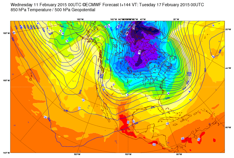
Our computer models are hinting at a significant shift in the large-scale pattern over western North America.
For some time, we've had a ridge locked in over us. We had a modest cool down with the frontal passage on Monday, but temperatures have remained well above average. The forecast below from the ECMWF is for 5 PM tomorrow and it shows what we have seen for some time — a high-amplitude ridge over western North America.
The models, however, are calling for that ridge to weaken late this weekend and early next week, with a new ridge forming further west over the eastern Pacific.
This is a fairly significant shift for our weather as it will mean a return to more seasonable temperatures, at least temporarily, and I think we can be fairly confident that cooler weather will be here early next week. The pattern is not one in which we typically see a lot of moisture, so I'm not overly excited about deep-powder prospects, but the models are hinting that we may get a little snow and there are a few ensemble members calling for some higher amounts.
We will have to see how this all comes together. Keeping ones hopes low is the key to happiness if and when we do get something.


Looking at ensemble runs the past few days, I think this might be more of a pattern "blip" than a pattern shift. Doing some forecasting for CalWater 2015 and we are planning to send the NOAA G-IV to Hawaii on Friday because storm prospects are so bleak along the West Coast the next 7-10 days. Granted, things might be a little more interesting for Utah.
ReplyDeleteAgreed. That's why I said "at least temporarily." Most of the extended model guidance suggests the western "Death Ridge" will continue to be a long-term force. Although I'm always reluctant to strongly endorse such extended-range projections, inertia this year seems quite strong.
Delete