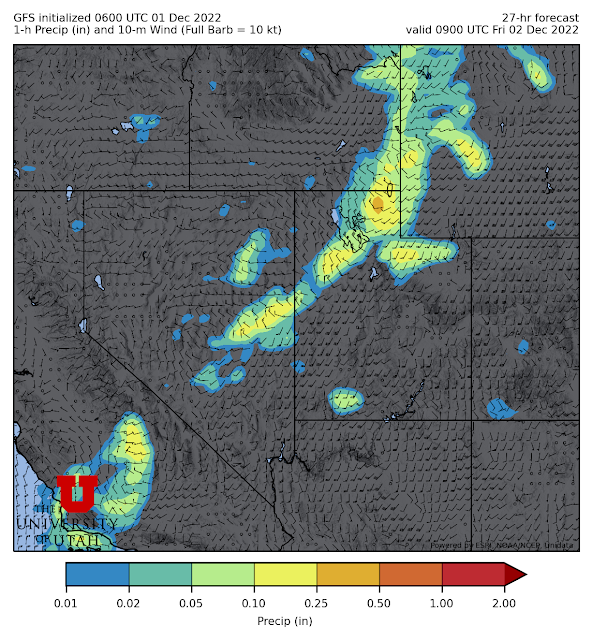
A strong, quick hitting cold front will plow its way through Utah tonight, preceded by strong winds and accompanied by mountain and valley snow.
The GFS forecast below shows the sharp wind shift and precipitation band accompanying the front as it enters the Salt Lake Valley at 0900 UTC (2 AM MST) tonight.
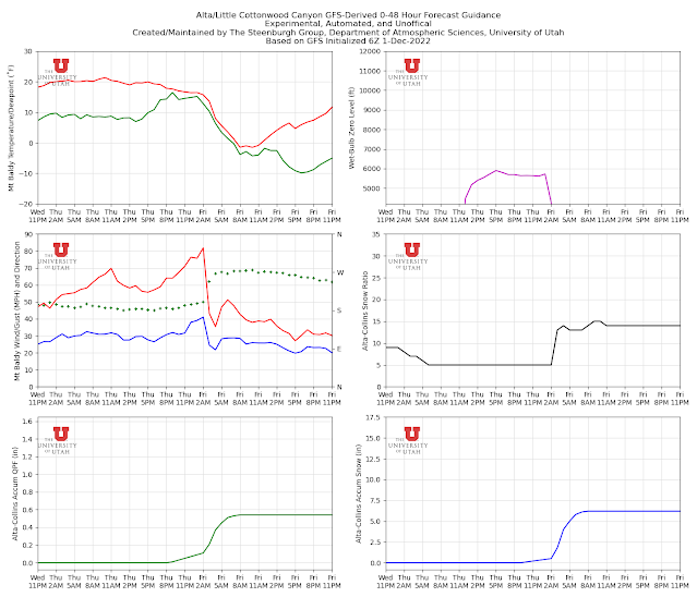
It's hard to miss the front in the GFS-derived Little Cottonwood forecast below. Mt. Baldy winds are forecast to howl ahead of the front, with a peak gust of just over 80 mph just ahead of the front after which wind speeds drop. This is accompanied by a shift in wind direction from south to west and about 0.45" of water-equivalent precipitation which adds to the 0.1" that comes in fits and starts ahead of the front. Total snowfall is about 6".
The HRRR is a touch wetter with a storm total of 0.75" of water equivalent.
I figure expect 5-10" and hope for a bit more. These numbers are lower than the NWS forecast for the Cottonwoods issued overnight, which calls for 10-18".
Go with your wishcast.


Wish casting is what always got me in trouble! Your GFS derived little cottonwood forecast has been consistent for several runs now showing around 6". When did you last tweak this forecast? In the past it has matched up very well with the WRF-GFS forecast out of the University of Washington which is the forecast I have found does the best on average, not always.
ReplyDeleteHow bout, either way, go skiing!!!
ReplyDeleteNah no skiing. Any snowfall will have blown to CO.
ReplyDeleteThis morning a plume of moisture has been visibly rising from Warm Springs, and I've noticed similar events at other times. Has storm enhancement over Warm Springs been studied?
ReplyDelete