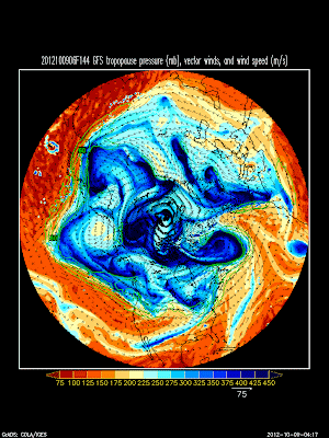
Yes, that's right. After months of the summer doldrums, the westerlies will be returning to the western U.S. in the coming days. Details are sketchy, but check out the 144 hour GFS forecast below (valid 0600 UTC Monday 15 Oct), which shows the Pacific jet penetrating across the northwest United States.
Ahead of that, we have a closed low rumbling across the southwest, which will probably bring some snow to the higher elevations. The Wasatch might even get some on the higher peaks depending on the track of the low.
Looking forward to it.


Is the closed low spinning off the coast of California right now--the one that's slated to move through the Southwest later this week--a remnant of Typhoon Jelewat?
ReplyDeleteHa, good one...
DeleteIn the GFS archive, you can watch the development of the closed low over the eastern Pacific near 30N during the Sept 23-27 period. It has been around for at least 2 weeks now.
ReplyDelete