Following up on the previous post (New HRRR Products on weather.utah.edu), I've now added new GFS model soundings and time-height sections as well. They are under the GFS-0.25 deg tab.
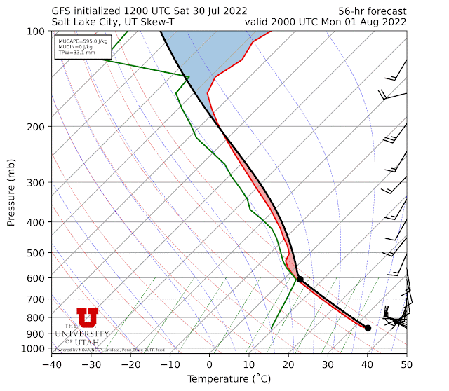
The soundings are plotted on a thermodynamic diagram known as a "Skew-T," so called because a line of constant temperature is skewed 45˚ from the horizontal (grey lines that slope upward to the right below). There is a wealth of information on these charts, but there's a summary available here. The diagram lines, described in greater depth at that link, include pressure (horizontal grey), dry adiabats (red dotted), moist adiabats (blue dotted), and mixing ratio (green). The red and green lines are the model forecast temperature and dewpoint.
The black line is the theoretical profile a parcel of air would have if it were lifted. In this case, I am plotting the "most unstable" parcel. That is, the parcel with the most Convective Available Potential Energy (CAPE). Sometimes it is the surface parcel (as is the case in the plot above). In others, it can be elevated. Black dots show the level of the most unstable parcel and its lifting condensation level, which is the level at which the the parcel reaches saturation. No black lines or dots are plotted if there is no parcel that has CAPE. Maybe more on all this stuff in the future.
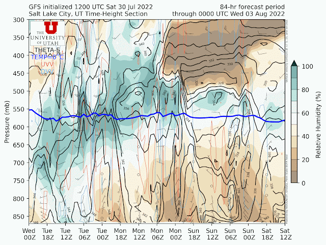
The time-height sections include relative humidity (color fill), the 0˚C isotherm, wind barbs, and vertical velocity (upward red, downward blue). These are very useful for forecasting mountain precipitation and should be valuable this coming winter.
- I've eliminated the high-resolution nam nest. It's never been very useful for wintertime precipitation forecasting due to a high bias, so I've elected to axe it so I have one less product to support.
- I've added HRRR forecasts out to 48 hours. This is basically a better alternative to the NAM nest. These forecasts are available every 6 hours, so there are now tabs for the 48- and 18-h HRRR runs (the latter available every hour).
- I've done some rearranging and naming of the products in the left-hand nav bar to make it simpler.
- The old LCC guidance product has been removed and only one LCC guidance product, based on the GFS, will be available moving forward.
I know that the interface for weather.utah.edu is old and obtuse. I can do some basic editing of it, but a wholesale upgrade is beyond my programming abilities. It will remain as is until I can find someone to work on it.


No comments:
Post a Comment