
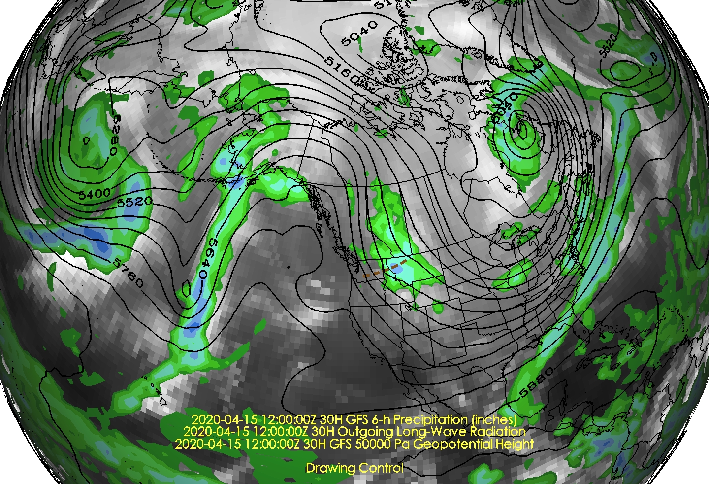
Today we'll make it to perhaps the low 50's before another we begin the transition with the next cold surge tomorrow. The setup for this cold blast is the high amplitude upper-level pattern over the North Pacific and North America with an upper-level ridge over the Gulf of Alaska and a deep trough over central North America. A short-wave trough (dashed brown line) that was over the Aleutians at 1200 UTC (0600 MDT) 12 April moved over the ridge and across Alaska on the 14th and will dive southward in the large-scale northerly flow today.


Preceding this trough will be mountain snow showers and a few valley rain showers on Wednesday, and eventually the cold air Wednesday night. Below shows the NAM forecast for 2100 UTC (3 PM MDT) Wednesday with mountain snow showers in the westerly crest-level flow and then the colder, post-frontal northwesterly flow at 1200 UTC (6 AM MDT) Thursday.


This is a relatively dry system, so mountain accumulations will likely be limited. The downscaled SREF mean for Alta is around 6 inches by Thursday morning (16/12Z in the plume diagram below), but the spread is fairly large with some members producing little and others generating 10 inches or more.

My view is that this will probably not get to the 10 inch threshold, although there's a low probability that could happen if tomorrow ends up being more productive than advertised. Personally, given the stay at home orders, I'd prefer it to be about 15 degrees warmer so that it was more enjoyable in the valley. Let's save the cold air for next season when we can put it to better use.
No comments:
Post a Comment