Saturday, June 25, 2022

Irish and English Travels

We dropped back into Utah last night after three weeks in Ireland and southern England.  Today is the first day I've used a desktop computer in three weeks.  It was a wonderful break!  I even tried to avoid using e-mail and removed my e-mail apps from my phone and tablet before going, but as soon as we got to Amsterdam our flight to Dublin was cancelled and they said "for updated travel information, check your e-mail."  So the first thing I did in Europe was install Outlook.  Lol.  

Ireland was simply wonderful.  I had no idea what a lovely country it is. Although it lacks big mountains, the hills and coastlines are rugged and beautiful.  It was cool and showery too, which we absolutely loved.  I think the highest temperature we saw there was about 21˚C when we were in Belfast.  The rest of the time it was sweater and shell weather. I can't tell you how good it felt.  

We did a full circumnavigation of the island, doing lots of short hikes and enjoying Irish food and beer.  We then spent a few days in London and southern England before returning.  Here's a longer than needed tour.  
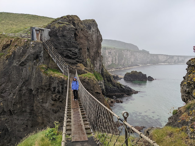
This is the Carrick-a-Rede rope bridge on the north coast.  It's a short hike and requires a fee.  I'm sure it is a massive tourist trap, but we get up early and it was raining and we had the place to ourselves.  Fantastic!

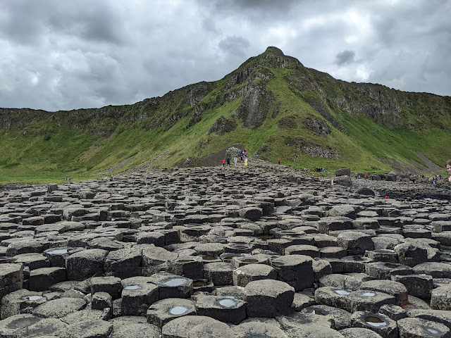
Giant's Causeway is a geological formation on the north coast, also very touristy, but pretty cool.  We parked in a far lot and did a nice circle hike through it.


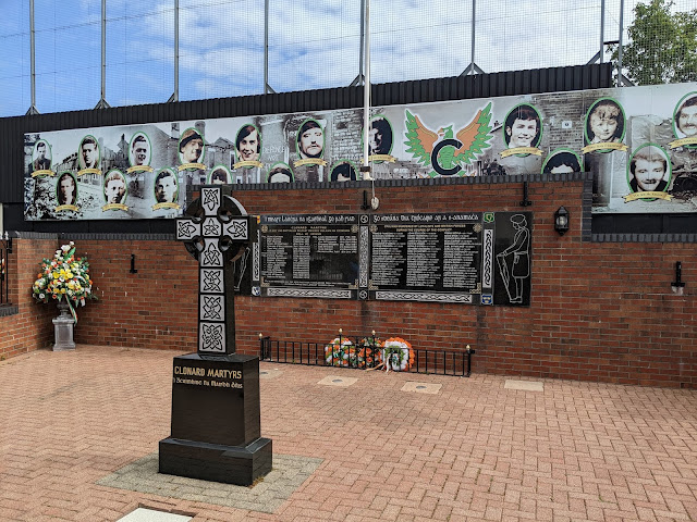
In Belfast and Derry we did some historical touring to try and understand Ireland's history and, more recently, The Troubles.  This is a Peace Wall mural in Belfast honoring those killed by the British and Loyalists during the Troubles.  Others honor Loyalists killed.  About 3,500 people died during The Troubles.  I still have more to learn.  

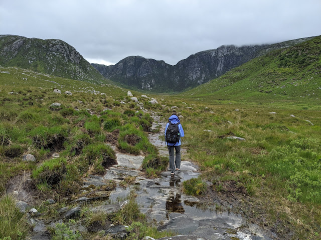
One of our favorite regions was County Donegal.  We saw few people here.  We did a short hike up the "Poisoned Glen."  The source of the name is unclear, but could be a mistranslation.  For the rock climbers, the mountains in the distance house Ireland's largest rock face, the Beamas Buttress.  It's a wet walk to get there.  

Dunlewey Church (abandoned) at the head of the Poisoned Glen.  Scenes like this are everywhere. 

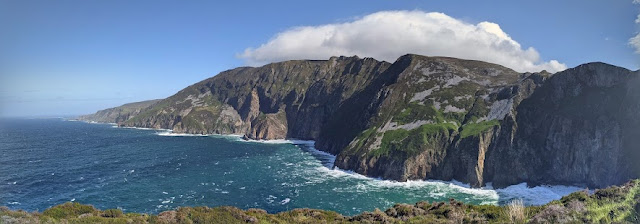
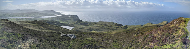
When we started our hike to Slieve League, it was pouring and the wind was blowing hard.  We were in full rain gear.  As we approached the overlook, the clouds parted and we got this incredible view.  These are the among the highest sea cliffs in Europe.  Can you see the orographic cloud?

It is possible to hike out along the Slieve League Ridge, but my foot was still giving me trouble so we did a shorter hike up to One Man's Pass.  What scenery!

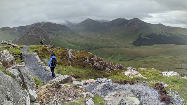
Near the summit of Silver Hill in Connemara National Park.

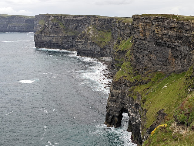
The Cliffs of Moher are one of Ireland's more popular natural wonders.  There is a crowded visitor center near there highest point, but we hiked in from Hag's head to the south, which given our early start was pretty quiet (it was busier when we returned).

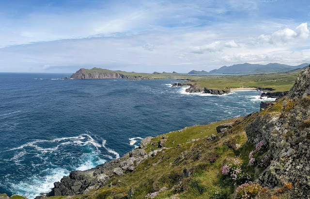
One of our favorite areas was the Dingle Peninsula.  This was taken near Clougher Head.

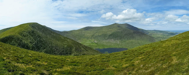
Also on the Dingle Peninsula is the Brandon Group Mountain Range.  We did a short hike from Connor Pass to enjoy the vistas.  Yeah, it was green.  I believe that Brandon Peak is right of center in this photo.

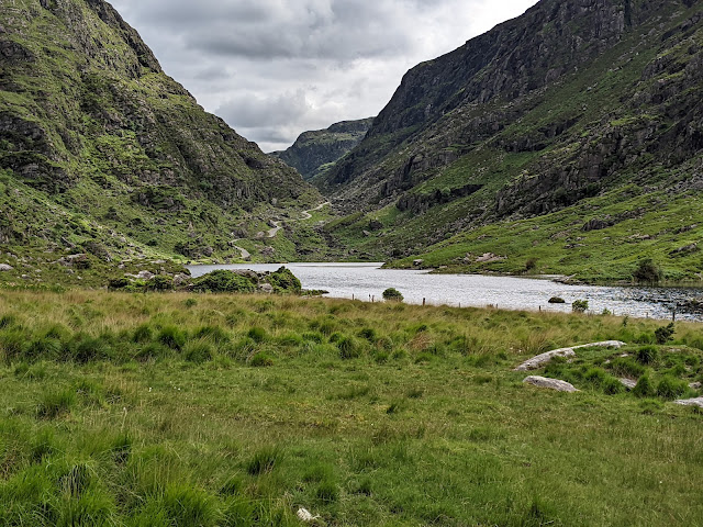
One day as we were driving along we saw a sign for the Gap of Dunloe.  I had seen it previously on a map and said we should check it out.  The thing about Ireland is you never know what the roads are going to be like.  Turns out, the road is one lane, has two way traffic, and is traveled by hikers, bikers, horses, horse-drawn carriages, etc.  It was, however, late in the day and we largely had the place to ourselves.  The hills here have an incredible ancient feel.

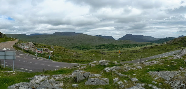
Above is the view of the Gap of Dunloe from Molls Gap.  The mountains to the left of the gap are the highest in Ireland at a bit over 1000 meters.  My foot was not ready for an ascent on this trip, but I would like to return and hike them.  

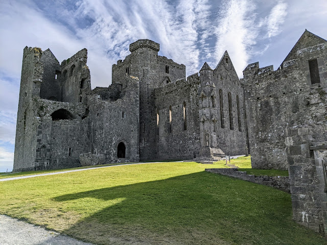
We made the obligatory stop at the Blarney Castle, which houses the Blarney Stone.  We enjoyed the grounds but skipped kissing the Blarney Stone as it was an hour-long line and I've never really been into that sort of thing.  The next day we went to the Rock of Cashel, pictured above, which was far more impressive than Blarney Castle.  

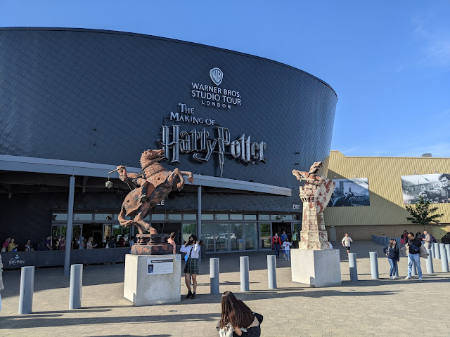
We flew across the Irish Sea to London for a few days.  Yes, we did this.  I am a closet Harry Potter film. We had a great time.

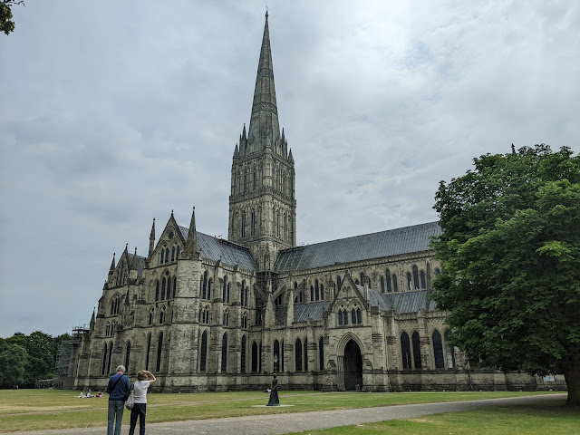
On our last touring day in England, we made an unplanned stop in Salisbury and decided to check out the Cathedral there.  Amazing.  Construction started in 1200.  The main spire is 404 feet high and was built in the early 1300s.  It is the tallest medieval structure in England.  

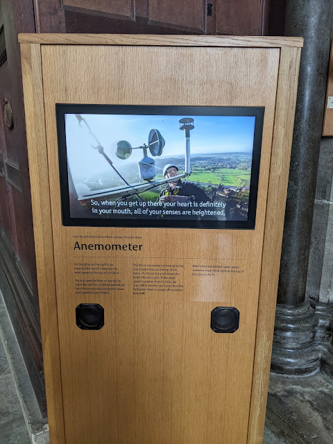
But, it gets better.  They have a weather station on the spire.  I understand there's a weather station on Mt. Everest, but this was incredibly cool.  An anemometer on an 800 year old, 400 foot high spire!  And it's no easy feat getting up there.  It's incredible to think about building such a structure back in the 1300s.

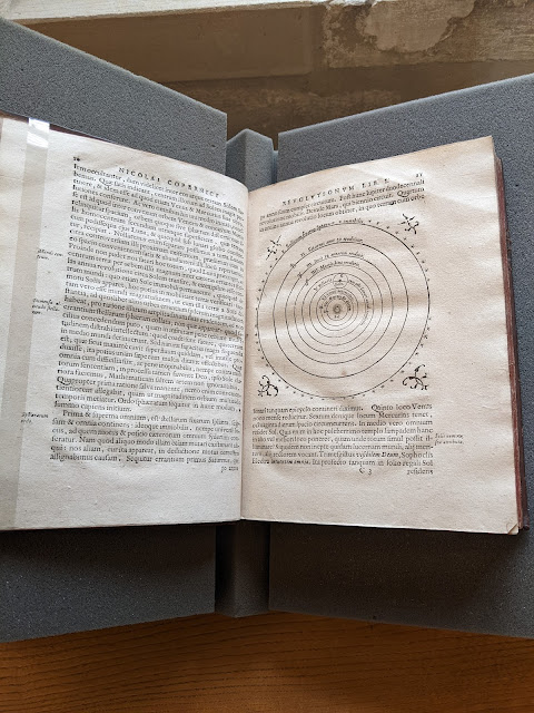
And it gets even better than that.  As we were exiting the cathedral, one of the cathedral workers asked if we would like to see the library.  I was going to say no, but somehow we decided to check it out.  In it, they had a Nocolas Copernicus' De revolution iorbium coelestium, 3rd edition, published in 1617, shortly after it would have been placed on the Catholic Church's Index of Prohibited books (see https://www.gla.ac.uk/myglasgow/library/files/special/exhibns/month/apr2008.html).  The first edition was published in 1542.

Thanks for entertaining my travel blogging.  I'll be attending the Mountain Meteorology Conference in Park City next week, so blogging may continue to be light for a while longer.  

Wednesday, June 1, 2022

Blog Break

It's been a long 2+ years since the start of the pandemic.  I'm taking some downtime for the next few weeks.  Blogging will be very light to non-existent.  Enjoy the first month plus of meteorological summer.  

Sunday, May 29, 2022

Snow Update

A soggy Sunday has settled in over northern Utah.  One could complain given that it is the holiday weekend, but we need every soaking we can get in these droughty times.  

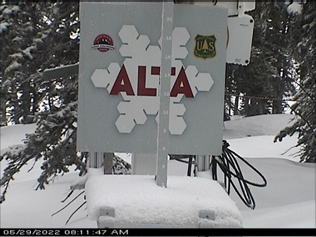
Alta is beginning to look wintery this morning.  

Overnight temperatures fell at Alta-Collins to 31˚F as of 7 am.  Water equivalent precipitation since midnight is about 0.5", with no accumulation so far on the interval stake, although how well it is being maintained is unclear.  

The web cam shows perhaps two inches.  


Call it cream on crust.  

The GFS has been pretty consistently calling for significant accumulations today, totaling 1.2 inches of water and, based on our snow-to-liquid algorithms, about 14 inches of snow from midnight last night to Monday afternoon.  


There's a certain amount of crapshootedness to these spring storms given their scattered, convective nature, but perhaps we can get one last day of fresh out of this event.  I suspect snow densities will be even higher than indicated above, which may limit accumulations to less than indicated above if water equivalents don't go big.  There will also be a sharp increase in accumulation with altitude as the transition zone is sitting in that 8000-9000 foot elevation range.  Late may snow.  Don't complain :-).

weather.utah.edu

Our Center for High Performance Computer performed a major software and hardware upgrade of our computer systems from Wednesday to Friday.  Things are up again, but some weather.utah.edu products are still not available.  


Tuesday, May 24, 2022

Dismal Snow Situation in the Eastern Alps

 It's looking like this past season was especially dismal for seasonal snow in the eastern Alps and I suspect by the end of summer it will have been one for the glaciers as well, if it isn't already.  

The Zugspitze on the border of Germany and Austria is my bellwether as there's a very good web cam there and it is at an elevation where there once was a glacier, but no more.  

This year looks to be a double whammy due to a "meh" snow season and the damage being done by Saharan Dust that was deposited onto the snowpack a few weeks ago.  

Below is the view looking south from the Zugspitze yesterday.  The snow cover is already spotty and covered with the Saharan Dust, which increases the absorption of solar radiation and the snowmelt.  

Source: https://www.foto-webcam.eu/

Below are images taken on the same day or prior day back to 2016 (also from https://www.foto-webcam.eu/), showing the especially poor snow coverage this year. 


Only 2020 is close, but even then, the coverage was more extensive.

Below is a view from late September of last year. 

It will be interesting to see how things look this September.  I suspect this year will be a big mass lost year at glaciers in the eastern Alps and perhaps the central and western Alps as well.  

Sunday, May 22, 2022

Build the Trails, Part II

When I first moved to Salt Lake City in the 1990s, purpose-built mountain-biking trails didn't exist near town, with the exception of the pipeline trail in Mill Creek Canyon, which I'm not sure was truly designed for mountain biking.  There was no Avenues Bonneville Shoreline Trail (BST).  I used to ride the fire road above Terrace Hills Drive and then hike a bike to the top of the Avenues Twin Peaks.  One could descend via that route or down the Bobsled or the Agony Escalator.  

In 1998 a friend and I had been looking at topo maps and decided that we should ride to Rudys Flat above  Bountiful via ridge thats west and north of City Creek Canyon.  Looked "doable" on the map.  There was to TrailForks or other app to give us a trail report. 

We left after work.  We road up the Ensign fire road past the various comms towers, which beyond the first set of towers was as bad then as it is today.  Then we started working our way out the ridge.  Initially it was a pretty good double track, then a lousy double track, then a single track, then a heard path.  The ridge is pretty lumpy and the route went straight up and straight down everything.  The vertical added up.  It started getting dark.  Finally we saw the trail down North Canyon and beelined too it.  We then descended and road home in the dark via paved roads.  I was depleted.  

I swore I'd never do it again, but a few years later I did, this time better equipped with more reasonable expectations.

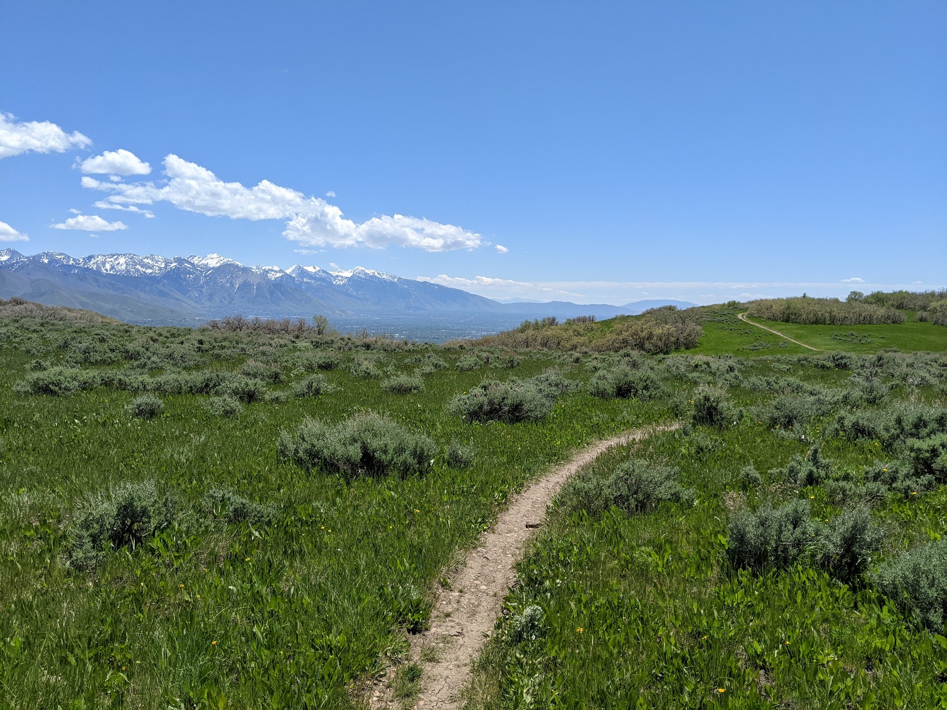
I always thought it would be a great place for some properly built trails.  Although not on the ridge, the BST from above is now nearly finished to North Canyon (I've read it's not quite to North Canyon yet, but if you have a more recent update, please comment).  I rode some of it yesterday and it offers up great views as it contours in and out of the scrub oak. 

Here and there, a dense carpet of vegetation covers the ground.

The trail is very well constructed and perhaps single track and a half rather than single track.  


It's fairly easy riding once there.  The route to it from Wild Rose has a steep section that requires some pushing, but it's not a biggie.  Perhaps a lower-angle option will eventually be constructed.  

We did ascend the old-school Eagle Crest trail to the ridge above City Creek to enjoy the views of the central Wasatch.  


This is an area I always thought could offer up some great biking and hiking and it is great to see more trails being built.  Really, the potential is enormous.  

It was also a sad reminder that while other communities are moving forward with trail construction and providing more opportunities for their residents, Salt Lake City continues the pause on trail construction in the Avenues Foothills.  Let's get that process going again.   The reality is that a new trail system will be better than what we have now.  

Wednesday, May 18, 2022

Build the Trails

It's prime season for biking and hiking in the Avenues foothills.  This year it seems especially lush and the vegetation is filling in nicely around the recently constructed trails.


There could be more trails available to hike and ride, but trail construction was halted in May of last year.  This was allegedly a "pause" that would last until that fall.  Then it was extended to this summer.  In April, the city council further extended the pause until at least spring 2023.  

My views align with those of Ashley Patterson's in her op/ed in yesterday's Salt Lake Tribune.  The Foothills Trail System Plan included three years of public input.  Those surprised by the construction successfully pushed the city to pause completion of the project.  Some legitimate concerns were raised and the trails community supports addressing these.  

On the other hand, we do not want to see trails construction stopped permanently or delayed significantly.  After the pause last year, consultants should have been hired to evaluate the trail construction plans, but that hasn't happened.  Instead, the can has been kicked down the road for another year.  

It is long past time for city council and Mayor Mendenhall to move this process forward.  Other communities along the Wasatch Front have built world-class multiuse trail systems.  We can too.  

For more information, see https://slctrailsalliance.org/