
A soggy Sunday has settled in over northern Utah. One could complain given that it is the holiday weekend, but we need every soaking we can get in these droughty times.
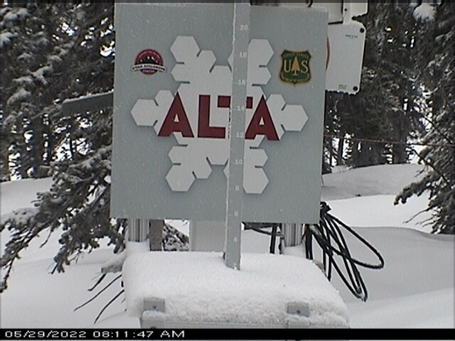
Alta is beginning to look wintery this morning.

Overnight temperatures fell at Alta-Collins to 31˚F as of 7 am. Water equivalent precipitation since midnight is about 0.5", with no accumulation so far on the interval stake, although how well it is being maintained is unclear.

Call it cream on crust.
The GFS has been pretty consistently calling for significant accumulations today, totaling 1.2 inches of water and, based on our snow-to-liquid algorithms, about 14 inches of snow from midnight last night to Monday afternoon.

weather.utah.edu
Our Center for High Performance Computer performed a major software and hardware upgrade of our computer systems from Wednesday to Friday. Things are up again, but some weather.utah.edu products are still not available.
https://epod.usra.edu/ Check it out 5/31
ReplyDelete