
The weather over the past week has been wonderful by my standards. Four of the past six days have seen highs in the 80s, lows have been in the 60's, and we've had measurable rain at the airport on four days. You might have done even better than that depending on where you live.
The GFS analysis for 0000 UTC 19 August (6 PM MDT Sunday) shows the situation as of yesterday afternoon. An upper-level ridge predominates over west Texas and New Mexico with a deep upper level trough off the Pacific Northwest Coast.
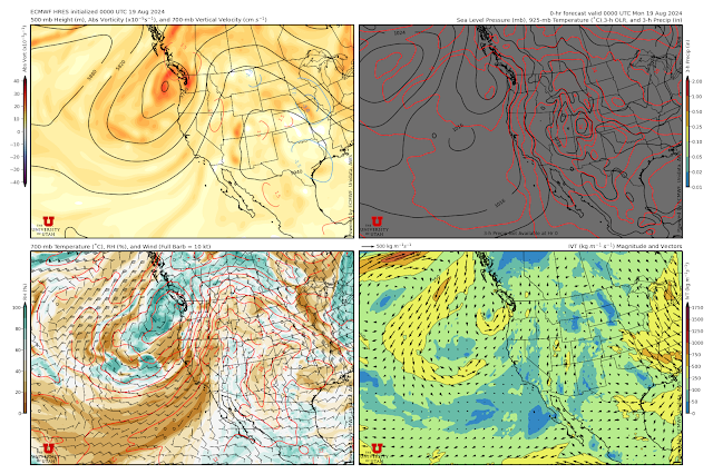
This has put Utah in a so-called "monsoonal" flow around the upper-level ridge.
This general pattern will predominate over the next several days, with changes in the position and strength of the upper-level ridge and trough affecting our temperatures and likelihood of precipitation. For example, the ECMWF forecast valid 0000 UTC 21 Aug (6 PM Tuesday) shows a slight westward shift in the ridge, weakening of the trough, and a bit more of a southwest (and slightly drier) flow over northern Utah.
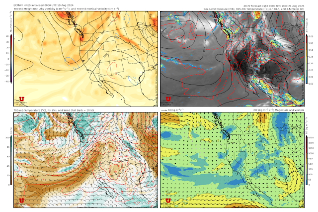
That will probably mean low thunderstorm chances for Tuesday in the Salt Lake Valley.
By Thursday though, a trough from the high latitudes drops into the northwest trough and the flow pattern has strengthened again, resulting in another surge of monsoon moisture and increased thunderstorm activity over southern and eastern Utah.
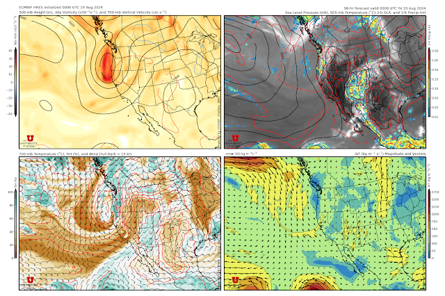
Whether or not the Salt Lake Valley gets back in the action is a bit unclear. In part, this is because there are three major weather players in that pattern. The first is the monsoon ridge and surge with the latter streaming up from Arizona across southern and eastern Utah and Colorado. The second is a dry southwesterly flow extending across southern California, Nevada, and northeast Utah. Finally, the third is the cold air accompanying the Pacific trough. In the forecast above, we're just in the dry airstream and just miss out on the monsoon surge. Maybe we can get lucky and that surge will shift just a bit farther to the west.
In the forecast above (valid 0000 UTC 23 August), 700-mb temperatures (about 10,000 feet above sea level) near the center of the trough off the coast of California and Oregon are about -4°C, which would be good enough for about a 7000 foot snow level if the trough were over high terrain. Some long-range forecast models call for that trough to eventually get here, in weakened and modified form, by next weekend. The ECMWF forecast is one. Below is the forecast valid 1800 UTC 25 August (1200 MDT Sunday) with the trough moving across Utah.

So, if we're lucky, we might see a decent surge of "cold" air in here over the weekend. Highs in the 70s or low 80s are a possibility on Sunday.
No comments:
Post a Comment