Posts

Adding Up

Image
I'm on the road this morning with limited connectivity or ability to enjoy freshies, but it's good to see that the snow produced by today's weak trough passage is adding up.  Looks like about 5" thusfar at the Alta-Collins stake. Even Park city is getting in on the action. Enjoy!

A Year Without a Winter

Image
It's official.  This is the year without a winter.  A Steenburgh winter that is.  Let me explain. Steenburgh winter is different from astronomical winter, which extends from the winter solstice to the spring equinox.  Steenburgh winter is based on ski conditions. Steenburgh winter begins the first day that the Alta-Collins snow stake reaches 100".  That's a big number, but it represents the approximate snow depth needed to transition from early season conditions to winter conditions in the Cottonwoods.  Some might think this is high, but it is roughly when most of the brush, pucker trees, and big, angular boulders are buried in the backcountry.  Case in point, the Alta-Collins snow depth is just under 70", yet I hit a buried pucker tree this weekend and took quite a digger.  That is a rare event once we reach a 100" base. Steenburgh winter ends on February 10.  Why February 10?   It seems to be around this time of year when the...

Misery Loves Company

Image
Source: NRCS There are only four basins in the western US with >110% of average snowpack, 3 in New Mexico and 1 in Wyoming.  Much of the west is below average, and California and Nevada are "seeing red." As usual, if you want snow, head to Mount Baker, WA , which reports a 139–179" base.  Their famed banked slalom is this week.  I'm thinking a road trip to the Cascades for the spring corn harvest may be needed this year.

Squeezing Snow Out of the Split

Image
The latest GFS forecast produces persistent split flow over western North America, but the upper-level troughs in the southern branch of the jet are far enough north that the Wasatch may get some periods of snow later in the forecast period. Details remain uncertain and right now these look to be fairly weak storms, but any freshening up will help.

New Perspectives on Lake Effect

Image
Skiers love the Great Salt Lake effect, but it is a serious thorn in the side of Utah weather forecasters.  So much so that we call it the "dreaded lake effect" or DLE for short.   We've just submitted a paper entitled  Great Salt Lake-Effect Precipitation: Observed Frequency, Characteristics, and Associated Environmental Factors that presents a revised climatology that we hope will improve both understanding and prediction.  The project was spearheaded by Trevor Alcott, a graduate student here at the University of Utah, and includes collaboration with Neil Laird, a professor at Hobart and William Smith Colleges in upstate New York.  Neil's students Benjamin Albright and Jessica Popp performed the initial event identification for the climatology.   The climatology is based on 149 lake-effect events that were identified over 13 seasons.  Skiers will be interested to learn that the event frequency is greatest in the fall (Oct–Nov) and sprin...

Remarkable Storm Splitting

Image
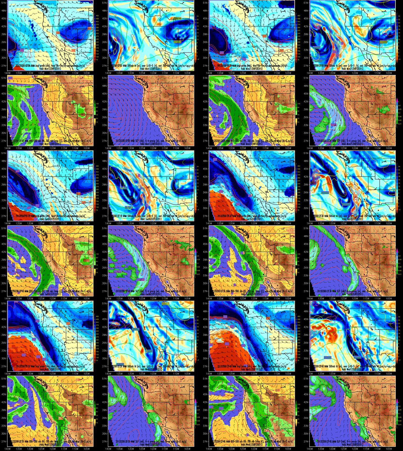
Split flow is now in full control over the western US.  The NAM forecast for the storm that will move into California tomorrow is quite remarkable as it just gets torn to shreds as it moves inland. Pity...

BDOY (So Far)

Image
It's been a difficult season with limited snow and dangerous avalanche conditions.  My expectations are now well adjusted and we enjoyed what was my Best Day Of the Year (BDOY) at least so far today as we had the high alpine to ourselves and farmed the low-angle powder.  It's tough to look at so much powder on steep slopes, but the potential of a big slide has us Norelco Skiing.  Wondering what that means?  Santa provides a hint below.