Yesterday's storm delivered. Total snow depth at Alta Collins now sits at 17" with 2.08" of water falling through 6 AM.
 |
| Source: MesoWest |
Things pretty much exploded yesterday with a surprise pre-frontal band moving through in the morning and then the front in the afternoon, with peak snowfall rates near 3 inches an hour and SWE rates of 0.34. This first part of the storm brought some really high-density snow, which is just what we need to start the season.
Overnight, densities have dropped as have snowfall and precipitation rates. There were even a few breaks.
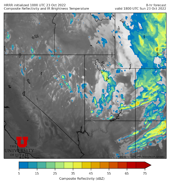
The situation overnight ended up proving that in the post-frontal environment, there are a lot of "critters in the woods" with plenty going on. Sure, some cells bubbling up over the lake, but also over the west desert and to the northeast of the lake. Hopefully this will show up well in the loop below. I never know what blogger is going to do with .mov files.
At the moment, we're staring to see a bit more focus over and downstream of the lake, with some stronger cells (apologies for the old lake outline...not my software).
The early morning hours are often the best for getting lake-effect organized. We'll see if this trend continues. The Cottonwoods are still getting some snow, but the echoes are strongest in and around the Oquirrhs including eastern Tooele County and western Salt Lake County.
The HRRR is really jacked up on this continuing through the morning.


No comments:
Post a Comment