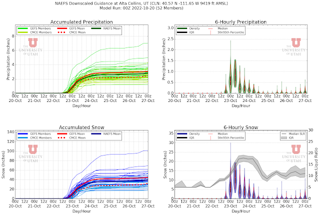
After a dry spell for the rest of October, a deep upper-level trough is expected to develop along the west coast of the US. We can be reasonably confident of that, but the details of its amplitude, movement, and accompanying precipitation features are still very murky and uncertain. As a result, the North American Ensemble Forecast System (NAEFS) plume for Alta Collins is a big mess of spaghetti for November 2nd and 3rd with a range from 0 to 2.4 inches of water and 0 to 40 inches of snow.
If you want good news, about half of the members produce more than 10 inches of snow. If you want bad news, about half are less than that (through 0000 UTC 4 November). The various ensemble members have not converged around a favored solution.
In a couple of days, perhaps they will. For example, forecasts for the storm last weekend also exhibited a great deal of spread when the storm was about 5-7 days out.
However, they began to cluster and give indications of a solid storm at a lead time of about 4-5 days.


Gonna be all time with early resort openings
ReplyDeleteIn 2004 Brighton opened in October. From a snowpack perspective this is a nice start but not all time.
DeleteBird opening in 92 w 100in base was all time.
ReplyDelete