Yesterday evening, the northern portion of the state won the thunderstorm lottery with strong storms developing over the West Desert and Great Salt Lake and moving across the Northern Wasatch Front, Box Elder County, and Cache County.
Strong wind gusts were reported at a remote observing site east of Snowville (78 mph) and the Logan airport (61 mph). Lightning data shows numerous cloud-to-ground strikes across that area, but none south of Ogden or over the Salt Lake Valley.
 |
| Source: lightningmaps.org |
 |
| Source: NWS |
 |
| Source: SPC |
During the course of the day today, the surface trough is expected to progress slowly into northwest Utah, while the precipitation band to our east remains roughly between Salt Lake and Vernal. The big question mark for our weather is whether or not something will bubble up in the intermediate dry slot. The HRRR shows this as a possibility. Note the strong simulated reflectivity cells between the two precipitation bands early this afternoon.
However, these types of storms are very chaotic and we're just going to have to see how this plays out.
This evening the surface trough will approach Salt Lake, and should be accompanied by showers and thunderstorms. It's not the usual rapidly moving cold front. It sort of stalls over northern Utah as the upper-level trough moves through and eventually the so-called "wrap around precipitation" moves across the state. Tonight through tomorrow night looks quite unsettled and the mountains will get snow. I need to run to class, however, so discussion of that will need to wait until tomorrow.


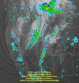
The precipitation band to our east (which extends down across much of Arizona as a narrow band of showers) is at least partly due to the low-level remnant of Hurricane Paine. After the system was sheared apart, the low-level center remained to the south and finally moved inland from the Gulf of California into southwestern AZ yesterday, then stretched northward into a long band of showers overnight.
ReplyDeleteTotally unrelated question. I've noticed the blob of abnormally warm surface water in the NE Pacific has returned (wasn't present last winter). I've seen some people attribute recent below average Utah snowfall to this phenomenon. Thoughts?
ReplyDeleteThe science available suggests that sea-surface temperature anomalies in the mid-latitudes are more a reflection of the large-scale pattern than a driver of it. Until shown differently, I don't think the existence of the blog is a reliable predictor of snowfall.
DeleteSuper exciting :D
DeleteA nearby local weather station in South Ogden recorded a 81 mph gust: https://www.wunderground.com/personal-weather-station/dashboard?ID=KUTSOUTH3 Don't know how official it is, but the guy is almost as much as a weather nut as you: http://weatherbear.com/ :)
ReplyDeleteConfirmed tornado near OGD at 3:45 pm produced by long-lived svr tstorm that tracked from Dugway. Nice loop on my twitter feed.
DeleteIs there a damage rating on that tornado?
DeleteNot yet
DeleteIt hit a mile from my home. I drove by the place. Just from my view, it was definitely more than what's listed on F0 damage. It fits the F1 profile well, and judging by the wrecked house I saw, maybe it hit F2 for a moment? I'll be waiting to see the official measurement later. Total path length was about 2 miles
DeleteIf you look at the current radar loop (1830 MDT) there is a tiny lake effect band in the shallow cold NW flow, with the primary convective showers coming from the south higher up. I can see the lake band visually, and am getting some real light sprinkles from it. This is kind of an interesting situation.
ReplyDeleteSounds like another tornado happened in Panguitch today
ReplyDelete