
At 6 AM MST, it was 31ºF on Alta's Mt. Baldy (11,066 ft.).
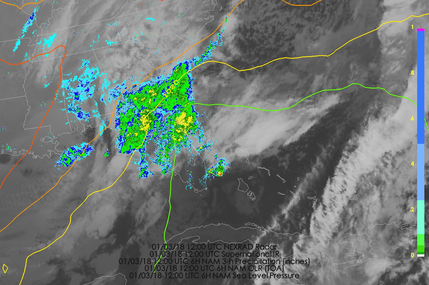
At the same time, it was 30ºF in Tallahassee, Florida, with ice pellets and snow.
That's right. SNOW. In Florida.
A remarkable weather event is unfolding as a nor'easter develops along the eastern seaboard. It is a textbook event, of the type I watched for as a kid viewing the evening news. The loop below shows the classic high-amplitude wave setup with a ridge over western North America and a deep trough over eastern North America. In addition, there is a short wave trough moving through the long wave pattern. You can see it moving from near Wyoming to the Golf coast in the loop below.

In the loop above, you can see how the large-scale ascent associated with the upper-level trough is generating clouds and precipiation as it moves over the southeast United States. However, that trough will also spark cyclogenesis as it rounds the long-wave trough and is able to move over warm, unstable, water-vapor-laden air over the Atlantic Ocean and along the Gulf Stream.

The end result is a very powerful nor'easter. The NAM forecast initialized at 0600 UTC deepens the system from a weak, inverted trough along the Florida coast with a minimum sea level pressure of about 1013 mb at 1200 UTC this morning to a 961 mb low off the coast of North Carolina by 1200 UTC 4 Jan and then 953 mb by 0000 UTC 5 Jan over the Gulf of Maine.


The GFS isn't quite as deep (not shown), but the 0000 UTC had similar numbers to the NAM with central pressures of 961 mb and 948 mb at 1200 UTC 4 Jan and 0000 UTC 5 Jan respectively.
Using numbers from the NAM, that is a fall in central pressure of 52 mb in 24 hours and 60 mb in 36 hours, easily meeting the criteria for what is known as explosive cyclogenesis, or rapid cyclone development.
The structure of the NAM-forecast storm off the North Carolina coast is consistent with an intense marine cyclone. The cold and warm/occluded fronts are oriented at right angles, forming a frontal T-bone. The temperature gradient along the cold front weakens near the warm/occluded, a characteristic known as the frontal fracture (there is some uncertainty in the exact cold front position in this forecast and one might place it further west than I have). The 925-mb temperature contours (black) become quite concentrated along the occluded front near the low center and its back-bent extension south of the low, where the strongest 925 mb winds are found (color fill). This area of strong winds is referred to as the poisonous tail of the back-bent occlusion by Norwegian meteorologists. Cold air has encircled the low center, cutting off a pocket of warm air known as a warm-core seclusion.

The severity of ompacts along the eastern seaboard will depend strongly on storm track as a slight shift to the west or east will make a difference in the amount of precipitation, which and severity of winds along the coast. One need only look at the watches, warnings, and advisories map from the Boston National Weather Service Office to realize what a mess this storm could bring.

If you are in the area, monitor official forecasts.
No comments:
Post a Comment