
 |
| 0600 UTC 2 Jun 2011 GFS Forecast valid 1800 MST Sunday |
That would yield a high temperature of about 85F! I have a feeling that there will be a lot of sunburned people going to work on Monday. Use your sunblock liberally.
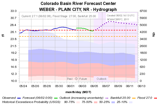
With this warming, rivers will be rising across the state. The Weber river at Plain City is already at flood stage and is projected to rise further over the weekend.
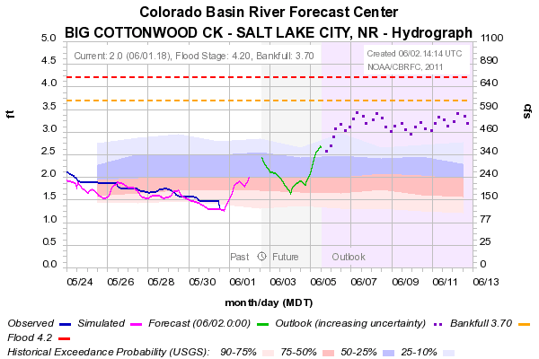
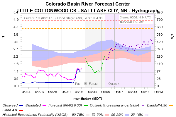
The big runoff has yet to start in the Cottonwoods, but streamflows there will also increase, but are presently projected to remain below flood stage.
The upper-level trough is forecast to lift and move through the Intermountain West early next week, so the warming will be short lived. That's probably a good thing for the runoff, at least for now.
No comments:
Post a Comment